Clear Sky Science · en
Fire dynamics in the South American Chaco and their link to agriculture and drought
Why fires in a little-known region matter to us all
The South American Chaco is not as famous as the Amazon, yet it is one of the largest tropical dry woodland regions on Earth and a major storehouse of carbon and wildlife. This study asks a question with global relevance: are rising fires in these landscapes mainly a result of climate-driven drought, or of how people farm and ranch the land? The answer matters for how societies try to curb greenhouse gas emissions, protect biodiversity and reduce smoke-related health risks.
A vast dry forest under pressure
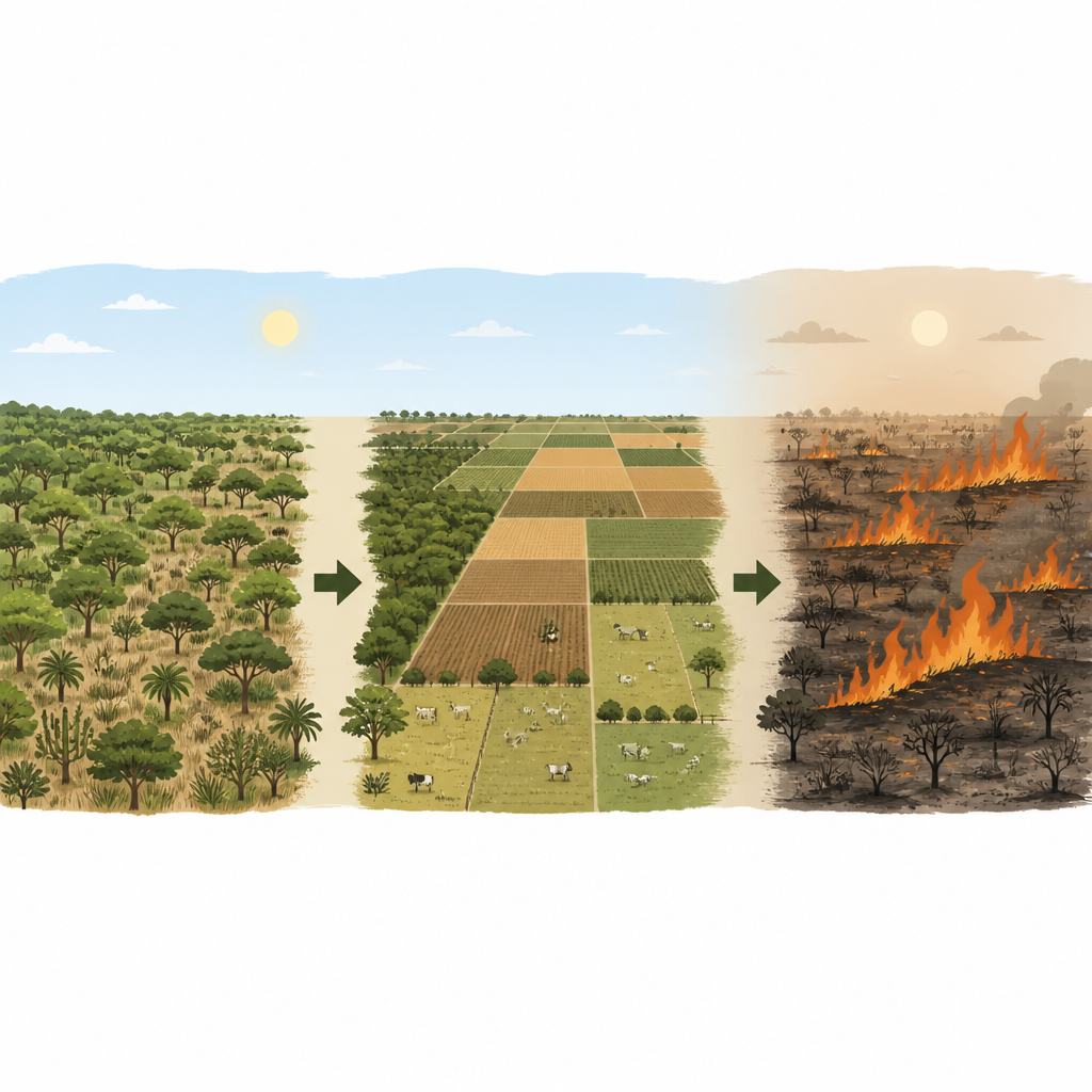
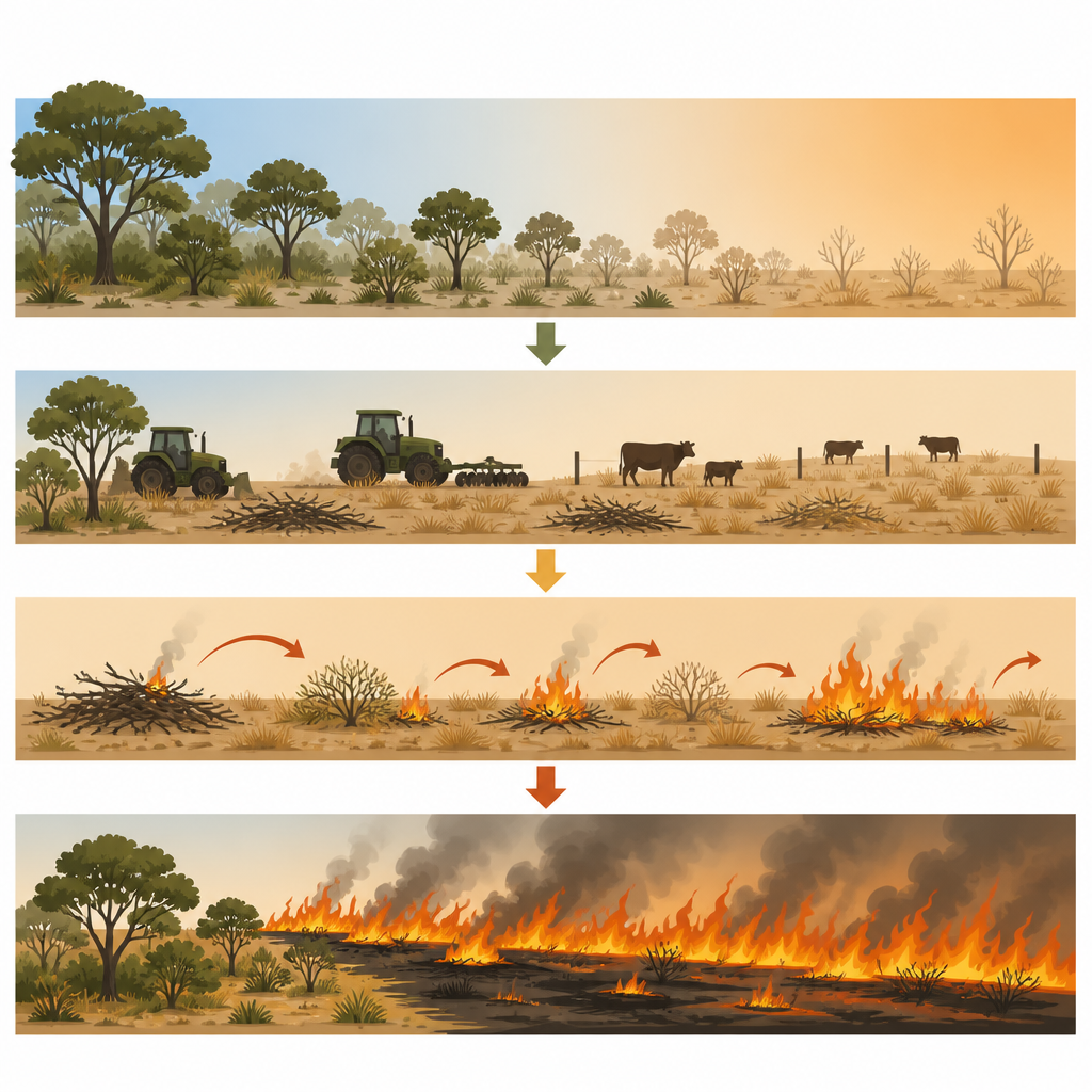
The Chaco stretches across Argentina, Bolivia and Paraguay, covering an area more than four times the size of the United Kingdom. It is a mosaic of dry forests, savannas and grasslands that naturally burn from time to time, for example after lightning strikes. Fire has long shaped which plants grow there and how nutrients cycle. But in recent decades, the Chaco has become a hotspot of deforestation as forests are cleared for cattle pasture and soybean and maize fields. At the same time, the region has been getting hotter and drier, raising alarms that climate change might be turning it into a tinderbox.
Reading nearly forty years of fire from space
To untangle these influences, the researchers used about 175,000 images from Landsat satellites to reconstruct yearly fire maps for the entire Chaco from 1986 to 2023. They combined these maps with detailed records of where forests were cut and how the land was later used. This allowed them to separate fires linked to clearing natural vegetation, fires set on existing croplands and pastures for management purposes, and other fires that occurred in areas that stayed natural. Their reconstruction shows that nearly two thirds of the Chaco has burned at least once since the 1980s, confirming that fire is a widespread and persistent feature of this landscape.
Agriculture as the main spark
The analysis reveals that around 70 percent of all burned area in the Chaco is directly tied to agriculture. Most fires occurred either when natural vegetation was cleared and converted to farmland or pasture, or when ranchers used fire to manage pastures, for example to remove shrubs and encourage new grass growth. Fire activity surged during the early and mid-2000s, the same period when deforestation peaked. Where forests were turned into crops or pastures, the chance of burning shot up dramatically during the conversion years and then dropped back once fields were established, especially for cropland. Pastures, in contrast, remained fire-prone because regular burning is part of how they are managed.
Drought as a helper, not the main driver
Drought still plays an important part, but not in the way many broad-scale studies suggest. By comparing yearly fire records with rainfall anomalies, the authors found that fires linked to land clearing and pasture management became more frequent and covered larger areas in dry years. In other words, people took advantage of drier conditions to burn more, perhaps because fires spread more easily and are cheaper than mechanical clearing. At the same time, fires not associated with agriculture actually became less common during drought, likely because natural vegetation in this dry region does not always build up enough fuel under prolonged water stress. Differences among Argentina, Bolivia and Paraguay further support the central role of land use, since countries with similar climates showed different fire histories that mirrored their agricultural policies and practices.
What this means for forests, climate and people
The study concludes that in the Chaco, and probably in many other tropical dry woodlands, rising fire activity is driven more by farming and ranching than by drought alone. Drought matters because it makes land-clearing and pasture fires spread farther, but it is people who decide when and where to light them. That is cautiously hopeful news: while we cannot quickly change the climate, societies can act on land-use choices. Stronger controls on deforestation, better pasture and fire management, education campaigns and faster fire monitoring and response could substantially cut smoke, carbon emissions and damage to nature in the Chaco and similar regions worldwide.
Citation: Baumann, M., Maillard, O., Gasparri, I. et al. Fire dynamics in the South American Chaco and their link to agriculture and drought. Nat Sustain 9, 674–681 (2026). https://doi.org/10.1038/s41893-026-01793-z
Keywords: Chaco wildfires, tropical dry forest, agricultural expansion, drought and fire, pasture management