Clear Sky Science · en
An open framework for assessing urban mobility resilience: evidence from New York City
Why City Travel After a Crisis Matters
The COVID-19 pandemic did more than empty streets for a few months—it reshaped when, where, and how city dwellers move. This paper looks at New York City’s ride-hail trips to ask a simple but far-reaching question: which neighborhoods bounced back, which changed their daily rhythms, and what does that reveal about inequality and the future of urban life?
Following the Pulse of a Moving City
The authors use millions of anonymized trip records from for-hire vehicles such as Uber and Lyft, covering 2019 to 2023, to trace New Yorkers’ everyday movements before, during, and after the height of the pandemic. These trips serve as a kind of "heartbeat" for the city, especially during late evenings and off-peak hours when other transport options thin out. By examining hourly patterns across weekdays in each neighborhood, the study identifies eight distinct daily rhythms, from early-morning surges to late-night and post-midnight activity, and tracks how these rhythms shifted across three phases: pre-pandemic, during restrictions, and the later "new normal."
What Changed and Where
The crisis did not affect all trips equally. Daytime-oriented patterns—especially very early mornings and midday movement—shrank, while evening and late-night travel grew, particularly in outer-borough areas such as eastern Queens and southern Brooklyn. Meanwhile, well-established evening and rush-hour hubs in Manhattan and inner Brooklyn largely kept their pre-pandemic character. This marks a subtle but important transformation: the city’s core held onto traditional office and nightlife rhythms, while peripheral neighborhoods absorbed more of the later, more flexible activities associated with remote work, changing leisure habits, and shifting social life.
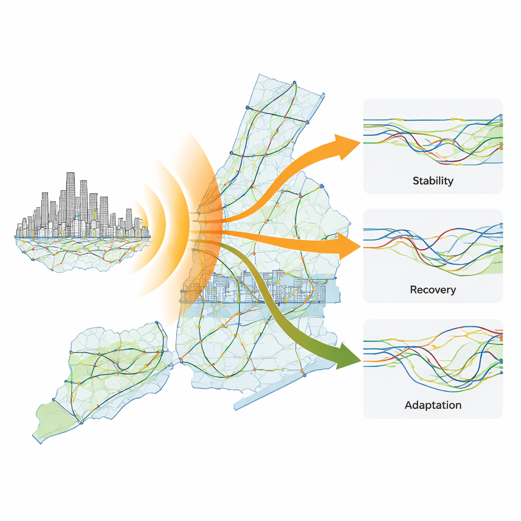
Three Ways Neighborhoods Responded
To turn these shifting patterns into an easy-to-read storyline, the researchers classify each taxi zone into one of three "resilience trajectories." In "Stable" zones, mobility patterns barely changed across the pandemic timeline. "Recovered" zones temporarily shifted but ultimately returned to their old rhythms. "Adapted" zones settled into new, lasting patterns that differ from what they looked like in 2019. Over half of neighborhoods fall into the Stable group, while only a small fraction truly Recovered. Adaptation dominates in more peripheral boroughs such as the Bronx and Staten Island, and in certain parts of Brooklyn and Queens. Stability, by contrast, clusters in central, well-connected areas including most of Manhattan.
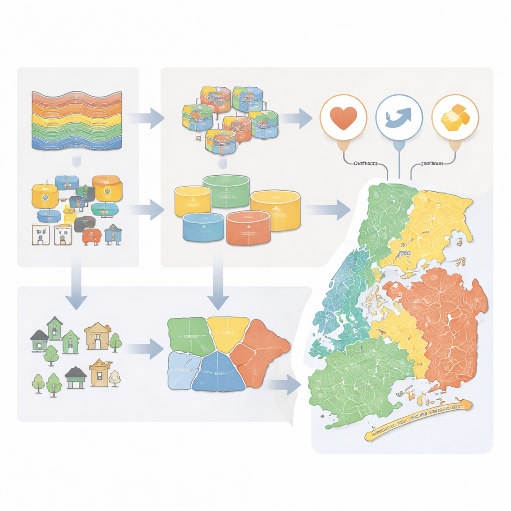
Who Lives Where Movement Changes
Travel patterns alone cannot show who benefits or loses from these shifts, so the authors build a second "context" layer. They group neighborhoods into six broad types based on open census and land-use data—capturing income, housing, car ownership, age structure, and local building forms. Affluent, central "elite enclaves" and modern mixed-use districts overwhelmingly show Stable mobility, reflecting dense services, strong transit access, and jobs that could be maintained or reorganized with relatively little disruption. More deprived but centrally located areas also appear relatively stable, likely because many residents in essential or schedule-fixed jobs had little choice but to keep traveling. In contrast, suburban and transitional zones on the city’s edges—areas with longer commutes, more cars, and ongoing redevelopment—are far more likely to Adapt, taking on later trips and altered daily rhythms rather than "snapping back" to old routines.
From Data to Fairer Urban Futures
For a lay reader, the central message is that resilience is not just about whether a city keeps moving, but about who bears the cost of change. New York’s wealthier core largely preserved its pre-pandemic travel habits, while many outer neighborhoods had to reorganize when they travel and how far they go, often with fewer choices and higher burdens of time, money, and safety. By combining open mobility records with public data on people and places, the framework shows where transport services and urban planning need to catch up—such as expanding late-evening transit in peripheral areas or redesigning mixed-use districts. The authors argue that cities should not aim for a simple "return to normal" but use these patterns to guide targeted, evidence-based investments that make everyday movement more equal and resilient for all.
Citation: Liu, Y., Chen, M. An open framework for assessing urban mobility resilience: evidence from New York City. npj Urban Sustain 6, 62 (2026). https://doi.org/10.1038/s42949-026-00368-3
Keywords: urban mobility resilience, COVID-19 and cities, New York City transport, spatial inequality, ride-hailing data