Clear Sky Science · en
Misalignment between residential segregation of non-EU migrants and urban barriers varies across Western European cities
Why city lines and invisible walls matter
In many cities, people talk about the “wrong side of the tracks” as if railway lines, highways, or rivers neatly separate richer and poorer neighborhoods or native residents and migrants. This study asks whether that idea actually holds in Western Europe. By examining where non‑EU migrants live in 520 cities across eight countries, the authors investigate whether big pieces of infrastructure really act as social dividing lines, or whether the story is more complex—and more local—than that.
Who lives where in Europe’s cities
The researchers focus on residential segregation: how unevenly different social groups are spread across a city. For non‑EU migrants in Europe, where you live can shape your access to schools, jobs, and clean, safe environments. Earlier work in the United States and South Africa showed a strong match between segregation and physical barriers, often created or reinforced by explicit policies such as redlining or apartheid. In those cases, tracks, highways, and rivers were deliberately used to separate groups. In Western Europe, however, segregation is mostly driven by the housing market, public housing allocation, and people’s preferences—not by formal separation laws. This raises a key question: do barriers still line up with social divides when they were not designed to do so?
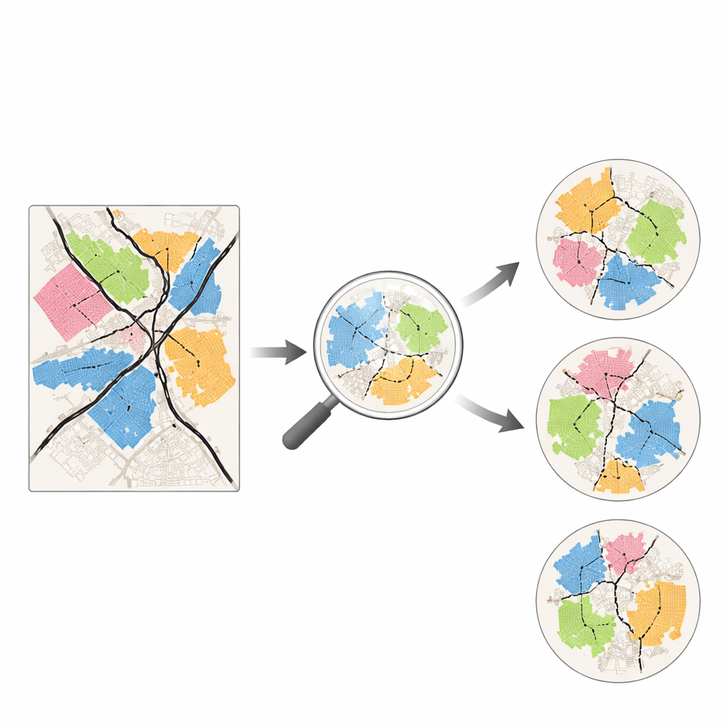
How the authors tested the city puzzle
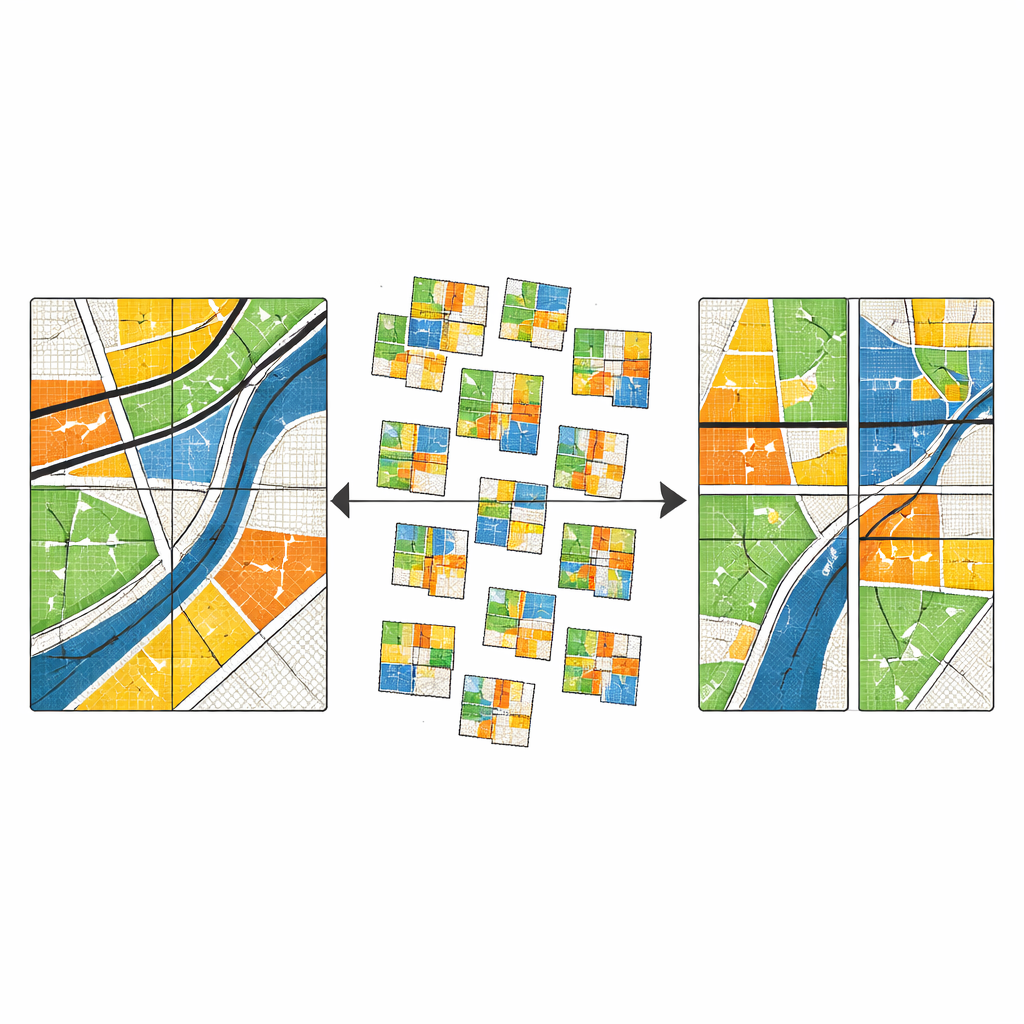
To answer this, the team combined two kinds of high‑resolution maps for each city. One map shows the share of non‑EU migrants in tiny grid cells, from which they grouped neighboring cells into larger areas that either over‑, under‑, or roughly match the city’s average migrant presence. These are the “social regions.” The second map shows “urban fragments” created by railways, motorways, waterways, and empty land that slice the city into separate chunks. They then calculated how well the barrier‑defined fragments could be used to rebuild the social regions: high scores mean barriers track social lines; low scores mean social lines cut across or ignore barriers.
Comparing cities to thousands of random worlds
Simply finding some overlap is not enough—chance patterns can look meaningful. The authors therefore built a statistical test using a Monte Carlo approach. For each city, they generated 200 alternative, synthetic ways of carving the urban area into fragments that match the real city’s fragment sizes but place the boundaries differently. They then compared the real overlap score to the 200 synthetic scores and asked: in what quantile does the real city fall? A very high rank (above 0.95) means the observed alignment is stronger than in at least 95% of random scenarios and is unlikely to be due to chance; a very low rank (below 0.05) means barriers and social lines clash more than one would expect at random.
A patchwork of patterns, not a single European rule
Across all 520 cities, there is no general European pattern in which urban barriers reliably mark the edges of migrant neighborhoods. Most cities show no significant alignment at all. In fact, slightly more cities than expected fall into the “less aligned than random” category, where major roads or tracks run through migrant areas rather than along their edges. Case studies of Lyon and Birmingham show clear social divides within the cities, yet these divides fail to follow the main highways and rail lines. On the other hand, a cluster of cities in the Netherlands and Germany does show strong alignment, with canals, rivers, or railways closely tracing the boundaries between areas with higher and lower migrant representation, as exemplified by Amsterdam.
What might explain country differences
To probe why some countries look different, the authors used a regression model that relates each city’s alignment rank to its country, overall segregation level, and how spread‑out its development is. Cities in the Netherlands and, to a lesser extent, Germany tend to have higher alignment scores even after accounting for these factors. Spain, Italy, and the United Kingdom tend to have lower scores than random, meaning barriers there are especially poor predictors of where migrants live. Interestingly, the overall intensity of segregation does not explain these differences, but a more decentralized or multi‑centered urban form does slightly increase the likelihood that barriers and social frontiers coincide. This suggests that planning histories and the way cities have grown over time matter as much as present‑day inequalities.
What this means for everyday life and policy
For a lay reader, the main takeaway is that big roads, railways, and rivers do not, by themselves, tell you where social divides run in most Western European cities. In many places they act more like shared corridors—sometimes noisy or polluted, sometimes attractive waterfronts—than hard borders between groups. Only in certain national contexts, notably parts of Germany and the Netherlands, do they more often coincide with the edges of migrant neighborhoods. This means that simply tearing down or redesigning physical barriers is unlikely to fix residential segregation on its own. Instead, policies will need to address housing markets, planning traditions, and how new neighborhoods are built if cities hope to reduce the social distance behind the maps.
Citation: Spierenburg, L., Ralon-Santizo, E., van Cranenburgh, S. et al. Misalignment between residential segregation of non-EU migrants and urban barriers varies across Western European cities. Sci Rep 16, 14186 (2026). https://doi.org/10.1038/s41598-026-44777-x
Keywords: residential segregation, urban barriers, migration in Europe, city planning, infrastructure and inequality