Clear Sky Science · en
Exploring the effects of riverine flooding on traffic demand forecasting using activity-based modeling in Ubon Ratchathani, Thailand
Why floods matter for getting around town
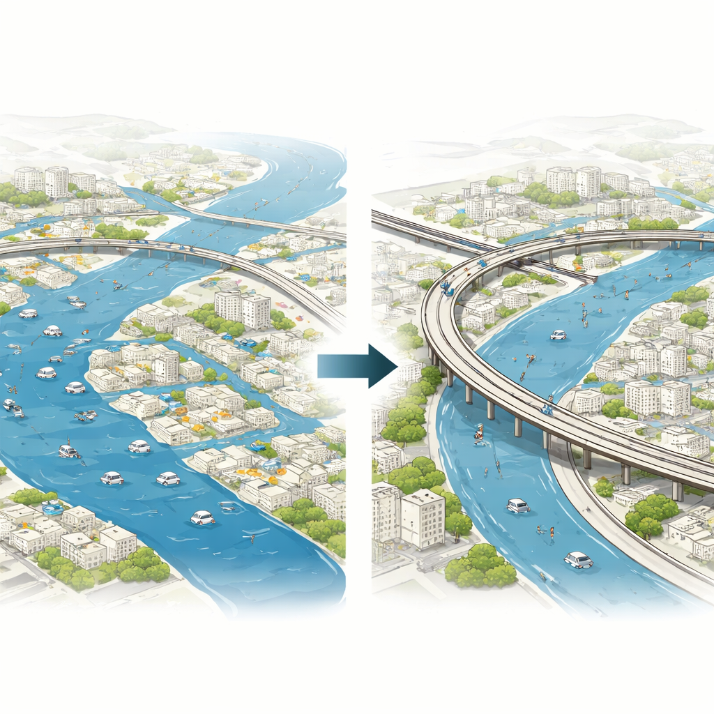
When a river spills over its banks and turns streets into canals, life in a city does not just get wet—it slows down. People still need to go to work, school, shops, and hospitals, but flooded roads, detours, and longer travel times can make even simple trips exhausting or impossible. This study looks at how long-lasting river floods in Ubon Ratchathani, a city in northeastern Thailand, reshape everyday movement, and how smart planning—especially raising key roads—can keep a city functioning even when water stays high for weeks.
How everyday routines change in a flood
The researchers began by asking a basic question: what actually happens to people’s daily routines when the streets are under water for a long time? To find out, they carried out a detailed diary survey with 300 households, recording who went where, when, how, and for what purpose under normal and flooded conditions. They found clear shifts. More people stayed home all day during floods, and non-working household members, such as homemakers, cut back sharply on outside errands like shopping. Workers adapted by taking on extra tasks: the share of workers who combined commuting with shopping trips rose noticeably, suggesting that when some family members cannot move easily, others step in to cover their needs.
From simple trip counts to full daily stories
Most traditional traffic models treat travel as a set of separate trips—how many journeys from A to B, by which mode, at what time. That approach misses the fact that travel is tied to chains of activities over an entire day. This study instead uses an activity-based model, which builds a synthetic population of residents and simulates each person’s daily schedule: whether they leave home at all, how many tours they make, the stops they add for shopping or school drop-offs, where they go, and which mode they choose. The team calibrated this model with Thai census data and a large person-trip survey so that the artificial city closely matches the real one in age, income, household size, and how people usually travel.
Bringing floodwater into the traffic picture
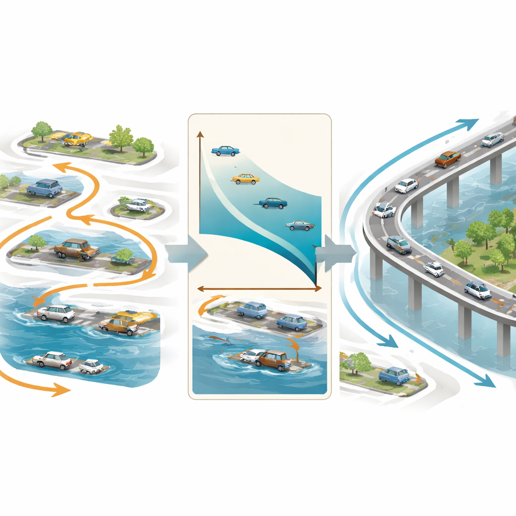
To make the model “feel” the flood, the researchers combined reported water depths from residents with traffic speed data from GPS-equipped taxis. By comparing speeds on key roads before and during a major 2019 flood, and by mapping how deep the water was on each road segment, they derived a simple rule: deeper water means slower traffic, and beyond about 40 centimeters, cars cannot pass at all. They then applied this relationship to the entire road network of Ubon Ratchathani, turning flood depth maps into slower speeds or closures inside the simulation. The resulting model could reproduce observed traffic volumes and mode shares under normal conditions, giving confidence that its flood scenarios were realistic.
Testing raised roads as a lifeline
Armed with this virtual city, the team explored a practical solution already used in some Asian cities: raising the height of selected arterial roads and bridges. They first ranked flooded road segments by how much they contributed to citywide accessibility—how many jobs, schools, hospitals, shops, and parks could be reached within 15 minutes. They then built four scenarios: no road upgrades, raising only medium-priority links, raising only high-priority links, and raising both. The results were striking. Without upgrades, many commutes to work stretched beyond 50 minutes and detours overloaded the remaining dry bypasses. With targeted road elevation, far fewer trips were severely delayed, congestion on key bypasses eased by tens of thousands of vehicles per day, and the number of people forced to stay home dropped substantially.
What the findings mean for flood-ready cities
To translate these mobility gains into economic terms, the researchers estimated the reduction in flood-related travel costs and compared it with the price of building higher roads. All upgrade options produced more benefits than costs, with the highest payoff coming from focusing on the most critical links. In simple terms, carefully chosen raised roads helped residents keep doing their usual activities, reduced wasted time in traffic, and paid for themselves over the long run. The study shows that looking at full daily routines—rather than just counting trips—gives planners a clearer picture of how floods disrupt urban life and how infrastructure changes can soften the blow. As river floods become more frequent and intense in many parts of the world, this kind of behavior-aware modeling can guide cities toward practical, cost-effective measures that keep people and economies moving even when the water rises.
Citation: Tsumita, N., Kaewkluengklom, R., Schreiner, S. et al. Exploring the effects of riverine flooding on traffic demand forecasting using activity-based modeling in Ubon Ratchathani, Thailand. Sci Rep 16, 14145 (2026). https://doi.org/10.1038/s41598-026-42434-x
Keywords: urban flooding, travel behavior, transport resilience, activity-based modeling, road adaptation