Clear Sky Science · en
Airborne geophysical imaging of freshwater reservoir beneath the eastern margin of Great Salt Lake
Hidden Fresh Water Under a Famous Salt Lake
The Great Salt Lake in Utah is famous for being so salty that swimmers float with ease. It might come as a surprise, then, that scientists now have strong evidence for a large body of fresh water hidden beneath its eastern shore. This study used instruments flown beneath an aircraft to “X‑ray” the ground and lakebed, revealing a buried reservoir of fresh groundwater that could matter greatly for future water supplies in a drying West.
A Closer Look at a Salty Giant
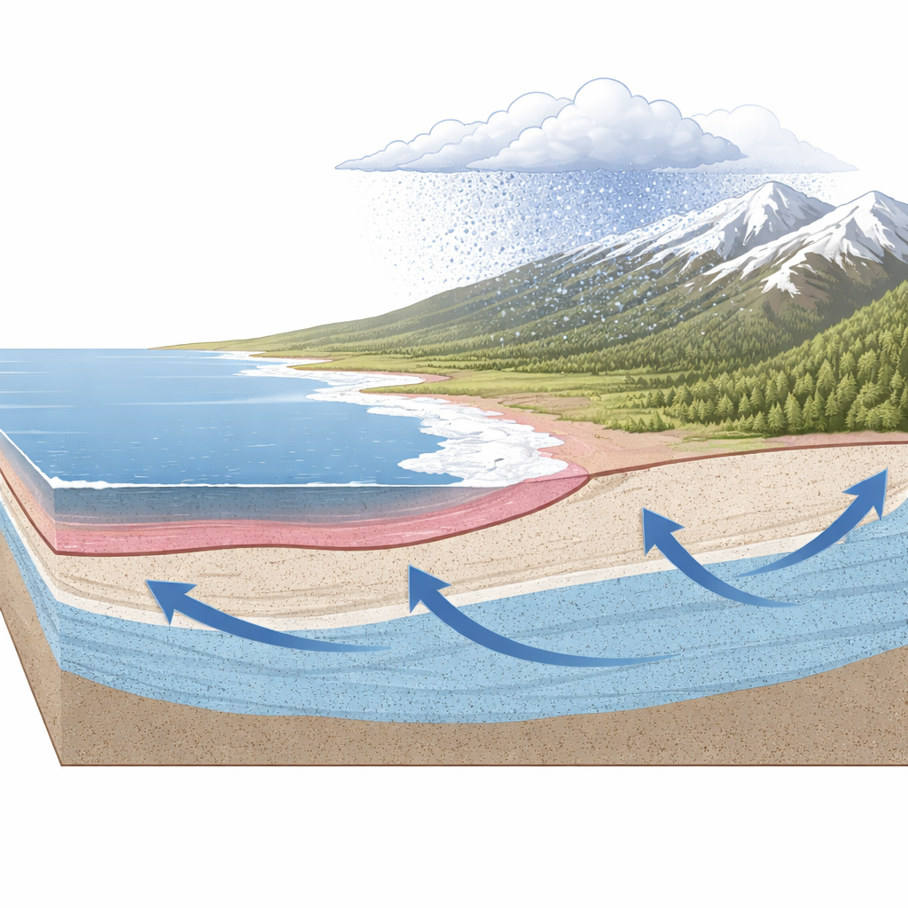
Great Salt Lake is the largest saltwater lake in the Western Hemisphere and has no outlet to the ocean. Water flows in from rivers, rain, snow, and groundwater, but it leaves only by evaporation, which concentrates salt over time. The surrounding mountains, especially the Wasatch Range to the east, receive much more rain and snow than the lake surface. Meltwater sinks into the ground there and slowly moves downhill underground toward the lake. Earlier studies using wells and ground-based measurements hinted that fresh water was pushing upward beneath a thin, extremely salty layer near the lake’s edge, but no one knew how extensive this hidden fresh zone was.
Scanning the Ground from the Air
To answer that question, the researchers turned to airborne electromagnetic and magnetic surveying. Suspended below a helicopter, a loop of wire sent brief pulses of energy into the ground, and sensors measured how the subsurface responded. Salt-rich water conducts electricity well, while rocks and fresh water conduct much more poorly. By inverting these signals with advanced three-dimensional computer models, the team built a kind of electrical map of the upper hundred meters or so beneath Farmington Bay on the lake’s eastern margin. At the same time, they measured subtle variations in Earth’s magnetic field to infer the shape of the deep, hard-rock “basement” that underlies the softer, water-bearing sediments.
A Freshwater Layer Beneath the Brine
The airborne images revealed a simple but striking structure. Near the surface lay a thin, highly conductive layer corresponding to salty lake water and brine-soaked sediments, typically about 10 to 15 meters thick in the Farmington Bay area, and much thicker—up to 50 to 80 meters—beneath the deeper western part of the lake. Directly beneath the thin salty layer on the east, however, the models showed a broad, more resistive zone extending laterally under the playa and lake margin. This resistive body, consistent with fresh groundwater, matched salinity and chemistry measurements from cores taken in nearby wells. In other words, the helicopter survey was able to “see through” the salty skin of the lake and map a widespread fresh groundwater reservoir just below it.
Freshwater Oases and Deep Structures
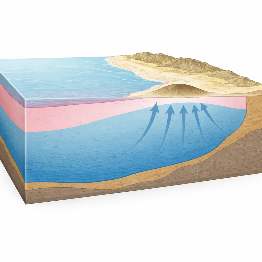
The high-resolution maps also picked out smaller features that help explain how this hidden water behaves. One is a circular mound on the playa colonized by dense stands of common reed, a plant that thrives in fresh water. The electrical images show that beneath this mound the salty layer thins sharply and fresh water rises closer to the surface, forming a kind of natural spring through the brine. On a larger scale, the magnetic data revealed that the solid basement rock is shallow—less than about 200 meters deep—near Antelope Island and the eastern bay, but drops abruptly to depths of 3 to 4 kilometers farther out in the basin. This deep trough likely holds a very thick stack of sediments capable of storing huge volumes of groundwater, much of it probably fresh.
Why This Matters for Water and Beyond
By combining airborne electrical and magnetic mapping with ground-based measurements, the study shows that a substantial fresh groundwater reservoir lies beneath the eastern margin of Great Salt Lake, protected by a relatively thin salty cap. It further suggests that an even larger volume of freshwater-saturated sediments may fill the deeper basin to the west, although more data are needed to confirm this. The work demonstrates that aircraft-based surveys can rapidly and non-invasively map fresh–salt water boundaries beneath large, salty lakes around the world. For communities facing water stress, these methods offer a powerful way to assess hidden groundwater resources and to plan for their sustainable use without disturbing the fragile ecosystems that depend on surface salinity.
Citation: Zhdanov, M.S., Jorgensen, M., Cox, L. et al. Airborne geophysical imaging of freshwater reservoir beneath the eastern margin of Great Salt Lake. Sci Rep 16, 11287 (2026). https://doi.org/10.1038/s41598-026-40995-5
Keywords: Great Salt Lake, groundwater, airborne electromagnetic survey, freshwater reservoir, hydrogeophysics