Clear Sky Science · en
The Climate Hazards Center Infrared Precipitation with Stations, Version 3
Why better rain maps matter
Knowing when and where it will rain is vital for farmers, water managers, and agencies that try to prevent famines. Yet in many parts of the world, there are few weather stations, and simple rain gauges can miss a lot of what actually falls. This paper introduces CHIRPS3, a new global rainfall dataset that blends satellite images with ground measurements to give a sharper, more realistic picture of rainfall from 1981 to today.
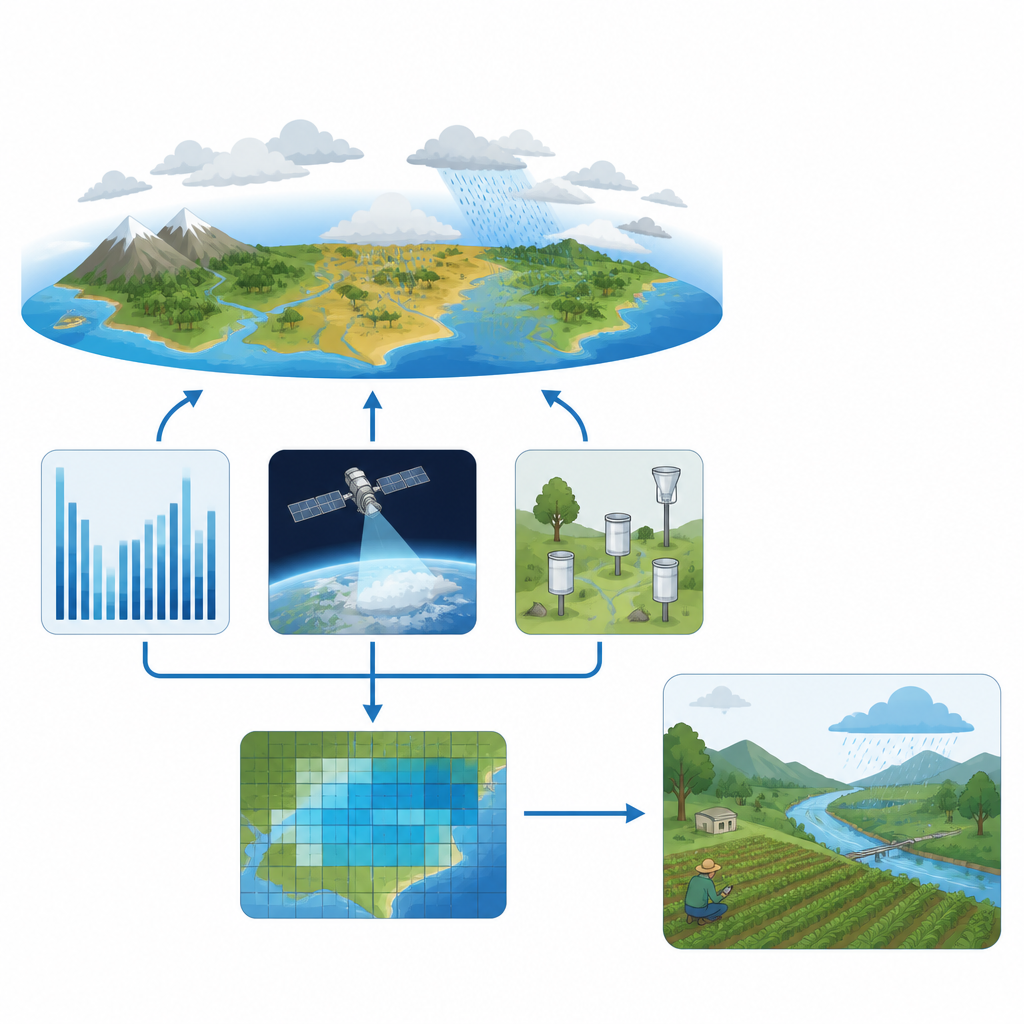
Bringing many views of rain together
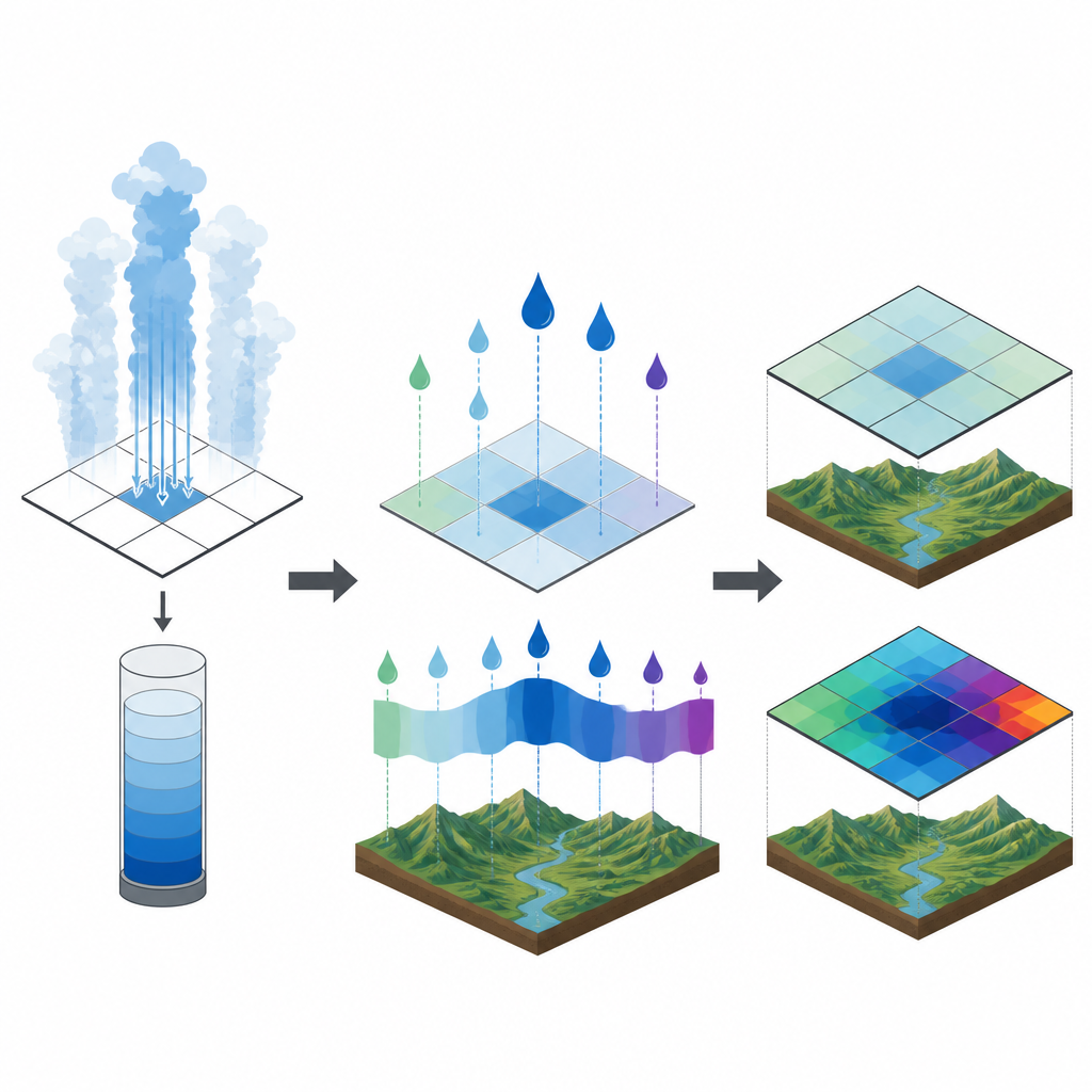
CHIRPS3 is built like a three-layer cake. The base layer is a detailed map of typical monthly rainfall, created from more than 84,000 long term station records and satellite information. The second layer comes from geostationary satellites that track how long very cold cloud tops sit over each location, a clue to how much rain is likely falling. The third layer comes from thousands of rain gauges spread around the world. By stacking these three pieces and updating them regularly, CHIRPS3 produces global rainfall maps every five days and every month, with daily values derived from those five day totals.
Fixing blind spots in older products
Earlier versions of this data, known as CHIRPS2, were already widely used for drought monitoring, crop modeling, and humanitarian planning. But several weaknesses became clear. CHIRPS2 tended to smooth out the highs and lows, underestimating both heavy downpours and sharp dry spells. Wind blowing across rugged terrain caused many gauges to catch less rain than actually fell, so totals were biased low in mountains and windy regions. The satellite method also produced too many tiny rainfall amounts, a kind of ever present drizzle that distorted counts of rainy days and muted extremes.
Smarter use of clouds, terrain, and gauges
CHIRPS3 tackles these issues on several fronts. The underlying rainfall climatology was rebuilt so that station data are adjusted for the rain that gauges typically miss in windy places, making the long term averages slightly wetter where appropriate. The satellite step was redesigned so that the amount of rain linked to time under cold clouds is tied directly to the local long term average, rather than relying on a simple global regression. This preserves natural swings between wet and dry periods and better captures rare heavy events, especially in dry regions. At the same time, the team nearly doubled the number of stations feeding the system, particularly in Africa and the Americas, and blended them in using a method that respects how quickly rainfall patterns change over distance.
Testing how well the maps match reality
To see how well CHIRPS3 performs, the authors compared its satellite component with a high quality reference dataset built from dense station networks in 12 well measured regions, including the United States, Europe, Australia, Iran, and parts of Latin America. They checked average wet season rainfall, how much values vary from one five day period to the next, and how often very wet events are detected. CHIRP3, the satellite only part of CHIRPS3, matched observed means more closely than its predecessor and reproduced about 80 percent of the observed variability, up from about half in CHIRP2. It also came much closer to the observed intensity of the wettest events. Separate tests using long station records in Ethiopia and Morocco showed that CHIRPS3 tracks month to month swings and heavy rainfall far better over complex terrain than the older product.
What this means for people on the ground
For users, CHIRPS3 keeps what made CHIRPS2 popular while reducing key errors. It still offers a long, consistent record back to 1981, frequent updates for near real time monitoring, and open access in common data formats. But it now covers a wider swath of the globe, uses many more gauges, and corrects for known measurement biases. Most importantly, it gives a truer picture of both droughts and intense rains, helping early warning systems, crop and water planners, and humanitarian agencies better judge how unusual current conditions are and where risks to food and water security are rising.
Citation: Funk, C., Peterson, P., Harrison, L. et al. The Climate Hazards Center Infrared Precipitation with Stations, Version 3. Sci Data 13, 718 (2026). https://doi.org/10.1038/s41597-026-07096-4
Keywords: satellite rainfall, drought monitoring, climate data, rain gauge network, food security