Clear Sky Science · en
Monsoon-driven waves induce a prevailing recession in mangrove forests across the Ganges-Brahmaputra-Meghna Delta
Why this matters for coastal life
Mangrove forests are natural coastal guardians, storing carbon, sheltering wildlife, and softening the blow of storms. This study looks at the world’s largest continuous mangrove system, in the Ganges-Brahmaputra-Meghna Delta of India and Bangladesh, to ask a pressing question: how are these forests coping with stronger monsoon waves, rising seas, and human activity, and what keeps them from vanishing?
A forest that is shrinking in front but growing within
From 1988 to 2022, the total mangrove area in this delta increased slightly, by about 0.77 percent, even though the seaward edge of the forest moved landward on average by nearly six meters per year. In simple terms, the outer fringe of mangroves facing the open sea is retreating, while new trees are taking root in more sheltered places such as inner channels, sandbanks, and the backs of islands. The western side of the delta, which holds most of the Sundarbans forest, has steadily lost mangrove cover, whereas the more active eastern side has seen enough gains to outweigh those losses at the delta scale.
Hidden changes in where trees are lost and gained
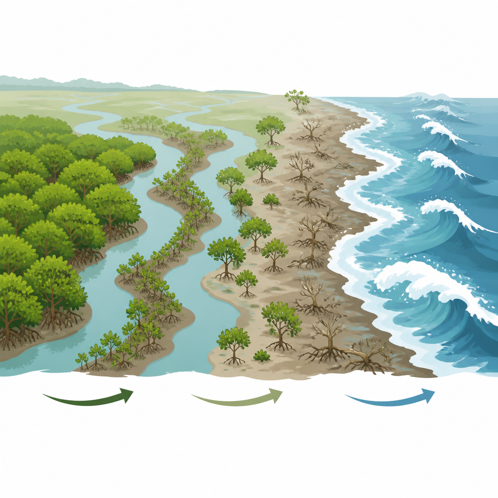
When researchers compared satellite images over several multi-year periods, they found a constant give and take. Along exposed coasts, especially on the western delta front, mangroves repeatedly disappeared as shorelines eroded. At the same time, new patches sprang up along tidal channels and on the sheltered sides of islands and sandbars, often farther from direct wave attack. Over 35 years, the delta gained more than 42,000 hectares of mangroves and lost about 37,000 hectares, but within the coastal zone itself the balance was negative: far more area was stripped from the seaward edge than added seaward. This means the forest is slowly pulling back from the open sea, even as it thickens in more protected zones.
Monsoon waves and storms as coastal sculptors
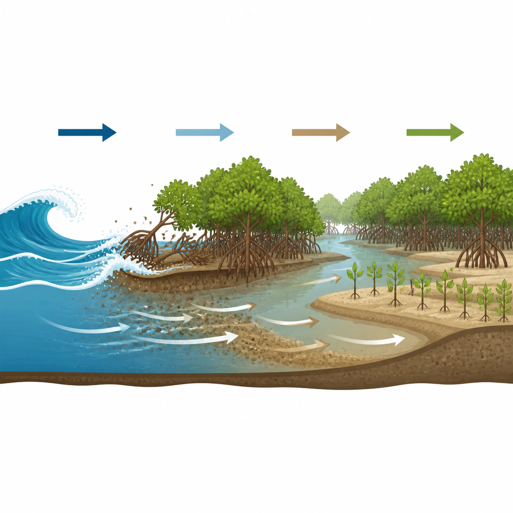
The authors found that seasonal waves driven by the southwest monsoon are the main force eating away at the outer mangrove belt. Using long-term wave data, they showed that stronger wave energy in the monsoon season matches faster shoreline retreat, especially on the western delta. Field photos reveal wave-cut cliffs at the forest edge, exposed roots, and dead stumps on tidal flats, all signs of repeated wave battering. Tropical cyclones add short, powerful bursts of wave energy that can quickly strip trees and sediment, while rising sea level acts as a slow “helper” to erosion by allowing larger waves to reach further inland without losing much energy on shallow flats.
Rivers, tides, and mud as quiet rebuilders
Despite these losses at the front line, water and mud flowing through the delta help rebuild the forest from within. Large tides push suspended river sediment back into tidal channels, where it settles, raises the bed, and creates higher, firmer ground suitable for mangrove seedlings. In the eastern delta, where sediment delivery remains strong, this process can overwhelm the erosive effect of waves, leading to expanding shorelines in some areas. The study also found that changes in mangrove area lag behind changes in sediment supply by about six years: after a period of high sediment input, new bars and flats form first, and only later do mangroves colonize and grow into noticeable stands.
Human hands on the river system
People influence these natural balances too. Upstream dams and barrages, such as the Farakka Barrage on the Ganges, divert water and trap sediment, reducing the amount that reaches the delta front, particularly in the west. Local embankments and land-reclamation structures further alter how sediment spreads and where it can be deposited. These actions tend to starve the outer mangrove fringe of the mud it needs to keep up with wave erosion and rising seas, even as protected reserves and limited development in some areas help maintain the forest interior.
What this means for the future of the delta
Overall, the study shows a mangrove system that is not simply shrinking or growing, but reshaping itself. Monsoon-driven waves and storms are steadily trimming the seaward edge, especially where sediment supply has been cut and coasts are exposed. At the same time, tides and river-borne mud nurture new mangroves along inner channels and on sheltered banks, partly offsetting those losses. For planners and communities, the message is clear: protecting sediment flows and allowing natural tidal processes to operate are just as important as shielding coasts from waves. Doing so can help sustain these forests as living buffers that continue to protect millions of people in the delta region.
Citation: Xiong, Y., Dai, Z., Long, C. et al. Monsoon-driven waves induce a prevailing recession in mangrove forests across the Ganges-Brahmaputra-Meghna Delta. Commun Earth Environ 7, 417 (2026). https://doi.org/10.1038/s43247-026-03397-z
Keywords: mangrove erosion, Ganges Brahmaputra Meghna Delta, monsoon waves, sediment supply, Sundarbans