Clear Sky Science · en
Increased methane emissions from boreal peatlands following linear disturbances
Why hidden cuts in northern wetlands matter
Boreal peatlands – soggy forests and open wetlands across northern Canada and beyond – quietly lock away vast amounts of carbon while also leaking methane, a powerful heat‑trapping gas. Energy companies cut long, straight corridors called seismic lines through these peatlands to search for oil and gas. This study asks a simple but crucial question: do those narrow cuts noticeably boost methane escaping to the air, and if so, how?
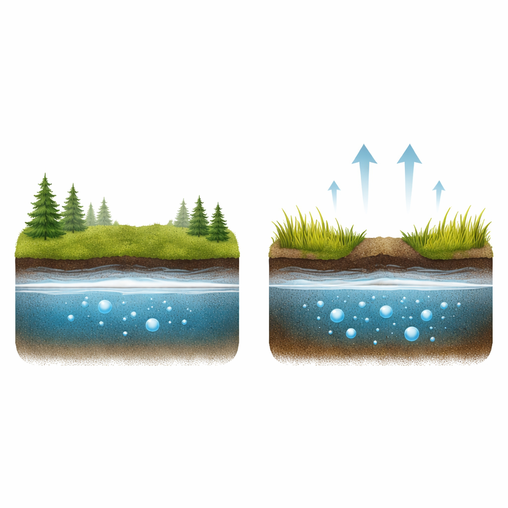
Peatlands: giant sponges of carbon and methane
Peatlands form where cold, wet conditions slow the breakdown of dead plants, building thick layers of peat that store carbon for thousands of years. Because water keeps oxygen out, microbes in these waterlogged soils produce methane as they chew through organic matter. Although peatlands cover only a small share of Earth’s land, they contribute a sizeable fraction of global methane emissions. Canada alone contains over a quarter of the world’s peatlands, many of them in regions targeted for oil and gas exploration, which makes understanding human impacts on these landscapes especially important for climate accounting.
How straight lines reshape wet ground
Seismic lines are narrow corridors, typically a few meters wide but stretching for hundreds of kilometers, cut through forests and peatlands to move exploration equipment. Cutting trees removes shade and a major pathway for water loss through transpiration. Heavy machinery can compress the spongy peat, lowering the ground surface and changing how water moves. Earlier work showed these lines are often warmer, flatter and wetter than the surrounding forested peatland, and that trees struggle to regrow. Such shifts in temperature, moisture and vegetation set the stage for different methane behavior compared with nearby “natural” patches that have not been disturbed.
Measuring gas leaks from disturbed and natural plots
To see how these changes play out, the researchers studied two wooded bogs and one wooded poor fen near Peace River in northern Alberta. Across three sites, they installed metal collars both on seismic lines and in undisturbed peatland a short distance away. During the 2018 and 2019 growing seasons, they regularly placed chambers over each collar to trap air and measured how quickly methane built up, along with water‑table depth, soil temperature and plant cover. They focused on the low vegetation layer – mosses, grasses, sedges and small shrubs – because it provides the freshest food for methane‑producing microbes and includes plants that can pipe gases directly from soil to air.
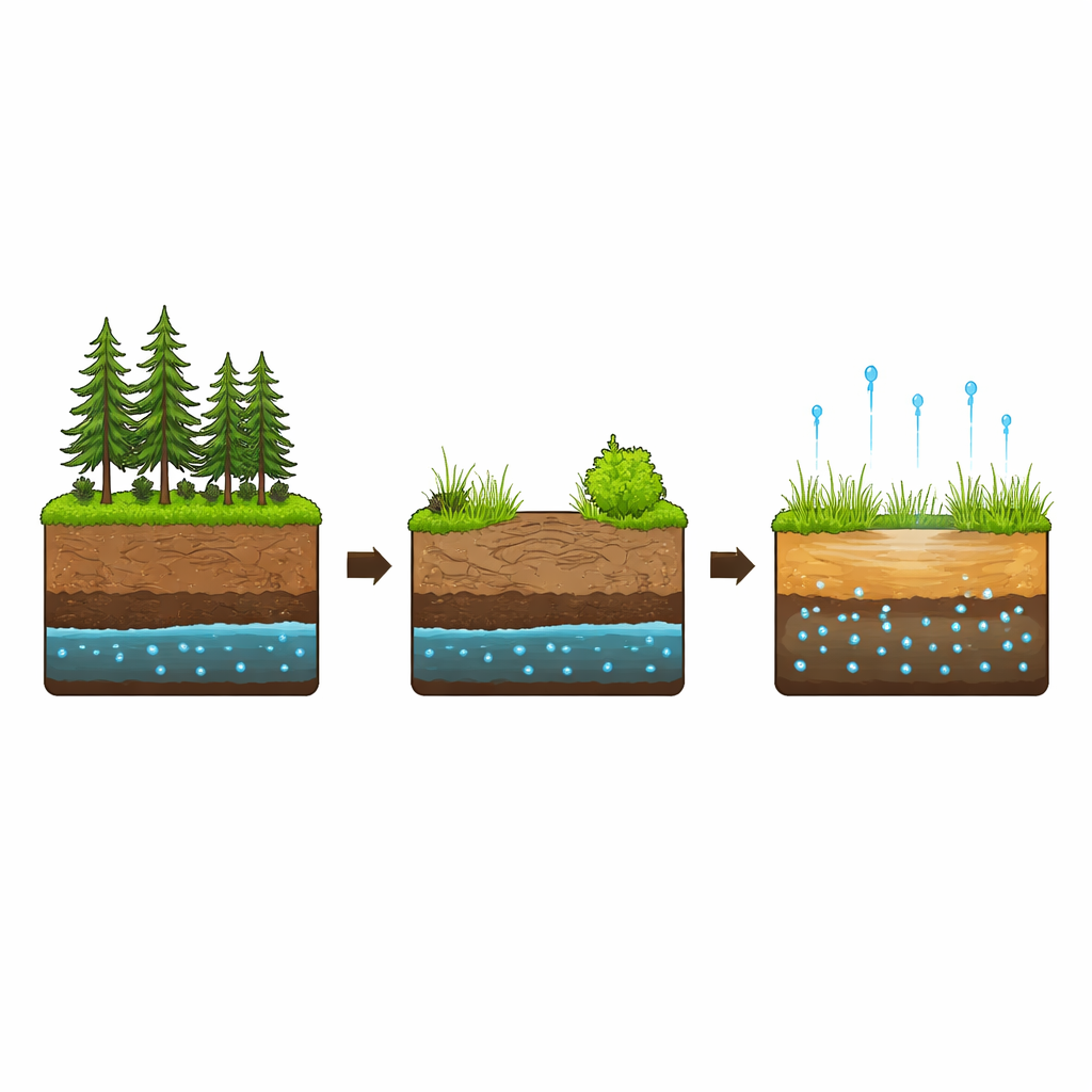
Warmer, wetter corridors with busier plant life
Across the study, seismic lines were consistently at least about one degree Celsius warmer and generally wetter than neighboring peatland. In the fen and one of the bogs, the water table on the lines sat several centimeters closer to the surface, creating thicker saturated zones where methane‑producing microbes thrive. Plant communities shifted as well: mosses and lichens tended to decline, while shrubs and grass‑like plants, particularly sedges, became more common and more productive on the lines. These changes meant more easily decomposed plant material entering the soil and more roots that can channel methane upward. Statistical analysis showed that water level – how close it was to the surface – was the single strongest factor explaining differences in methane flux, more so than vegetation cover or average soil temperature alone.
Big boosts in methane where cuts are made
The disturbed plots emitted noticeably more methane than nearby natural plots at all three sites. In the treed bogs, methane release from the understory on seismic lines was roughly three times that of the intact bog surface; in the treed fen, emissions were close to double. Even though the absolute methane output in bogs remained lower than in the fen, the proportional jump linked to disturbance was greatest in these forested bogs. When the team scaled up their measurements to entire peatland areas using satellite imagery of line density, they found that seismic lines increased growing‑season methane emissions by a few percent at each site, with the largest effect in the bog that had the highest fraction of its area cut by lines. Because tens of thousands of kilometers of such corridors cross boreal peatlands, these local percentage increases translate into significant additions to regional greenhouse‑gas emissions.
What this means for climate and land decisions
The study shows that even narrow, seemingly minor cuts through northern wetlands can persist for decades and substantially raise methane escaping from the peat just beneath our feet. By lowering and wetting the ground, warming the soil and favoring more productive, grass‑ and shrub‑dominated vegetation, seismic lines create ideal conditions for methane‑producing microbes and for gas to move into the atmosphere. For the public and policymakers, the message is clear: when we tally the climate costs of resource exploration in peatland‑rich regions, these “invisible” lines need to be counted. The findings provide vital field data to improve greenhouse‑gas reporting and to guide restoration efforts aimed at re‑wetting, re‑shaping and re‑vegetating disturbed peatlands so they can better resume their role as long‑term carbon guardians rather than growing methane sources.
Citation: Korsah, P., Davidson, S.J. & Strack, M. Increased methane emissions from boreal peatlands following linear disturbances. Commun Earth Environ 7, 360 (2026). https://doi.org/10.1038/s43247-026-03273-w
Keywords: boreal peatlands, methane emissions, seismic lines, oil and gas exploration, wetland disturbance