Clear Sky Science · en
An adaptive A-Star algorithm to handle blood transportation using UAVs
Why flying blood matters
When someone needs an urgent blood test or transfusion, every minute spent in traffic can cost a life. In many cities, crowded roads slow down ambulances and couriers, especially when samples must move between far‑flung hospitals. This study explores how small autonomous aircraft—drones—can be guided along safe, efficient routes so they can carry blood across complex landscapes without running out of battery or crossing into forbidden airspace. 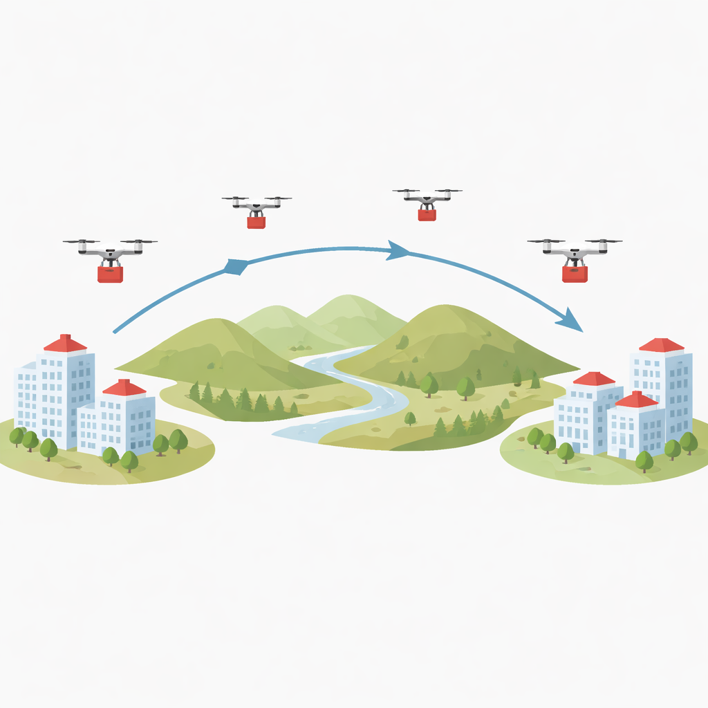
From city streets to air routes
The authors focus on a very practical question: how can drones reliably shuttle blood between hospitals in a real country, not just in simulation? They look at Lebanon, where mountainous terrain and heavy traffic make fast delivery difficult. Drones promise to fly straight over congestion, but they face two hard limits. First, their batteries drain quickly, especially when they carry heavy, cooled blood bags. Second, they cannot simply fly in a straight line, because tall hills, dense cities, and restricted airspace may lie in the way. The paper treats the landscape as a three‑dimensional puzzle and asks how to find paths that save energy while still getting blood where it needs to go in time.
Teaching drones to read the landscape
To solve this, the researchers adapt a well‑known navigation method called the A* algorithm, which normally finds the shortest route on a flat map. They feed it detailed digital maps that describe the height of the ground at every point, turning the region into a grid of tiny tiles, each with its own elevation. The enhanced algorithm measures real 3D distances, so it knows that climbing over a hill costs more effort than flying over a flat plain. It also checks for obstacles, such as no‑fly zones, and discards any step that would cross them. On top of pure distance, the team builds an energy model based on experiments showing that climbing uses extra power while descending uses slightly less. The algorithm therefore favors routes that gently weave through the landscape, trading a bit of extra distance for large savings in battery use. 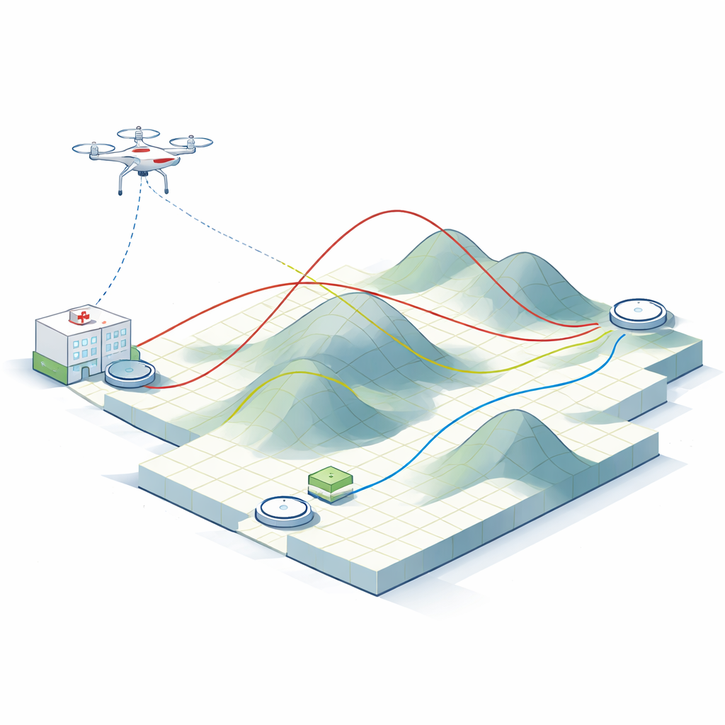
Planning where drones can catch their breath
Even with careful routing, today’s drones cannot fly indefinitely. The authors estimate how far a popular medical‑grade drone can travel while carrying a typical blood payload, taking into account wind and safety margins. They then link the route‑planning step with a second problem: where to place charging or battery‑swap stations. Using a clustering technique, they group hospitals that lie near each other and pick central sites that can serve as shared charging hubs. Along any planned route, when the remaining battery would no longer safely cover the next segment, the system chooses the closest realistic location—often a hospital or service center—to act as a charging stop rather than some remote, unusable spot on the map.
Putting the system to the test
The framework is tested on real hospital locations in Lebanon. The team compares several flight strategies between two distant hospitals: an unrealistically perfect straight‑line path, and three more realistic versions that respect terrain and energy use in different ways. They find that the naïve straight line is not the most battery‑efficient once climbs and descents are accounted for. The best‑performing approach starts the drone at the true height of the source hospital and limits needless changes in altitude, cutting overall energy use. The study also shows that, for the same travel speed, a drone can typically cover a shorter distance than a car constrained to winding roads, and it can avoid the unpredictable delays caused by traffic jams.
What this means for future medical flights
In everyday terms, the study shows that clever navigation and smart placement of charging points can turn drones from simple gadgets into reliable members of the medical transport team. By teaching drones to “see” hills, restricted areas, and their own battery limits, the proposed system helps ensure that blood samples and products arrive quickly, safely, and with enough power left in reserve. While the current work assumes fixed obstacles and single‑drone flights, it lays a foundation for future networks of cooperating medical drones that could serve patients across cities and remote regions alike.
Citation: Zaki, C., Taleb, H., Taki, M. et al. An adaptive A-Star algorithm to handle blood transportation using UAVs. Sci Rep 16, 13674 (2026). https://doi.org/10.1038/s41598-026-40040-5
Keywords: medical drones, blood transport, route planning, energy-efficient flight, healthcare logistics