Clear Sky Science · en
Spatiotemporal analysis for assessing the cultural significance of Pella (Tabaqat Fahl), Jordan
A Hidden City in the Hills
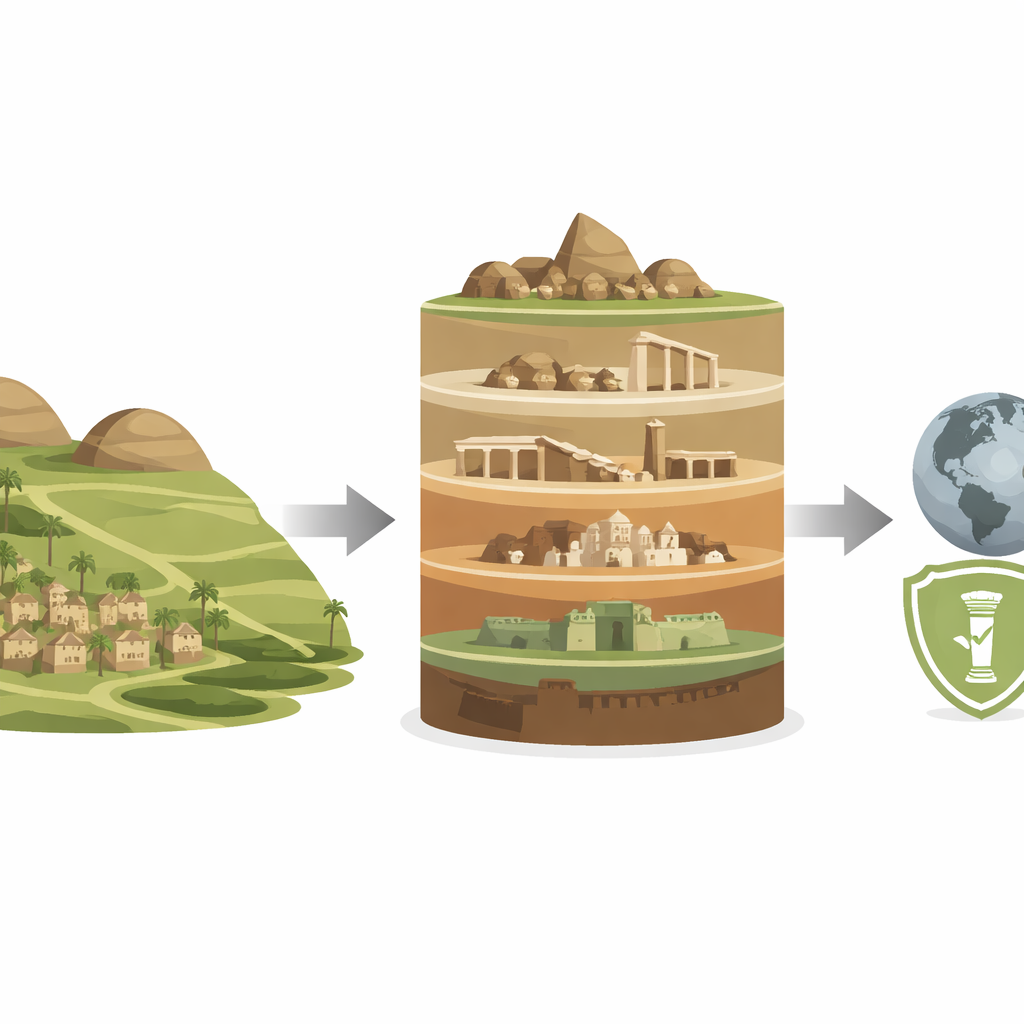
Pella, a quiet landscape of low hills in northern Jordan, holds the remains of more than 8,000 years of human life. This article explores how modern mapping tools let researchers peel back those layers of history without moving a single stone. For readers curious about how technology is transforming archaeology—and how one small place can tell the story of whole civilizations—Pella offers a vivid case study in seeing time written across the land itself.
A Place People Never Stopped Using
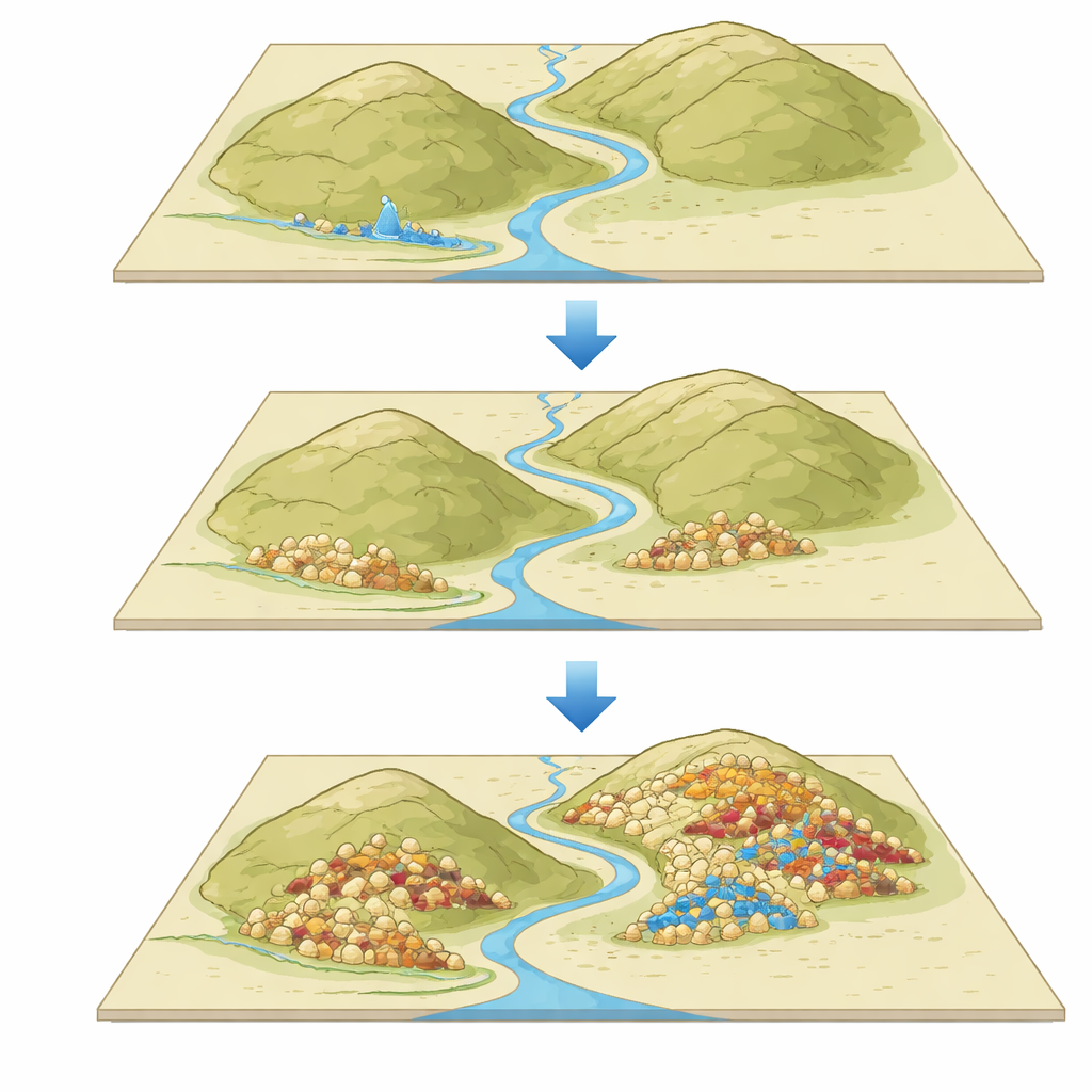
Pella, also known as Tabaqat Fahl, sits in the eastern hills of the Jordan Valley, not far from the Jordan River and the Sea of Galilee. Two rounded mounds rise about 30 meters above the surrounding terrain, marking the heart of the ancient settlement. Excavations show that people lived here from the Neolithic period through the Bronze and Iron Ages, and later under Hellenistic, Roman, Byzantine, and Islamic rule. Each era left its own buildings—fortresses, houses, churches, mosques, baths, theaters, storage silos—yet, strikingly, later communities rarely rebuilt directly on top of or reused earlier temples. This has preserved a rare, clear sequence of distinct historical layers.
Using Maps to Read the Past
Instead of retelling all of Pella’s archaeology, the authors focus on how to analyze the site using digital maps. They assemble information from excavation reports, national heritage databases, aerial photographs, and satellite elevation data into a Geographic Information System (GIS). In simple terms, GIS is a way to stack many kinds of maps on top of each other—showing ground height, building remains, water sources, and more—in a single, searchable model. By linking each feature to a time period, they perform a “spatiotemporal” analysis, comparing where people lived and built at different moments in history.
Why Hills, Springs, and Slopes Matter
The combined maps reveal that Pella’s long story is tightly bound to its landscape. The two main mounds, Tell el-Husn and Tabaqat Fahl, differ in height and steepness, and a shallow valley with springs runs between them. Early farmers in the Neolithic and Chalcolithic periods favored the flatter, more accessible Tabaqat Fahl mound near water, building storage facilities and installations tied to everyday survival. In the Bronze and Iron Ages, settlements spread across both mounds, adding fortifications, houses, and burial areas. Later Hellenistic and Roman phases used both heights for public buildings and defenses, while Byzantine and Islamic communities refocused on Tabaqat Fahl, clustering churches, mosques, and town centers near the gentler slopes and springs. Throughout, the patterns show repeated expansion and contraction rather than steady growth, as different societies adapted to shifting needs and opportunities.
Keeping the Past Intact
Because later builders at Pella seldom recycled earlier structures, many periods remain physically separate and recognizable, even though earthquakes and time have taken their toll. The modern village of Tabaqat Fahl sits close by but not directly on the densest zones of ruins, helping preserve the original layout. International conservation guidelines emphasize two key ideas: authenticity—whether a site truly reflects its history—and integrity—whether its important features are still whole enough to understand. By those measures, Pella scores well in terms of setting, landscape, and the continuity of local farming traditions, though the ruins themselves are often fragmentary and vulnerable to neglect, climate stresses, and tourism pressure.
From Local Ruins to Global Heritage
Pella is already on UNESCO’s Tentative List of World Heritage sites, but to move toward full recognition, officials need clear, evidence-based arguments about why it matters and how to protect it. The authors show that GIS-based spatiotemporal analysis can supply exactly that kind of evidence, grounding claims about cultural value in visible patterns of settlement through time. Their method—integrating archaeology, topography, and land use into one digital framework—can be copied for other sites facing threats from urban growth, looting, or climate change. In plain terms, the study proves that smart mapping does more than make pretty pictures: it helps turn scattered ruins into a coherent story, guiding better decisions about how to safeguard places where human history runs deep.
Citation: Jamhawi, M., Kazali, F. & Ruzuq, R.A. Spatiotemporal analysis for assessing the cultural significance of Pella (Tabaqat Fahl), Jordan. npj Herit. Sci. 14, 245 (2026). https://doi.org/10.1038/s40494-026-02534-3
Keywords: Pella Jordan, archaeological mapping, GIS heritage, cultural landscapes, World Heritage conservation