Clear Sky Science · en
Geophysical characterization of subsurface structures for optimal planning in the Abu Tartur phosphate mine
Why hidden rocks matter for food and jobs
Deep beneath Egypt’s Western Desert lie vast beds of phosphate rock, the raw material for fertilizer that helps feed much of the world. At the Abu Tartur phosphate mine, however, underground operations were shut down after disappointing results. This study asks a simple but crucial question: was the mine in the wrong place? By using subtle variations in Earth’s gravity and magnetism, the researchers mapped the buried rock layers in three dimensions and showed that the richest phosphate lies not where the mine was dug, but in nearby folded troughs that were never fully tapped.
From struggling mine to detective story
The Abu Tartur Plateau has long been seen as one of Egypt’s most promising phosphate regions, vital for national income and global fertilizer supplies. Yet its underground mine faced chronic problems: thin ore layers, unexpected faults and uneconomic extraction that ultimately forced a switch to surface mining behind the plateau. Earlier work had focused mainly on engineering issues such as how to support tunnels and size the extraction panels, while the basic picture of the underground geology remained sketchy. This study reframes the mine’s troubles as a geological detective story: perhaps the rock structures themselves, not only the tunnel design, doomed the original layout.
Listening to Earth’s pull and magnetism
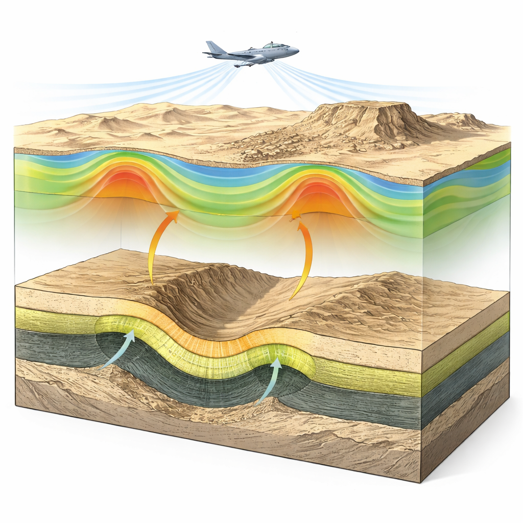
To see below the surface without drilling everywhere, the team turned to two non-invasive tools. Gravity measurements reveal how strongly rocks of different density tug on a sensor, while magnetic data respond to variations in the magnetic minerals they contain. Using regional aeromagnetic surveys and Bouguer gravity data, the scientists processed the signals with a suite of filters that sharpen edges, separate deep trends from shallow features, and highlight likely faults and folds. They then built two-dimensional computer models along five long cross sections, adjusting rock densities, magnetic properties and layer depths until the calculated fields matched the observed ones. This allowed them to trace key layers from the surface down to the hard basement rock across tens of kilometers.
Folds, breaks, and wandering phosphate beds
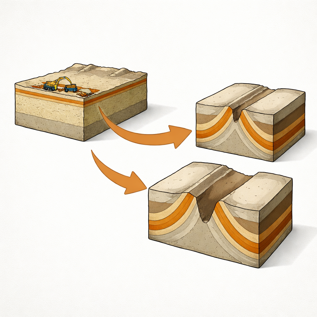
The resulting underground picture is far from a simple flat stack of sediments. The basement and overlying Nubian sandstone form broad, plunging folds and are cut by normal and strike-slip faults trending mainly east–west and northwest–southeast. Above these shifting foundations sit shales, limestones and the critical phosphatic Duwi Formation. The models show that the phosphate layer is broken and highly variable in thickness, sometimes forming a nearly continuous band, elsewhere thinning out or becoming disconnected. Its thickness ranges from less than a meter to about 32 meters, and these changes closely follow the hidden folds and faults mapped in the gravity and magnetic data.
Why the mine missed the sweet spots
When the researchers converted their models into depth and thickness maps, a clear pattern emerged. Under the central Abu Tartur Plateau—where the underground mine was developed—the phosphate layer is relatively thin. In contrast, the thickest accumulations occur in the troughs of synclines, bowl-shaped folds located to the northeast and southwest of the plateau. Normal faults ring the plateau with their downthrown sides facing outward, further shifting the richer rock away from the original workings. In effect, the mine was sunk on a structural high where ore is naturally scarce, while the best material pooled in nearby structural lows that were not the focus of the earlier development.
Rethinking where and how to dig
For a general reader, the takeaway is straightforward: if you do not understand the shape of the rocks you are mining, you can spend enormous sums digging in the wrong place. By fusing gravity and magnetic surveys with borehole information, this study shows that Abu Tartur’s underground mine was poorly sited from the start, helping explain its poor performance and closure. The work points to new, more promising targets northeast and southwest of the plateau, where thicker phosphate layers should be easier and more profitable to extract. More broadly, it illustrates how modern geophysical mapping can guide smarter, more sustainable mining—reducing waste, protecting landscapes and improving the security of key resources like fertilizer that underpin global food production.
Citation: Ahmed, G.M.K., Senosy, M.M., Boghdady, G.Y. et al. Geophysical characterization of subsurface structures for optimal planning in the Abu Tartur phosphate mine. Sci Rep 16, 13006 (2026). https://doi.org/10.1038/s41598-026-48186-y
Keywords: phosphate mining, geophysical exploration, gravity and magnetic surveys, Abu Tartur Egypt, sustainable resource planning