Clear Sky Science · en
Tsunamigenic fault structures revealed in the 2024 Noto earthquake (M7.6) rupture area
Why this matters for coastal communities
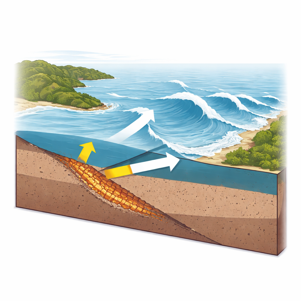
On New Year’s Day 2024, a powerful earthquake off Japan’s Noto Peninsula sent tsunami waves crashing into nearby shores. Many people asked the same question: exactly which hidden tear in the Earth’s crust lifted the seafloor and pushed the ocean toward land? This study uses detailed acoustic imaging of the seafloor and computer simulations of waves to pinpoint the underwater fault structures that most likely created the tsunami, offering clues that can improve future hazard assessments for coastal regions.
A closer look beneath the Japan Sea
The eastern edge of the Japan Sea has a long record of strong earthquakes, because old cracks in the crust have been squeezed and reactivated. Around the Noto Peninsula, small quakes had been building since 2018 and intensified sharply in late 2020, culminating in a magnitude 7.6 event in January 2024. Scientists knew the general area of the rupture from aftershocks and satellite measurements, and a tsunami survey found waves up to about 5 meters high along parts of the coast. But the exact offshore fault that moved, and how its shape affected tsunami size, were not clearly known because earlier surveys used relatively low resolution data.
Imaging a band of broken rock on the seafloor
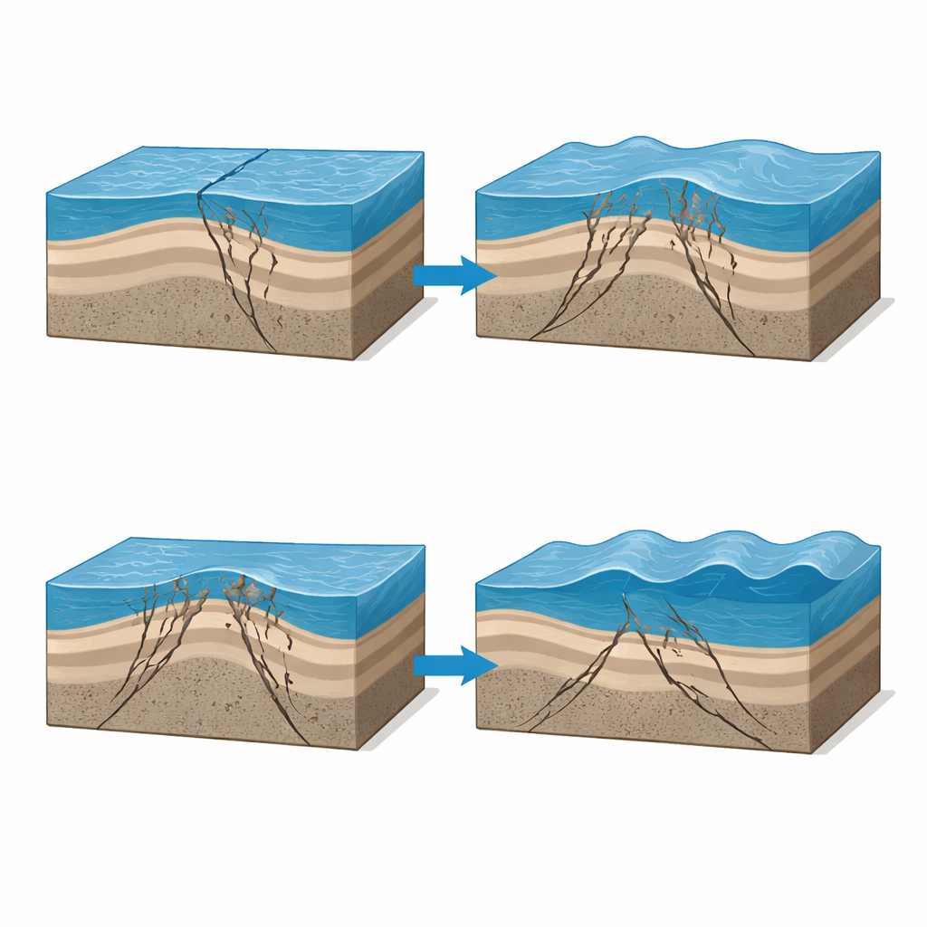
In March 2024, researchers used a research vessel to tow a line of underwater microphones and fire controlled sound pulses into the crust. By recording the echoes and converting travel times to depth, they built sharp cross sections of the shallow seafloor layers. These seismic reflection images revealed a striking feature: a band 2.5 to 3.8 kilometers wide and about 30 kilometers long where rocks are heavily broken, folded, and pushed upward. The team calls this band a large deformation zone. It sits within the main rupture area of the 2024 earthquake and is formed above a steeply inclined reverse fault that cuts upward toward the seabed, with several smaller side faults branching off and reaching close to the seafloor.
Active faults that slipped and faults that mostly stayed quiet
Within the large deformation zone, the main fault dips steeply toward the southeast and appears to be the shallow extension of a deeper, gently curving fault that actually slipped during the quake. The branching faults and associated “pop up” structures indicate that parts of the crust there also slide sideways, not just up and down. The seismic profiles and seafloor shape show long term uplift and erosion in this area, matching recent measurements that found up to about 3 meters of seafloor rise in 2024. The researchers also imaged other offshore faults farther north that dip in the opposite direction and clearly cut the seafloor, forming tall underwater scarps. These faults appear geologically active, but evidence suggests they slipped very little during the 2024 event and contributed only weakly, if at all, to the tsunami.
Testing which faults make the biggest waves
To connect these structures to real waves on shore, the team fed their mapped fault shapes into a tsunami computer model. They varied how far different fault segments slipped and compared the calculated coastal wave heights with field measurements of flooding along Honshu and nearby islands. The best match came from models where the main southeast dipping faults in the large deformation zone moved by about 6 to 7 meters, while the more northerly northwest dipping faults moved by at most about 1 meter. This amount of slip on the main offshore fault naturally produces seafloor uplift consistent with the observed 3 meter rise, and it reproduces measured tsunami heights around the Noto coast much better than earlier models that used simpler fault shapes and smaller slips.
What this means for future tsunami risk
For non specialists, the key message is that not all nearby faults are equal when it comes to tsunami danger. This work shows that a relatively narrow band of broken rock offshore the Noto Peninsula, sitting above a steeply dipping fault that curves with depth, was the most efficient tsunami maker in 2024. Other faults in the region remain active and may pose a future earthquake risk, but they did not play a major role in this particular tsunami. By tying detailed seafloor imaging to realistic wave simulations, the study provides a clearer picture of which hidden structures under the Japan Sea are most likely to lift the seafloor and send water toward shore during future large earthquakes.
Citation: Park, JO., Mohammadigheymasi, H., Yamaguchi, A. et al. Tsunamigenic fault structures revealed in the 2024 Noto earthquake (M7.6) rupture area. Sci Rep 16, 12046 (2026). https://doi.org/10.1038/s41598-026-48075-4
Keywords: Noto earthquake, tsunami generation, submarine faults, seafloor uplift, Japan Sea