Clear Sky Science · en
Coupling urbanization and landscape ecological risk in the agricultural-dominant Liaohe River Basin
Why this river basin story matters
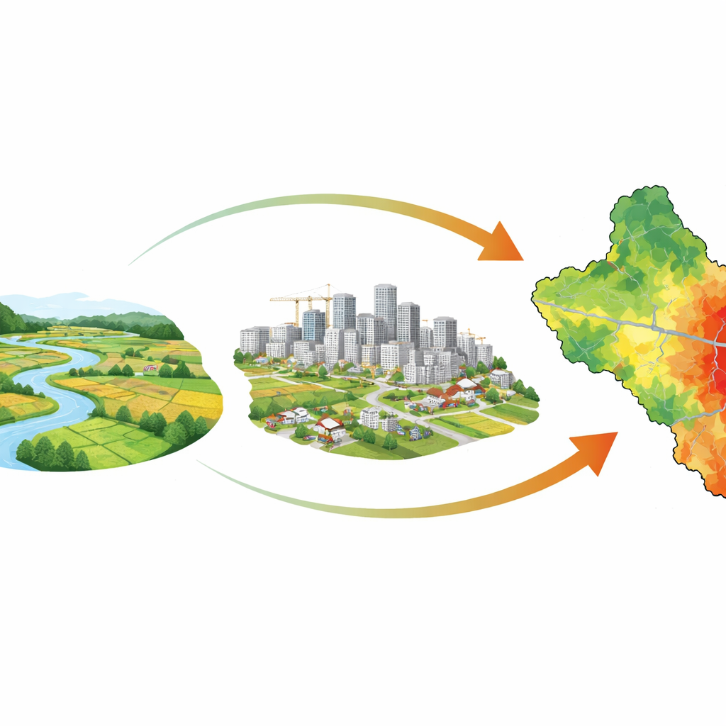
Across the globe, growing cities are transforming nearby farmland and natural areas. This study zooms in on one such place: the Liaohe River Basin in northeast China, a region where cropland dominates but urban areas have been expanding quickly. The authors ask a question that matters far beyond China: as towns and cities grow, can we keep the surrounding landscape healthy enough to provide food, clean water, and other benefits people depend on?
A working countryside under pressure
The Liaohe basin is both a breadbasket and a home to major cities such as Shenyang. Over the past three decades, the region has seen rapid growth in roads, factories, and housing. Instead of cities simply swallowing wild land, here they compete directly with farmland for space and water. This creates a distinctive tension: local leaders must support economic growth and better living standards while protecting cropland and sensitive areas like wetlands and forests. Understanding how these pressures reshape the land is key to planning a sustainable future.
Tracking city growth and land health
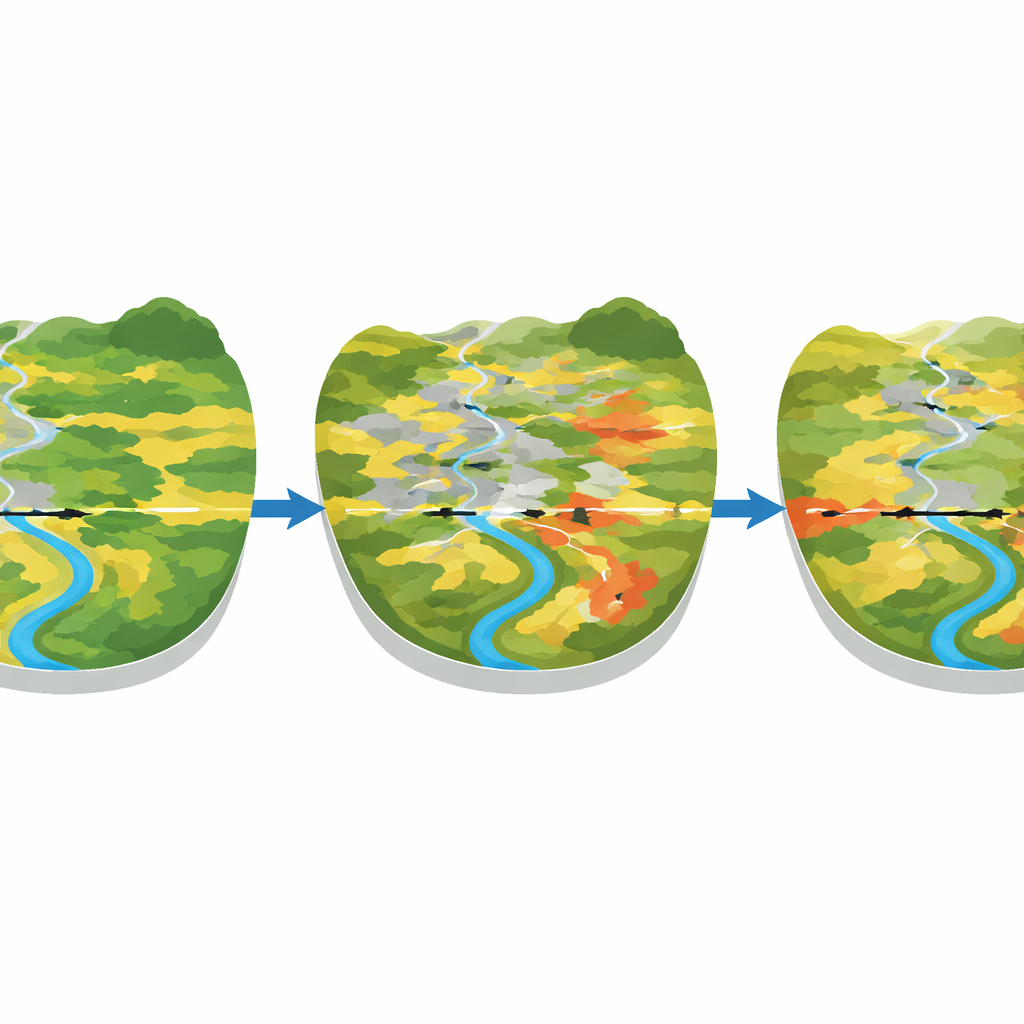
To follow these changes, the researchers divided the basin into a grid and used satellite-based land maps, population data, and economic statistics from 1990 to 2019. For each grid cell, they measured three aspects of urbanization: people, money, and built-up land. They also calculated a "landscape ecological risk" score that reflects how fragmented and vulnerable the local mix of fields, forests, grasslands, water bodies, and built-up areas has become. By combining these measures in a coupling coordination model, they could see not just how cities and risks changed, but how well they stayed in step with each other over space and time.
More city, slightly less risk
The results are striking. Urbanization in the basin rose by about 86%, with the fastest growth coming from paved and built-up land. Yet overall landscape risk did not spike; instead, it fell slightly, with many areas shifting from higher to medium or lower risk. Much of the basin is covered by cropland, which tends to form large, stable blocks that dilute some of the risk associated with scattered small patches. Policies that converted some fields to forests, grasslands, or river corridors also helped reduce risk in certain zones. At the same time, places where natural habitats sit close to city edges or heavy industry still face high pressure, especially wetlands near the river mouth.
Uneven partnership between cities and landscapes
When the team examined how urban growth and ecological risk moved together, they found a pattern that shifted over time: first the relationship tightened, then loosened, then strengthened again. On average, the basin stayed in a state of only slightly balanced development, and many areas showed what the authors call "urbanization lag"—the land system was relatively stable while city growth advanced more slowly. High coordination tended to cluster around large urban centers like Shenyang and Panjin, where economic development has increasingly gone hand-in-hand with environmental protection efforts. Outlying forest and grassland regions, by contrast, often showed mismatches and higher imbalances.
Guiding smarter growth in working river basins
The study concludes that even in a rapidly changing, agriculture-led river basin, it is possible to grow cities without sharply increasing ecological risk—but only with careful, place-specific management. The authors recommend different strategies for different zones: tighten protection and stepwise risk control where natural landscapes are already stressed; manage cropland more intensively and limit sprawl where farmland dominates; and in areas where city growth and land health are already well matched, focus on higher-quality, not simply faster, development. In simple terms, their message is that urban and rural interests do not have to be in conflict. With the right planning tools, city expansion and landscape protection can be coordinated so that rivers, farms, and towns can thrive together.
Citation: Song, F., Sun, Z., Wu, H. et al. Coupling urbanization and landscape ecological risk in the agricultural-dominant Liaohe River Basin. Sci Rep 16, 11698 (2026). https://doi.org/10.1038/s41598-026-46980-2
Keywords: urbanization, river basins, landscape risk, cropland, China