Clear Sky Science · en
Assessment of coastal land use structure and efficiency based on multi-source data: From the perspective of sea-land gradient
Why Coastal Land Use Matters to Everyday Life
Coastal regions are some of the busiest and most valuable places on Earth. They host ports, factories, housing, farms, railways, and fragile ecosystems all packed into narrow strips of land. This study looks at how land along the coast of Jinpu New Area in Dalian, China, is being used and how efficiently it supports economic activity and daily life. By examining how land use changes with distance from the shoreline, the researchers uncover patterns that can guide smarter urban growth, protect the environment, and help coastal cities avoid both waste and overload.
A Coast-to-Inland Strip of Contrasting Worlds
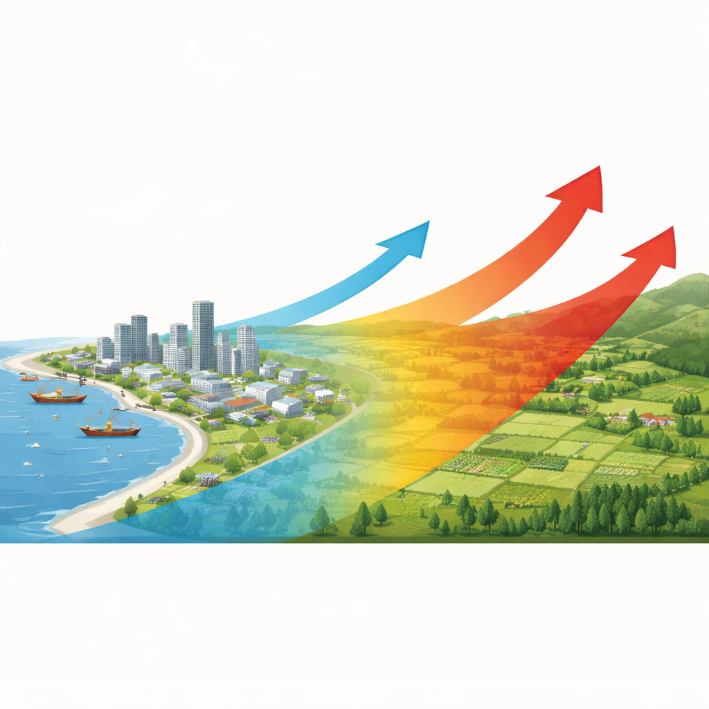
The authors focus on Jinpu New Area, a state-level development zone flanked by the Yellow Sea and the Bohai Sea. They divide the land into bands that stretch inland from the shoreline, like concentric ribbons, and then ask how different types of land—ports, city blocks, town centers, highways, railways, reservoirs, and mining sites—are arranged within each band. They find a clear gradient: land near the sea is dominated by port terminals and urban areas, middle bands host town centers, roads, and water engineering projects, while farther inland, railways and more dispersed uses become dominant. This spatial “fingerprint” shows that coastal areas act as intense economic gateways, while the hinterland plays a different, often less developed, role.
Measuring How Hard the Land Is Working
To move beyond a simple map of land categories, the study evaluates how intensely land is used and how much benefit it produces. Intensity is captured by how much of each 300-by-300-meter grid cell is covered by built surfaces and by the average building height, combining to show how “stacked” and built-up a place is. Efficiency is estimated using a fusion of satellite observations and statistical data: night-time lights as a proxy for economic activity, land surface temperature as a sign of urban heat, population density, the density of points of interest such as shops or services, and gridded economic output. These ingredients are blended into a composite index that reflects how effectively each patch of land translates physical development into human and economic output.
Where Land Use Is Wasteful and Where It Is Overloaded
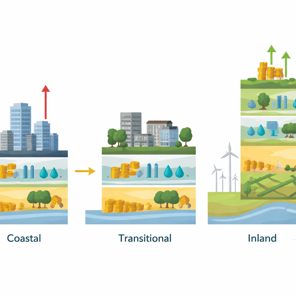
The heart of the study is a “coupling index” that compares intensity and efficiency in each grid cell. If development is intense but efficiency is low, the land is considered inefficient—too much concrete for too little return. If efficiency is high while intensity is low, the land is judged overloaded: it is carrying more activity than its physical development would suggest, potentially straining infrastructure or limiting future growth. The researchers find a striking sea-land pattern. Very close to the coast, many areas—especially around ports and dense urban streets—show high intensity that outpaces efficiency, signaling wasteful or premature development. In the middle bands between coast and inland, intensity and efficiency are better matched, forming “well-coupled” transition zones. Farther inland, especially where railway land is concentrated, efficiency tends to exceed intensity, suggesting underdeveloped areas that could support more balanced growth.
How Land Mix Shapes Performance
By linking land types to efficiency, the study shows that structure matters as much as quantity. Urban land has a strong positive relationship with efficiency: where city blocks are present in a sensible pattern, land tends to be used more productively. Railway land, in contrast, shows a negative relationship with efficiency in later years, especially in outer inland bands where rail corridors occupy large swaths of land but are not matched by surrounding economic hubs. Coastal port zones, though crucial for trade, contain many grids where development intensity has surged ahead of realized benefits. The authors argue that planning should prioritize reusing and upgrading existing urban and port land, encourage mixed-use and vertical development, and carefully synchronize new railway and industrial projects with realistic demand.
What This Means for Coastal Cities
To a layperson, the study’s message is straightforward: not all development is good development, and where you are along the coast-to-inland strip matters. In Jinpu New Area, the coast is heavily built but often inefficient, the mid-zone is relatively well balanced, and the inland areas are underbuilt for the activity they already carry. The authors propose using these gradients to guide policy: curb wasteful expansion in coastal bands, protect and fine-tune the well-coupled transition zones, and plan smarter, denser development around inland rail and town centers. More broadly, their approach—mixing satellite data, economic indicators, and simple comparative indices—offers a practical template for other coastal regions seeking to align urban growth with environmental limits and long-term prosperity.
Citation: Pei, Y., Zhu, J., Zhou, J. et al. Assessment of coastal land use structure and efficiency based on multi-source data: From the perspective of sea-land gradient. Sci Rep 16, 11876 (2026). https://doi.org/10.1038/s41598-026-40256-5
Keywords: coastal land use, urban land efficiency, sea land gradient, remote sensing, spatial planning