Clear Sky Science · en
Route optimization in urban waste management using locally adjusted discrete cuckoo search: a hybrid metaheuristic approach
Smarter Paths for City Garbage Trucks
Overflowing trash bins, noisy trucks stuck in traffic, and rising fuel bills are all side effects of how cities collect garbage today. As urban populations grow, simply adding more trucks or more collection rounds is costly and polluting. This study explores a new way to plan garbage truck routes so that the same bins are emptied using far less driving, fuel, and time—helping cities move toward cleaner streets and lower carbon emissions without expensive new hardware.
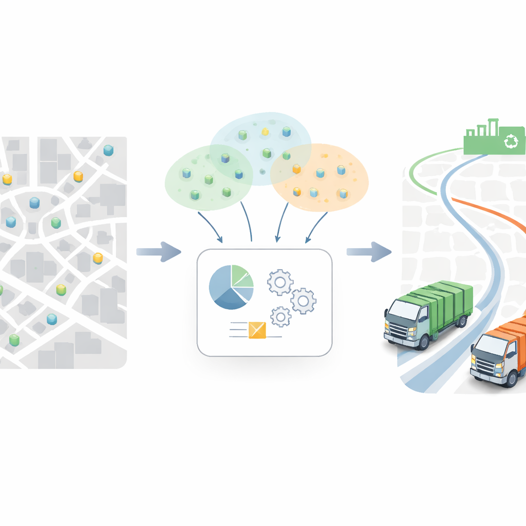
Why Waste Collection Routes Matter
Modern cities produce vast amounts of solid waste, much of which is still collected using fixed schedules and largely manual route planning. This often leads to trucks driving redundant loops, missing some bins while revisiting others too often, and wasting fuel in traffic. The problem is not just logistical; it has environmental consequences as well, because longer routes mean more fuel burned and more greenhouse gases released. At the same time, installing and maintaining electronic sensors in thousands of bins is expensive and technically challenging, especially in dense or low-income neighborhoods. The authors argue that to make waste collection both efficient and sustainable, cities need better route planning methods that can work with data they can realistically obtain.
Using Eyes in the Sky Instead of Sensors
Rather than filling every bin with electronics, the researchers turn to satellite imagery and mapping tools. They use Google Earth Engine and high-resolution Sentinel-2 images to spot locations of public waste bins across a part of Bengaluru, a major Indian city. Semi-automatic image processing techniques highlight likely bin shapes, and simple geometric rules filter out obvious false positives. The end result is a map of 232 verified bin locations, each represented as a point with geographic coordinates. This map becomes the starting point for planning how trucks should move: every bin is a stop that must be visited, and the central challenge is to find routes that cover all bins while minimizing driving distance and related costs.
A Nature-Inspired Route Planner
To tackle this puzzle, the study introduces a new computer method called Locally Optimized Discrete Cuckoo Search (LO-DCS). It is inspired by the behavior of cuckoo birds, which lay eggs in other birds’ nests, and by how nature explores and filters many possibilities. In the algorithm, each possible route for a truck is treated like a candidate “nest.” The method shuffles the order of bin visits in a controlled way, exploring different route patterns. A simple but powerful improvement step repeatedly swaps pairs of road segments to see if the total distance can be shortened, removing needless backtracking and crossings. Because the city is large, the algorithm first groups nearby bins into clusters, then optimizes each group separately, which keeps the search manageable while still covering the entire service area.
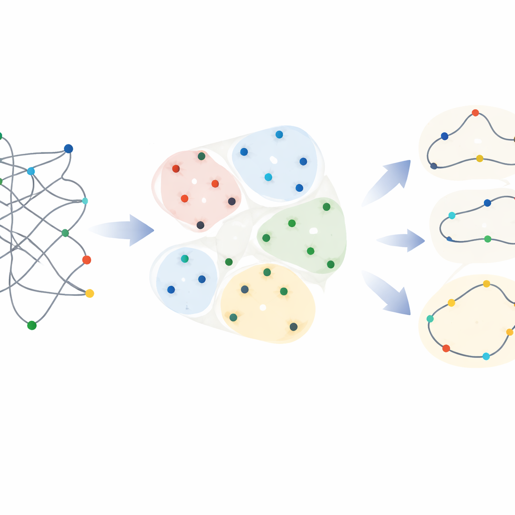
How Well the New Method Performs
The researchers test LO-DCS on the Bengaluru dataset and compare it with several well-known planning tools, including genetic algorithms, particle swarm methods, and other recent search techniques. They run each method many times under the same settings to check both average performance and consistency. Across three bin clusters, the new approach slashes the driving distance from over 400 kilometers in a naïve, non-optimized setup to under 70 kilometers per cluster after optimization. This translates into average improvements of about 85% in key measures—distance, fuel use, carbon emissions, and travel time—when compared to the unplanned routes. Against the other advanced algorithms, LO-DCS still achieves roughly 78% better performance on average. Statistical tests confirm that these gains are not just lucky runs, and detailed checks against exact mathematical solvers on smaller problems show that the routes are very close to the true best possible.
What This Means for Everyday City Life
Put simply, the study shows that cities can make garbage trucks drive much smarter routes using only location data derived from images and a well-designed planning algorithm. Without installing sensors in every bin, municipal agencies can cut truck mileage, shrink fuel budgets, and reduce carbon emissions while keeping streets cleaner. Although the method does not guarantee mathematically perfect routes and still relies on static bin locations, it provides a practical, scalable starting point that can later be combined with real-time traffic or fill-level data. For residents, the impact would be less noise and congestion from trucks and a smaller environmental footprint, all achieved through better use of information and clever optimization rather than major new infrastructure.
Citation: Goswami, A., N. V., P., P., P. et al. Route optimization in urban waste management using locally adjusted discrete cuckoo search: a hybrid metaheuristic approach. Sci Rep 16, 10097 (2026). https://doi.org/10.1038/s41598-026-40208-z
Keywords: urban waste collection, route optimization, metaheuristic algorithms, smart cities, sustainable logistics