Clear Sky Science · en
GIS-based soil bearing capacity zonation maps for the Dhaka metropolitan development plan (DMDP) area, Bangladesh
Why the ground under Dhaka matters
As Dhaka grows upward and outward, the hidden layer that matters most is not steel or concrete, but the soil beneath every building. If the ground is too weak or uneven, foundations can sink or crack, damaging homes, offices, and critical infrastructure. This study creates detailed maps of how well the ground across the Dhaka Metropolitan Development Plan (DMDP) area can safely carry building loads, giving planners and engineers a powerful new tool for safer, more economical construction.
Looking underground without digging everywhere
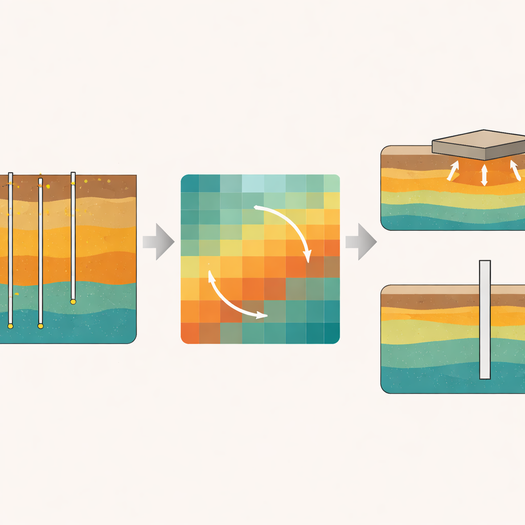
Directly testing the soil at every potential building site is time-consuming and expensive. Instead, engineers rely on boreholes drilled at selected locations, where a standard penetration test (SPT) measures how resistant the soil is to being driven into. The authors gathered data from 360 such boreholes and nearly 4,700 measurement points spread across the DMDP region, which includes Dhaka and several surrounding districts. Using this network of tests, they set out to “fill in the gaps” and estimate how the ground behaves even in places where no hole was drilled.
Turning scattered tests into citywide strength maps
To transform scattered measurements into continuous maps, the team used geographic information system (GIS) software. A key step was choosing a method that can smartly estimate soil strength between test points. They compared two common approaches and found that an approach called Ordinary Kriging gave the most reliable estimates, because it takes into account not only distance, but also how similar nearby measurements tend to be. With this method, they calculated how much pressure the soil can safely carry near the surface (for shallow foundations) and deeper down (for piles), using well-known engineering formulas that relate SPT values to bearing capacity.
Shallow ground versus deeper support
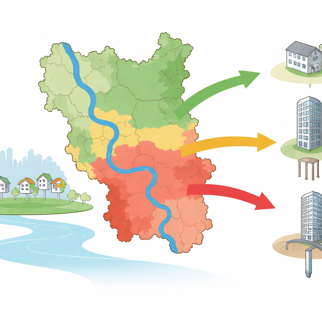
The maps show that the ability of near-surface soil to carry building loads varies strongly from place to place. At depths of 1.5 and 3.0 meters—typical for shallow foundations—large parts of the area can support moderate loads, while some southern and eastern zones have weaker ground that is less suitable for heavier structures without special measures. In general, the soil becomes stronger at 3.0 meters than at 1.5 meters, reflecting a transition from loose fill or disturbed topsoil to more compact natural layers. The study also compares two widely used calculation methods, finding that one consistently predicts higher capacities than the other, a reminder that engineers must treat such formulas with care.
Where piles are needed and how strong they can be
For taller or heavier buildings, engineers often rely on piles—slender columns driven or cast into the ground—to carry loads to deeper, stronger layers. The researchers created maps for precast piles of a standard size at depths of 12 and 20 meters. At 12 meters, most of the region can support moderate pile loads, with only a few zones capable of much higher values. By 20 meters, capacities increase noticeably, with many areas able to support substantially larger loads, though some pockets remain relatively weak. To check their approach, the authors compared their mapped pile capacities with results from real-world pile load tests at several building sites. The match was reasonably close, with errors small enough to make the maps useful for early planning.
How these maps help city builders
The final product is a set of geotechnical maps that show, at a glance, which parts of the DMDP area are better suited for shallow foundations and which are likely to require piles reaching deeper soil. For city authorities, developers, and engineers, these maps can save time and money by guiding site selection, flagging higher-risk areas, and helping estimate foundation costs long before detailed investigations begin. While they do not replace site-specific testing—especially for critical structures—they provide a solid starting point for safer and more efficient building in one of the world’s fastest-growing megacities.
Citation: Rahman, M.S., Alajlan, Z.S. & Ansary, M.A. GIS-based soil bearing capacity zonation maps for the Dhaka metropolitan development plan (DMDP) area, Bangladesh. Sci Rep 16, 9878 (2026). https://doi.org/10.1038/s41598-026-39800-0
Keywords: soil bearing capacity, foundation design, Dhaka urban development, geotechnical mapping, pile foundations