Clear Sky Science · en
Global 0.25-degree gridded Snow water equivalent data derived from machine learning using in-situ measurements
Why global snow matters to everyday life
Snow is more than a winter scene; it is a vast natural reservoir that stores water in cold months and releases it in spring to feed rivers, farms, cities, and hydropower. Knowing how much water is locked up in snow around the world helps societies prepare for floods, droughts, and shifting water supplies in a warming climate. Yet the key quantity that tells us this, called snow water equivalent, has been surprisingly hard to measure on a global scale.
The challenge of weighing the world’s snow
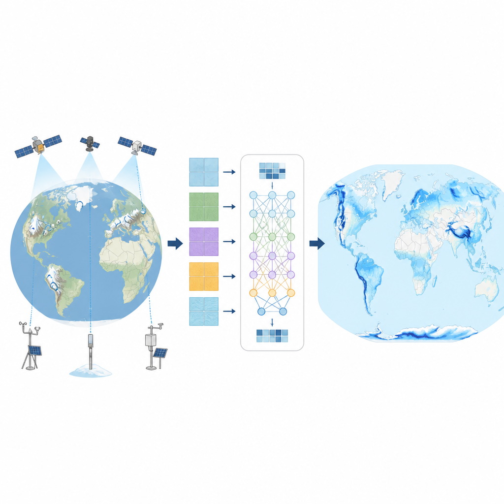
Scientists can measure snow at specific spots using snow courses, automated pillows that weigh the snowpack, and other ground stations. Networks in North America, Europe, and Russia have collected such data for decades. Satellites, weather models, and radar instruments also give clues about snow. But each source has gaps and weaknesses, especially in deep snow, forests, and steep mountains. As a result, existing global maps often disagree on how much snow is present, and many regions, such as the Andes or parts of Asia, remain poorly described.
Teaching a computer to learn from snow and weather
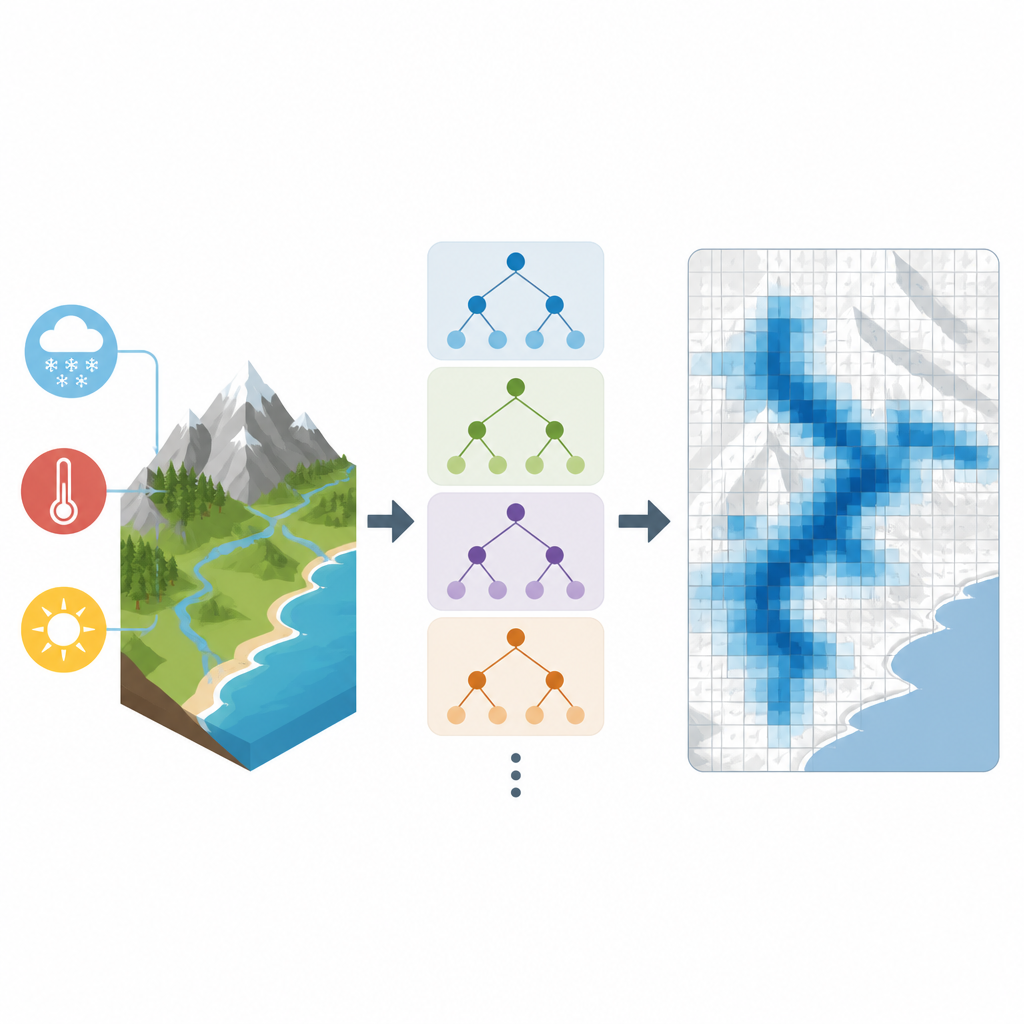
To close these gaps, the authors built a new daily global snow water dataset called SWEML using a machine learning method known as random forests. They gathered long records of ground snow measurements from multiple countries, along with satellite-based products and a modern global weather reanalysis that provides consistent temperature, precipitation, radiation, and wind fields. Terrain features such as elevation, slope, and vegetation type were added because they strongly shape how snow accumulates and melts. The team grouped the world’s snowy grid cells into 14 regions with similar climate and landscape traits, then trained separate machine learning models for each region so the system could learn local snow behavior more accurately.
From scattered points to a global daily snow map
Because different agencies measure snow in different ways, the raw station data do not always line up. The researchers first adjusted each station’s record so that its average and variability matched a widely used global weather product, while keeping the day-to-day swings from the original observations. This step made the input data more consistent without erasing their local character. The random forest models then learned the links between these adjusted snow values and the surrounding weather and terrain. Once trained, the models were used to estimate daily snow water for every 0.25 degree grid cell on Earth, except Antarctica, from 1980 to 2020, yielding a seamless 41-year record.
Checking the maps against other sources
The team rigorously tested SWEML against several independent references. These included airborne gamma-ray surveys over North America that infer snow water from how snow blocks natural radiation, high-resolution snow maps for the Andes built from satellite images, and a suite of widely used global snow and land surface datasets. Across millions of comparisons with untouched ground measurements, SWEML showed the lowest typical error and a small overall bias, slightly tending to underestimate snow. It performed especially well in high mountains such as the Rockies and the Alps, where many other products struggle, and it reproduced seasonal patterns like the timing and size of peak snowpack more faithfully than its peers.
What this means for water and climate planning
For the first time, scientists and water managers have a machine learning based, globally continuous daily record of how much water is stored in snow over four decades. SWEML will not replace local fieldwork, and it still faces challenges in very rugged terrain or in regions with little or no training data. But it provides a powerful new foundation for tracking changing snow resources, improving flood and drought risk assessments, and feeding climate and water models that need consistent long-term inputs. In a world with shifting winters, this kind of big-picture view of the planet’s snow reservoir is an important step toward smarter stewardship of water.
Citation: Seo, J., Panahi, M., Kim, J. et al. Global 0.25-degree gridded Snow water equivalent data derived from machine learning using in-situ measurements. Sci Data 13, 739 (2026). https://doi.org/10.1038/s41597-026-06895-z
Keywords: snow water equivalent, machine learning, global snow dataset, hydrology, climate change