Clear Sky Science · en
Socio-ecological impacts of the 2025 Los Angeles urban fires on communities, neighborhoods, and homes
When City Streets Burn Like Forests
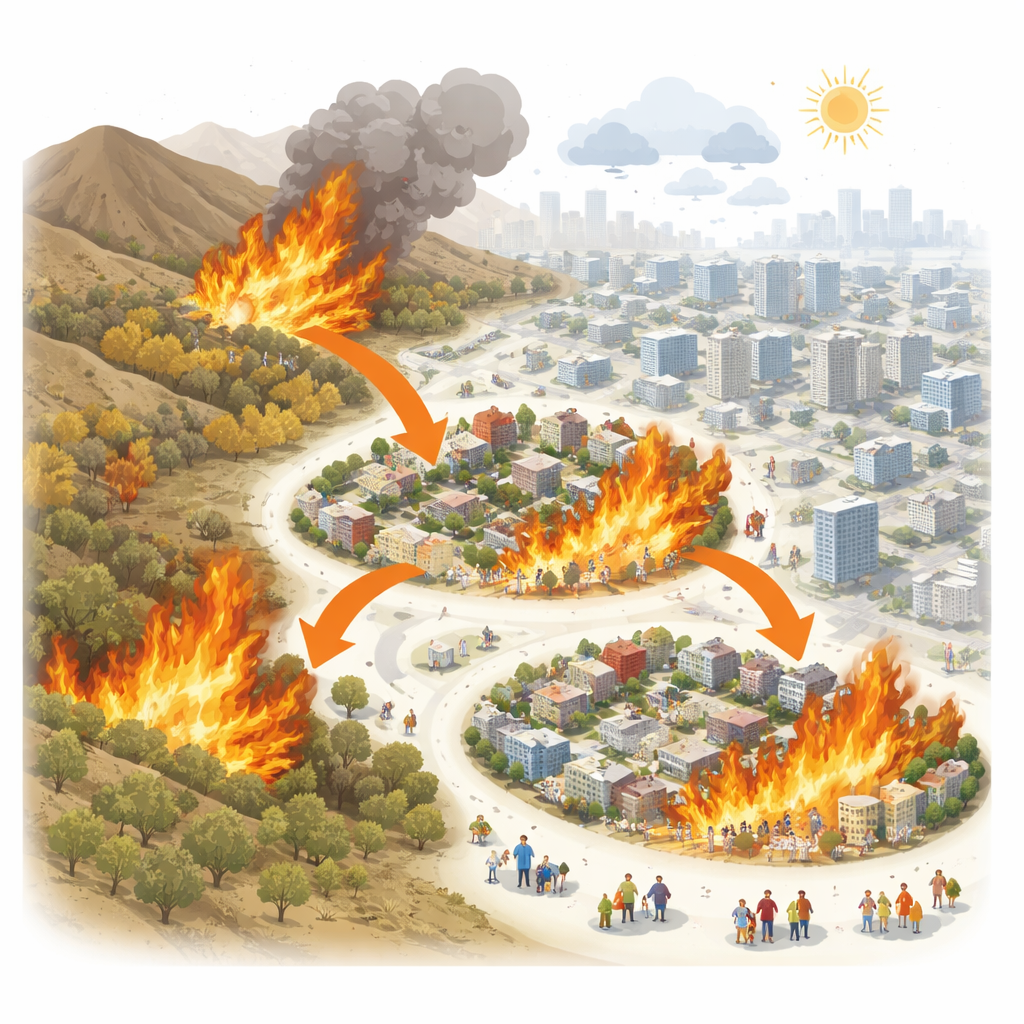
The 2025 fires in Los Angeles were not just another wildfire season; flames jumped from nearby hills into dense neighborhoods, turning city blocks into disaster zones. This study asks a question that matters to anyone living in a growing, fire-prone metropolis: what really decides which homes survive when wildfire becomes an urban firestorm? By looking beyond acres burned and tallying destroyed houses, the authors examine how the layout of neighborhoods and the makeup of communities shaped the damage in two hard‑hit areas: Eaton and Pacific Palisades.
Two Communities, One Catastrophic Fire Season
The fires studied here began in the foothills near Los Angeles in January 2025 after two unusually wet winters were followed by months of hot, dry weather and powerful Santa Ana winds. These conditions helped carry fire into highly built-up areas, burning roughly 16,000 structures and displacing more than 180,000 residents. The researchers focused on Eaton, a racially diverse, more middle‑income area, and Pacific Palisades, a wealthier, largely white coastal community. Both were dominated by single-family homes but differed in income, housing age, and past fire experience. By examining these two contrasting places side by side, the study shows that urban fires are not just wildfires that happen to reach cities, but disasters shaped by city form and social patterns.
Looking Closely at Neighborhoods and Individual Homes
To understand damage patterns, the team combined detailed maps of past fires, housing records, satellite‑based tree cover, and census data with state damage inspections from the 2025 fires. They analyzed impacts at two scales. At the neighborhood level, they measured what share of homes on each city block was destroyed and related this to factors such as housing density, home value and age, tree cover, and residents’ income, race, age, and education. At the parcel level, they zoomed in to individual homes, asking which specific properties were more likely to be heavily damaged. This multi‑scale approach let them see how the same factor—like how close buildings sit to each other—can look different when viewed across whole neighborhoods versus at the level of a single house.
How Urban Form and Social Patterns Shaped the Damage
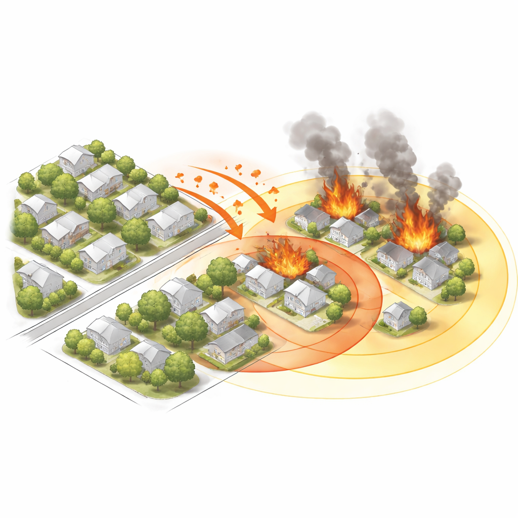
Across both communities, the way buildings were arranged mattered more for destruction than simple measures of nearby vegetation. Neighborhoods with larger total building footprint per unit land area—a sign of denser, bulkier construction—tended to suffer more damage. Homes that were surrounded by many other structures within a few dozen meters were especially vulnerable, because embers and radiant heat could leap from building to building even without direct contact with wildland vegetation. Higher home replacement values and more recent construction were generally tied to lower destruction, suggesting that stronger materials or stricter building standards helped in some areas, though in Palisades many newer homes burned because they had been built in the densest, most exposed parts of the community.
Who Lived There Also Affected Outcomes
The social makeup of neighborhoods influenced damage in complex ways. In Eaton, blocks with higher proportions of African American residents and of people with college degrees or living below the poverty line saw higher destruction rates, while areas with more non‑English speakers experienced somewhat less. In Palisades, neighborhoods with more Hispanic residents and more people with lower formal education tended to suffer greater home loss. In both communities, higher per‑person income was linked with less destruction. These patterns echo broader research showing that communities of color and lower‑income groups are increasingly exposed to severe fires, but also highlight that vulnerability does not map neatly onto any single demographic measure and can vary sharply from one city to another.
Why Scale Changes the Story
Comparing neighborhood‑level and home‑level results, the authors found that some indicators reverse or weaken when you shift scales. For instance, in both Eaton and Palisades, higher building footprint density was tied to more destruction when looking across neighborhoods, yet at the parcel level, larger footprints could coincide with reduced risk once other factors were accounted for. Such differences show that planning for fire‑safe cities cannot rely on a single mapping scale or metric; both neighborhood patterns and parcel‑level details like exact spacing between structures must be considered.
What This Means for Future Fire‑Prone Cities
Overall, the study concludes that recent Los Angeles urban fires resemble the great city conflagrations of the 19th and early 20th centuries more than traditional forest fires. What matters most is not just nearby brush, but the mixture of buildings, people, and past development choices packed into urban space. By treating communities as socio‑ecological systems—where housing design, city layout, income, race, and history intersect—the authors argue that planners and emergency managers can better identify who is at risk and how to adapt. For residents and city leaders, the take‑home message is clear: protecting homes from the next urban firestorm will require rethinking how and where we build, not just managing the vegetation at the edge of town.
Citation: Norlen, C.A., Sharma, S. & Escobedo, F.J. Socio-ecological impacts of the 2025 Los Angeles urban fires on communities, neighborhoods, and homes. Nat Commun 17, 3941 (2026). https://doi.org/10.1038/s41467-026-71376-1
Keywords: urban fires, Los Angeles 2025, wildland-urban interface, fire risk and housing, social vulnerability