Clear Sky Science · en
Seafloor geodetic evidence of slip deficit near the southwestern Kuril Trench
Why the Quiet Seafloor Matters
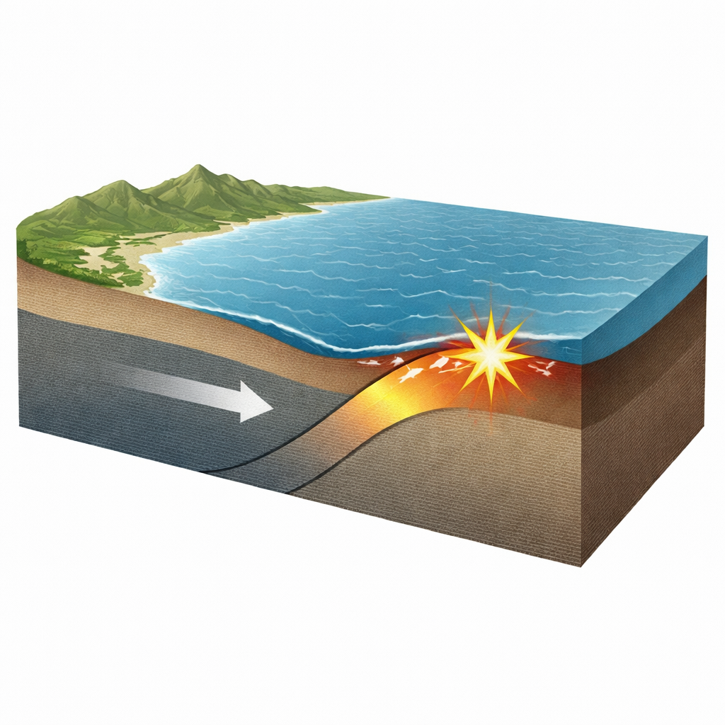
Along Japan’s northern coast, where one tectonic plate dives beneath another, the seafloor has been unusually quiet for centuries. Yet this silence may be hiding the slow buildup to a very large earthquake and tsunami. This study uses precise measurements from instruments on the ocean floor off Hokkaido to show that the shallow part of the plate boundary near the southwestern Kuril Trench is not peacefully sliding—it is stuck and storing strain. That finding points to the possibility of a future trench‑breaking megathrust event, similar in style to the 2011 Tohoku earthquake, with serious implications for coastal communities and tsunami planning.
Watching the Plates from the Ocean Floor
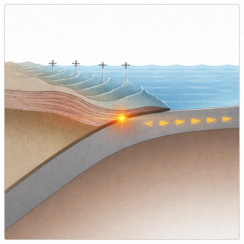
Most measurements of crustal motion in Japan come from land‑based satellite navigation receivers. These stations have revolutionized earthquake science, but they lose sensitivity to what happens far offshore, right above the plate boundary where giant tsunamis are born. To fill this gap, the researchers installed three seafloor geodetic sites—called GNSS‑A stations—off Nemuro in 2019. Each site combines GPS‑like positioning at the sea surface with acoustic ranging to transponders on the seafloor, allowing the team to track tiny horizontal shifts of the ocean crust over several years, down to a few centimeters per year despite the challenges of changing water conditions.
Evidence that the Plate Boundary Is Stuck
Between 2019 and 2024, the three offshore sites all moved horizontally in nearly the same direction as the subducting Pacific Plate. Two of them, closest to the trench, moved at rates comparable to the plate’s own speed. This pattern is a hallmark of a strongly locked plate interface: the upper plate above the fault is being dragged along with the lower plate instead of slipping quietly. When the researchers compared these observations with computer models of how the crust should deform under different assumptions, only models in which the shallow part of the plate boundary was fully locked all the way to the trench could reproduce the strong landward motion seen at the key site near the trench.
Hidden Strain Building over Centuries
Historical tsunami deposits along this coast show that very large earthquakes have struck the region repeatedly over thousands of years, with an average spacing of a few hundred years but with large variability. The most recent giant event, in the 17th century, is estimated to have had a magnitude around 8.8 and to have slipped up to 25 meters on the shallow part of the fault. Since then, only moderate‑sized earthquakes have ruptured deeper segments, while the shallow segment near the trench has been a seismic gap, with neither regular quakes nor slow slip. Using the measured seafloor motion as a proxy for how fast slip deficit is accumulating on the fault, the authors estimate that 20.5 to 30.0 meters of strain may have built up on this shallow segment over roughly 400 years—comparable to or even exceeding the slip released in the 17th‑century event.
A Supercycle of Rare but Huge Quakes
The pattern off Hokkaido closely resembles what was observed along the Japan Trench before the 2011 Tohoku earthquake: frequent moderate quakes at depth, little activity near the trench, and geological signs of rare, very large events separated by centuries. This has led scientists to describe a “megathrust supercycle,” in which long intervals of quiet strain buildup on the shallow plate interface are punctuated by trench‑breaking earthquakes that generate devastating tsunamis. The new seafloor measurements provide direct evidence that the shallow fault off the southwestern Kuril Trench is currently in a locked, high‑strain state, fitting this supercycle picture and underscoring the need to treat this area as a significant seismic and tsunami hazard.
What This Means for Future Risk
Although there are uncertainties—such as how strain varies along the trench and how steadily it has accumulated—the study’s end‑member scenario is sobering: if present conditions have persisted since the 17th century, the region may be approaching another great megathrust event. The work highlights that truly understanding such offshore hazards requires direct monitoring at the seafloor, not just on land. Expanding long‑term seafloor geodetic networks and integrating them with seismic records and geological tsunami evidence will be essential for refining forecasts and improving preparedness for the next giant earthquake and tsunami along the southern Kuril Trench.
Citation: Tomita, F., Ohta, Y., Kido, M. et al. Seafloor geodetic evidence of slip deficit near the southwestern Kuril Trench. Commun Earth Environ 7, 274 (2026). https://doi.org/10.1038/s43247-026-03297-2
Keywords: megathrust earthquake, slip deficit, Kuril Trench, seafloor geodesy, tsunami hazard