Clear Sky Science · en
Enhanced persistence of Ural blocking under strong positive AO: the role of North Atlantic storm tracks and potential vorticity dynamics
Why winter weather far away is connected
Winter cold snaps in Europe and Asia can feel mysterious when the Arctic is warming faster than the rest of the planet. This study explores how a key climate pattern, the Arctic Oscillation, and powerful North Atlantic storms can team up to lock in unusual weather over the Ural Mountains, with ripple effects that help shape deep freezes across Eurasia.
A climate pattern with a split personality
The Arctic Oscillation (AO) describes how air pressure seesaws between the Arctic and the midlatitudes, shifting the strength and position of the high-altitude jet stream. When the AO is negative, weaker west to east winds tend to favor atmospheric “traffic jams” called blocking over the Ural Mountains, often linked to a warm Arctic and cold Eurasia pattern. In contrast, the positive AO phase is usually thought to strengthen the jet stream and discourage blocking. Yet observations show that strong, long-lived Ural blocking events still occur under positive AO conditions, raising a puzzle this study sets out to solve.
Stronger positive phases change storm pathways
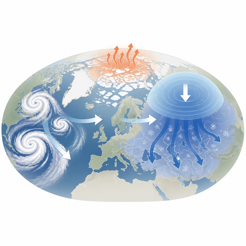
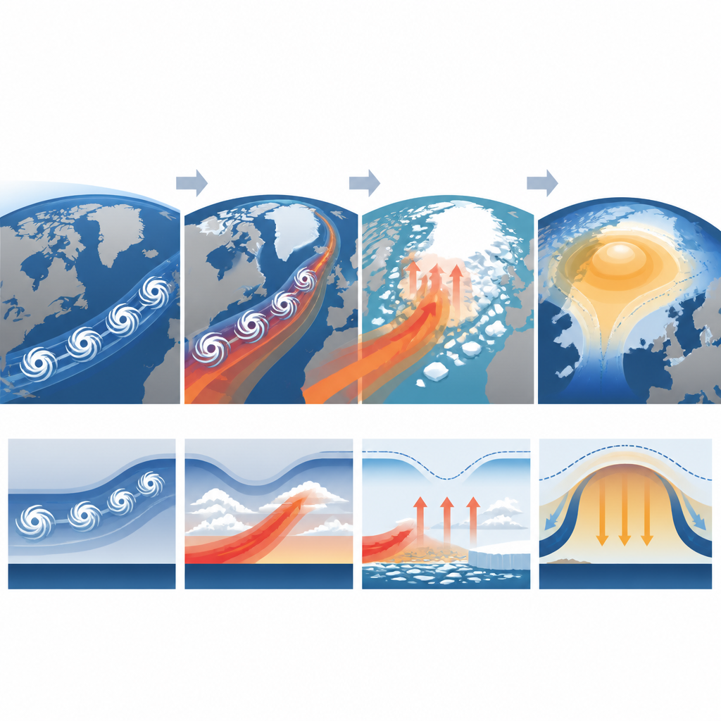
The authors examined more than four decades of winter data, tracking individual North Atlantic storms and classifying Ural blocking events by how strong the positive AO was in the days before they formed. They found that when the AO is weakly positive, storms follow scattered paths and only about half reach the Arctic. Under strongly positive AO conditions, however, the jet stream becomes a focused highway that bends storms northward into the Barents–Kara Sea, with more than two thirds of storms entering the Arctic. This organized storm train helps deliver large amounts of heat and moisture toward the polar ocean, setting the stage for more persistent blocking.
Arctic warming, sea ice loss, and feedback loops
Once these storm systems push warm, moist air into the Barents–Kara region during strong positive AO winters, the surface and lower atmosphere warm rapidly, sea ice shrinks, and clouds increase. The combination boosts downward longwave radiation, trapping more heat near the surface and reinforcing the initial warming. At the same time, reduced temperature differences between air and ocean temporarily cut back on heat loss from the sea, further supporting higher Arctic temperatures. In this environment, sea ice continues to decline for many days, and later, renewed air–sea exchanges release additional heat and moisture. Downstream, the anchored Ural high steers frigid air into central Eurasia, deepening the cold part of the warm Arctic–cold Eurasia pattern.
How the atmosphere’s internal “springs” are weakened
Beyond surface changes, the study focuses on how these processes alter potential vorticity, a quantity that helps describe how resistant the atmosphere is to large-scale wave distortions. Under strong positive AO conditions, storm-driven Arctic warming and radiative feedback weaken the contrast in this quantity between low and high latitudes over the Ural region. That reduces the restoring “spring” that normally pushes waves back into place, allowing the blocking pattern to linger. Event-by-event analysis shows that when this gradient is especially weak at the onset of blocking, the Ural high tends to last longer. Under weak positive AO conditions, these changes are smaller and less organized, so blocking is shorter lived and more prone to drift.
What this means for future winter extremes
Taken together, the results show that a very strong positive Arctic Oscillation can actually support, rather than suppress, long-lasting Ural blocking by guiding storms into the Arctic and reshaping both surface conditions and the atmosphere aloft. This “storm and potential vorticity coupling” helps explain why severe cold spells over Eurasia can still occur during winters dominated by a positive AO. It also suggests that as the Arctic continues to warm and sea ice retreats, the sensitivity of midlatitude winter weather to shifts in storm tracks and jet strength may grow, offering both a challenge and an opportunity for improving sub-seasonal forecasts of cold extremes.
Citation: Ku, HY., Noh, H., Wang, M. et al. Enhanced persistence of Ural blocking under strong positive AO: the role of North Atlantic storm tracks and potential vorticity dynamics. npj Clim Atmos Sci 9, 116 (2026). https://doi.org/10.1038/s41612-026-01384-x
Keywords: Arctic Oscillation, Ural blocking, North Atlantic storms, Arctic warming, Eurasian cold extremes