Clear Sky Science · en
Revisiting the application of variable infiltration capacity (VIC) model in the Colorado River Basin using SMAP and GRACE
Why this river story matters
The Colorado River keeps taps running and fields green for about 40 million people across the American West and Mexico, yet the basin has been locked in a long dry spell. As reservoirs shrink to historic lows, managers rely on computer models to guess how much water will flow each year. This study takes a fresh look at one of the most widely used models for the Colorado River, testing it against new satellite measurements of snow, soil moisture, and underground water storage to see how well it really captures the basin’s changing water balance.
A river under growing stress
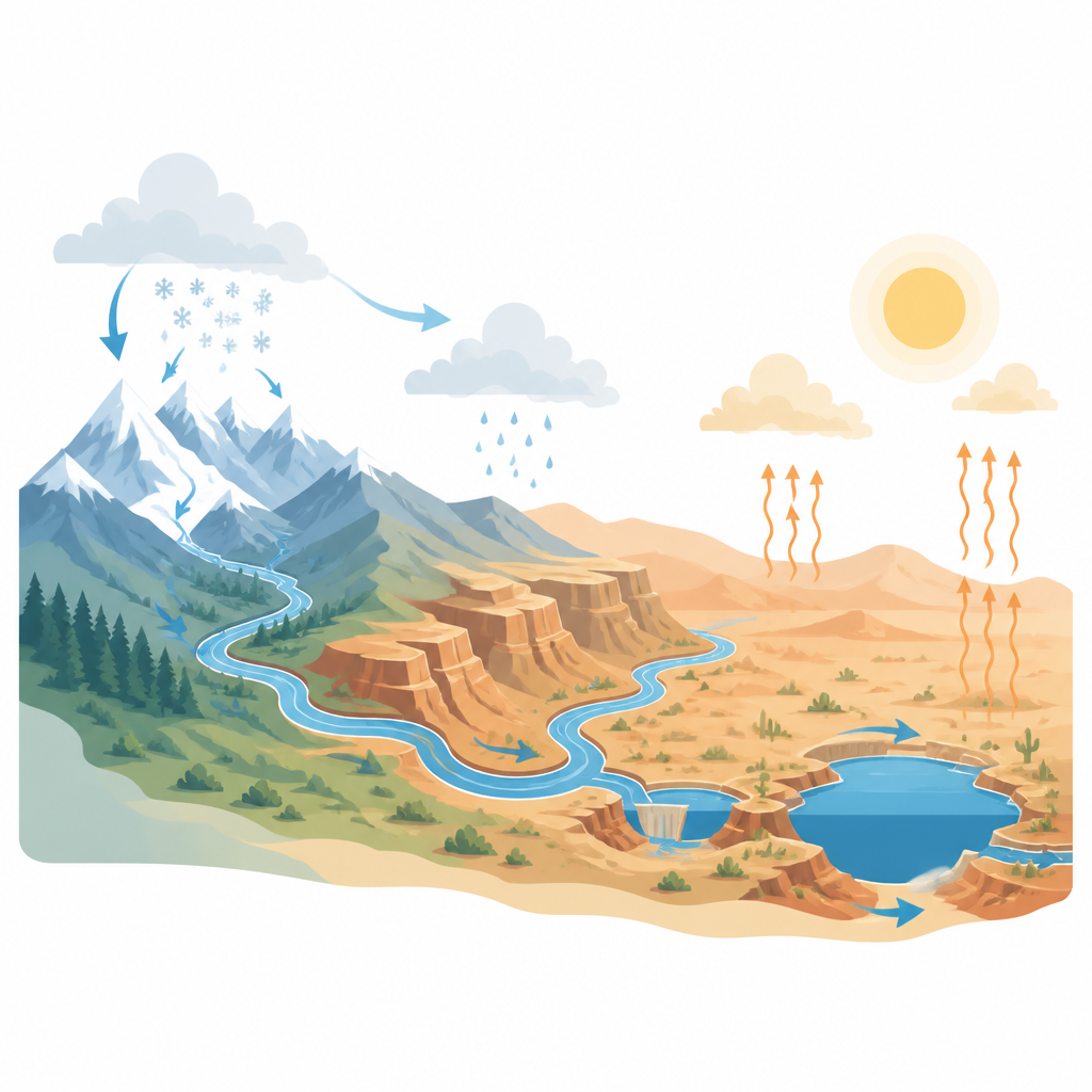
Since 2000 the Colorado River Basin has faced warmer temperatures, less snow, and falling reservoir levels, conditions often described as a shift toward a more arid climate. The Upper Basin’s mountain snowpacks act like natural reservoirs, releasing water in spring and early summer to feed downstream farms and cities. As those snowpacks shrink and soils and groundwater dry out, less of each year’s precipitation reaches the main river. At the same time, demand for water has stayed high, deepening the gap between supply and use and pushing Lakes Mead and Powell to less than one third of their capacity. With current operating rules set to expire in 2026, decision makers need models that do more than match past river flows; they must also correctly represent the hidden stores of water in snow and soil that control how drought unfolds.
Taking apart a trusted water model
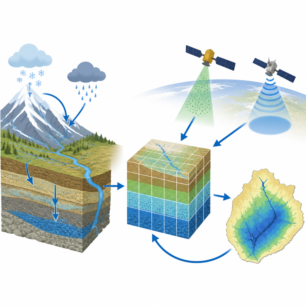
The researchers revisited the Variable Infiltration Capacity, or VIC, model, a long standing workhorse for studies and planning in the Colorado River Basin. VIC divides the basin into grid cells, simulating how rain and snow move through vegetation, soils, and streams. Earlier applications typically tuned the model only to match measured river flows at a few key gauges, leaving uncertainty about whether it was getting the right answers for the right reasons. In this study, the team updated the weather data driving the model, recalibrated key parameters for snow and soil behavior across major sub basins, and then put VIC through a wider set of tests that focused on how well it represented where snow accumulates, how runoff is generated at different elevations, and how water is stored below ground over months to years.
Listening to satellites track hidden water
To check VIC’s internal workings, the authors compared its output with two NASA satellite missions that sense water storage in different ways. The SMAP mission provides soil moisture in the top few centimeters and estimates for the full root zone down to about a meter, while the GRACE missions detect changes in total water stored on and beneath the land surface by measuring slight shifts in Earth’s gravity field. VIC, after calibration, closely reproduced the timing and size of the Upper Basin’s spring snowmelt pulse and showed that most snow and runoff come from a relatively small, high elevation portion of the watershed. SMAP comparisons revealed that the model captured the ups and downs of soil moisture well, especially at lower elevations, though there were small, consistent timing differences in the mountains. GRACE comparisons showed that VIC also tracked basin wide gains and losses in total water storage from year to year, including patterns linked to notably wet and dry periods.
What worked well and where gaps remain
The multi source evaluation showed that VIC does more than simply match total river flow. It reproduces key spatial patterns such as heavy snow accumulation and strong runoff in the northern high country, as well as the seasonal cycle in which water builds up during cool months and is drawn down by evaporation and streamflow in the warm season. At elevations below about 2,000 meters, the model and SMAP agreed strongly on how soil moisture changed through time. Above that, differences emerged, often as a roughly one month delay in the model’s root zone wetting compared with the satellite estimates. Additional checks with ground snow stations suggested that the model’s timing in these snow dominated zones may better reflect local conditions than the satellite product, though both the observations and the model carry uncertainties. The study also highlights remaining limits, such as VIC’s simplified treatment of groundwater, lack of glacier melt, and challenges in estimating evaporation in dry landscapes.
What this means for future water planning
For a lay reader, the main outcome is reassurance that a key tool used to study and plan for the Colorado River has passed a tough new set of tests. By showing that the VIC model can match satellite based views of soil moisture and total water storage, not just streamflow at a few points, the authors build confidence that it represents the basin’s hidden water stores in a realistic way. This makes VIC more reliable for exploring how long droughts may persist, how much water might reach reservoirs under warmer conditions, and how different management choices could play out. At the same time, the work pinpoints high mountain areas and certain subsurface processes as priorities for improvement, guiding future efforts to better track every drop in this heavily stressed river system.
Citation: Wang, Z., Ghimire, S., Whitney, K.M. et al. Revisiting the application of variable infiltration capacity (VIC) model in the Colorado River Basin using SMAP and GRACE. Sci Rep 16, 15890 (2026). https://doi.org/10.1038/s41598-026-47430-9
Keywords: Colorado River Basin, hydrologic modeling, soil moisture, satellite remote sensing, water storage