Clear Sky Science · en
Ecological flow guarantee rate along the Xijiang River mainstream at different scales based on multiple probability distributions
Why this river story matters
Rivers do much more than carry water; they keep entire landscapes alive. But dams, diversions and a changing climate are reshaping when and how much water flows, putting fish, wetlands and people at risk. This study focuses on China’s Xijiang River, the largest branch of the Pearl River, and asks a simple but crucial question: can the river still provide enough water, at the right times, to keep its ecosystems functioning? To find out, the authors blend modern machine learning with classic hydrology to see how reliably the river meets basic ecological flow needs over six decades.
Following the water through a busy river
The Xijiang River drains a rapidly developing region with hydropower dams, busy navigation routes and growing cities that all compete for water. At the same time, rainfall patterns and temperatures are shifting under climate change. The researchers chose four key gauging stations from the upper to the lower river to represent this long corridor. They collected daily records of river flow along with rainfall, temperature, evaporation, sunshine and wind from nearby weather stations. Their goal was to separate what the river would look like under natural climate alone from what it looks like after human interference, so they could judge how often nature’s minimum water needs are actually met.
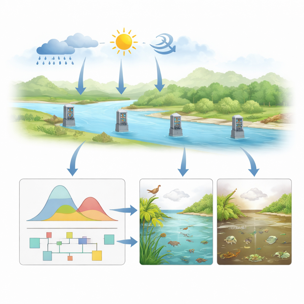
Rebuilding a “natural” river with data
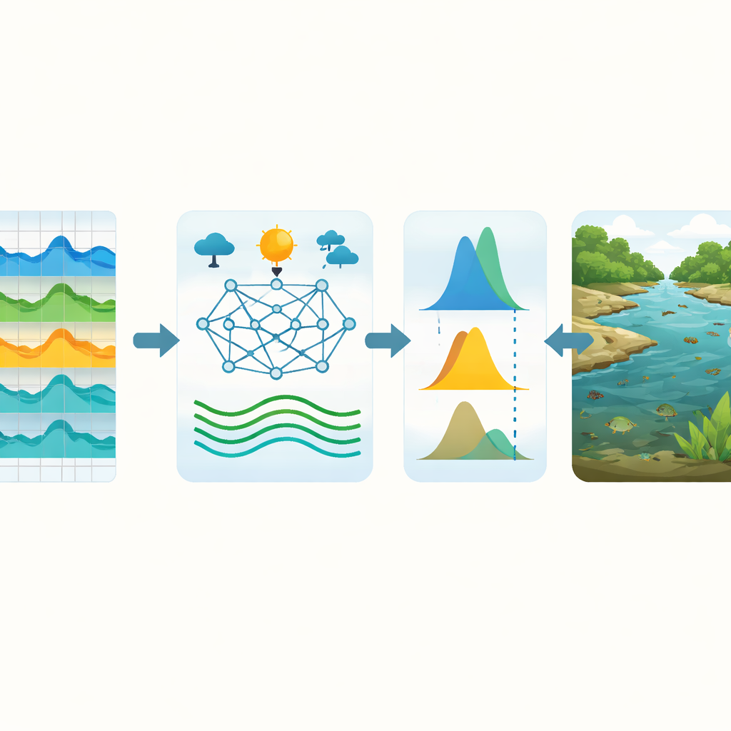
Because many dams and projects were built partway through the record, the team first identified years when the flow regime clearly shifted. They applied six different statistical tools to pinpoint these abrupt change points and used a conservative rule that required agreement among several methods. Early years before strong human impacts were treated as a “natural period,” and later years as a “change period.” Next, they trained a random forest model—a type of machine learning that combines many decision trees—on the natural period. The model learned how climate inputs translate into river flow when the river is mostly unregulated. They then fed climate data from the change period into this trained model to reconstruct what the river flow would likely have been without large human alterations, yielding a continuous “quasi‑natural” flow record at each station.
Turning fluctuating water into ecological thresholds
With these reconstructed flow series in hand, the researchers shifted from daily ups and downs to a more manageable monthly view. For each month at each station, they fit several different probability curves to the long-term flow record, using standard statistical tests to select the best-fitting shape. Two types of curves that emphasize extremes—Generalized Extreme Value (GEV) and P‑III distributions—worked best most of the time, especially for capturing low flows that matter for ecological safety. From the chosen curve, they read off the flow level that is equaled or exceeded 90 percent of the time. This “90 percent guarantee” became their basic ecological flow for that month. Finally, they checked how often actual observed flows surpassed these thresholds and evaluated whether the chosen values fall in “good” or “excellent” ranges according to an established ecological rule-of-thumb known as the Tennant method.
Where and when the river falls short
Across the entire 60-year record, the Xijiang River generally does meet its basic ecological flow targets: in both natural and altered periods, guarantee rates usually stayed above about 80 percent, and the Tennant evaluation rated most months as good to excellent for supporting river life. However, the study also reveals important stress points. After human impacts intensified, ecological flow guarantee rates dropped, especially at the two upstream stations, indicating that hydropower and other activities in the headwaters place stronger pressure on river ecosystems there. The sharpest declines occur from July to October, the main flood season and its recession, when reservoir operations for flood control and water storage can reduce in-stream flows at the very time many fish and other organisms depend on well-timed, plentiful water.
What this means for rivers and people
For non-specialists, the bottom line is that the Xijiang River still delivers enough water most of the time to meet a basic ecological standard, but the safety margin is shrinking in key places and seasons. By reconstructing a climate-driven “reference river” and comparing it with today’s regulated flows, the study pinpoints the upper reaches and the months from July to October as priority targets for protection and smarter dam operation. The framework—combining machine learning, probability curves and simple ecological benchmarks—can be transferred to other regulated rivers worldwide. It offers water managers a practical way to see when ecosystems are most vulnerable, so that decisions about reservoirs, withdrawals and conservation can better balance human demands with the river’s need to keep breathing.
Citation: Li, J., Deng, X., Liu, J. et al. Ecological flow guarantee rate along the Xijiang River mainstream at different scales based on multiple probability distributions. Sci Rep 16, 12975 (2026). https://doi.org/10.1038/s41598-026-43793-1
Keywords: ecological flow, river regulation, random forest runoff, Pearl River Basin, environmental water management