Clear Sky Science · en
Observed physical and biogeochemical variability due to tropical cyclone Mocha using glider observations in the Bay of Bengal
Storms That Stir the Sea
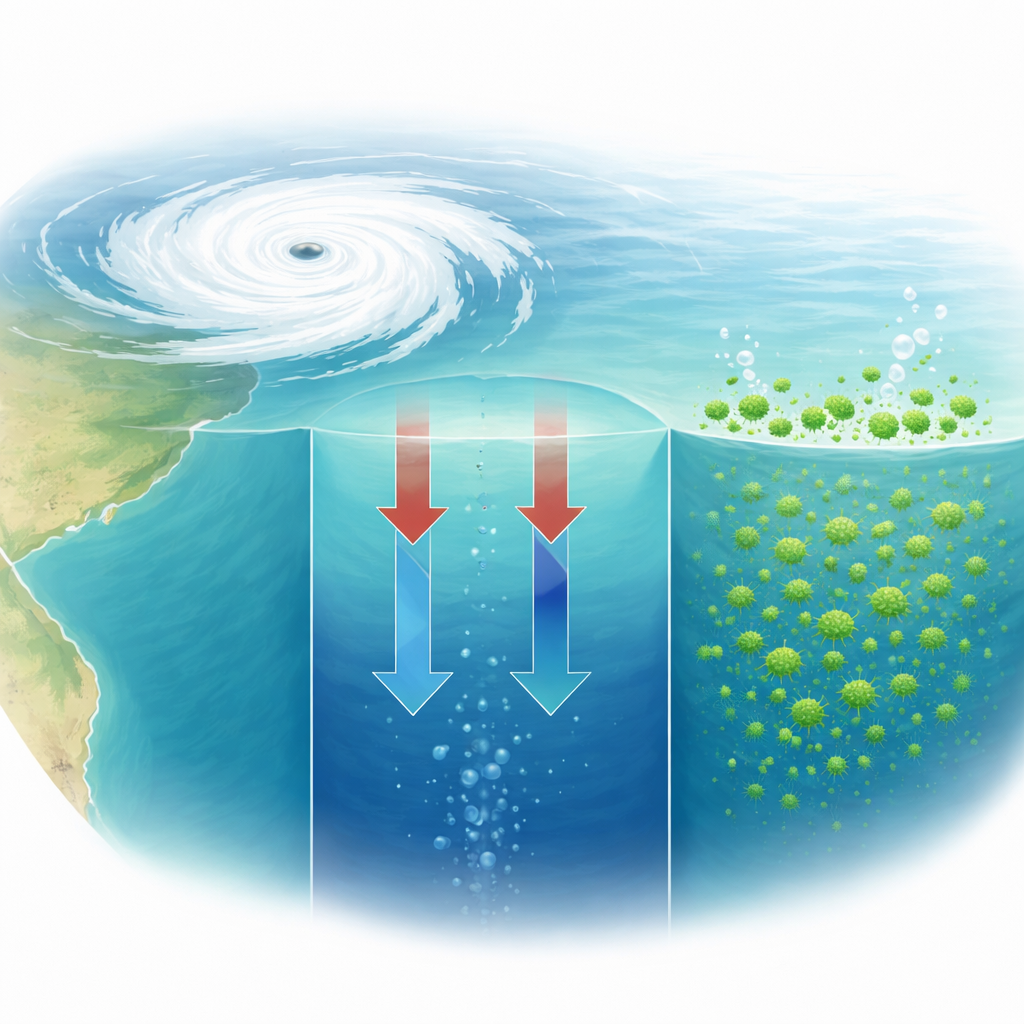
Tropical cyclones are usually seen as forces of destruction in the atmosphere and on land, but they also reach deep into the ocean, reshaping life beneath the waves. This study follows one such storm—Tropical Cyclone Mocha—as it crossed the Bay of Bengal in May 2023. Using a robot glider that dived repeatedly through the upper ocean, scientists captured how the storm cooled the sea, mixed its layers, and briefly supercharged microscopic plant life and oxygen levels—changes that matter for fisheries, weather, and our understanding of how the ocean responds to extreme events.
A Robot Follows a Dangerous Storm
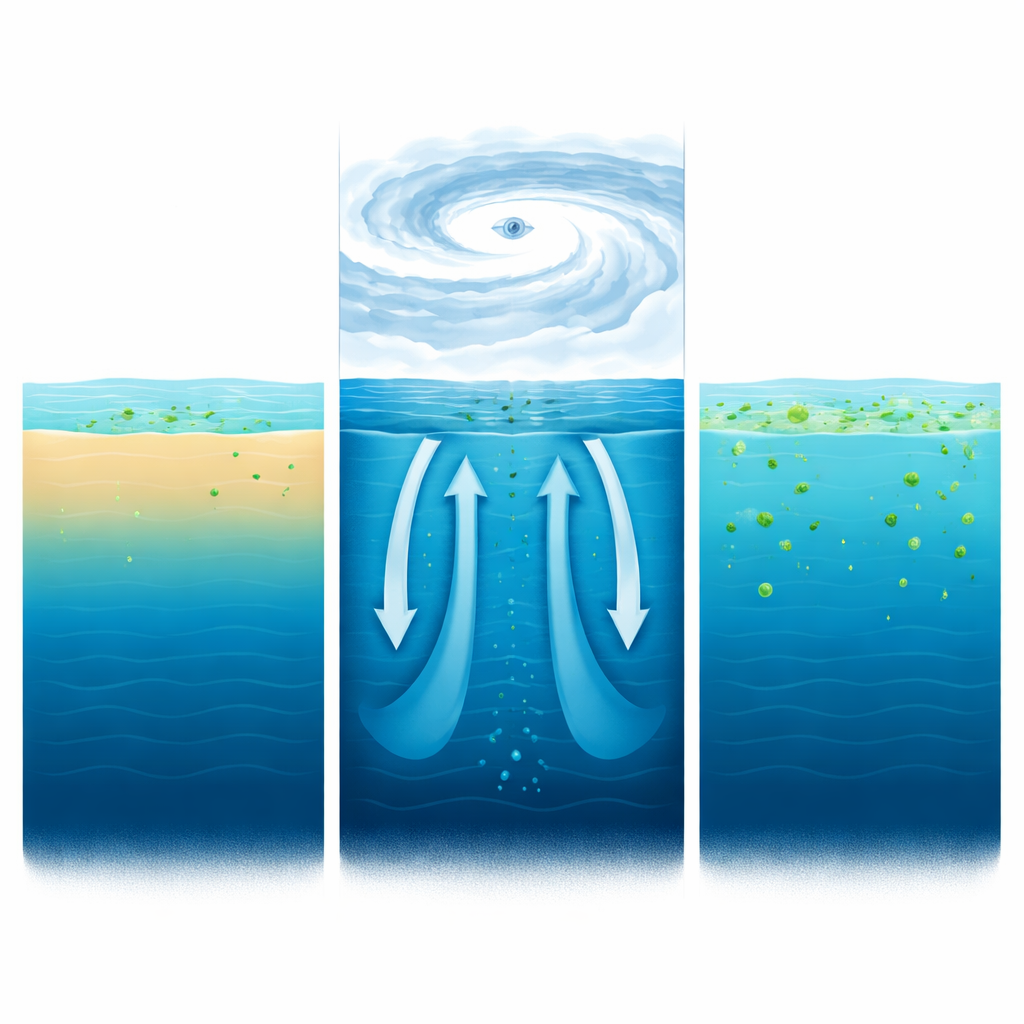
The Bay of Bengal is a hotspot for tropical cyclones and is also an ocean basin with a very shallow, fresh surface layer that usually keeps deeper, nutrient-rich waters locked below. That stable layering tends to limit the growth of phytoplankton—the tiny drifting plants that form the base of the marine food web. During May 2023, a deep-sea glider deployed by Indian scientists happened to be crossing the path of Cyclone Mocha. This autonomous underwater vehicle, remotely controlled from shore, repeatedly profiled the water from the surface down to hundreds of meters, measuring temperature, saltiness, chlorophyll (a proxy for phytoplankton), and dissolved oxygen with high vertical and time resolution before, during, and after the storm.
How the Storm Cooled and Shook the Ocean
As Mocha passed overhead, strong winds, heavy clouds, and intense heat loss dramatically altered the sea surface. The glider recorded a drop of about 2.5 °C in sea surface temperature, while satellite data showed similar cooling along the storm track. At the same time, surface waters became slightly saltier, a sign that deeper, saltier water was being mixed upward. The storm’s powerful winds deepened the surface mixed layer from a few tens of meters to nearly 60 meters and weakened the usual layering of the water column. This vertical churning, combined with upwelling driven by the storm’s circulation, brought cooler, nutrient-rich water closer to the surface and pushed the boundary between warm and cool layers upward.
Hidden Plant Life Surges After the Storm
Before the cyclone, phytoplankton were scarce near the surface, with a “hidden” maximum concentration lurking between about 60 and 95 meters where light and nutrients were better balanced. After the storm mixed the water, chlorophyll levels at the surface climbed quickly, first to about 0.8 milligrams per cubic meter and then, more strikingly, to about 1.7 milligrams per cubic meter eight days later. The first peak appears to have come from this deeper stock of phytoplankton being lifted upward. The second, stronger peak, occurring once skies cleared and light returned, likely reflected genuine new growth fueled by nutrients supplied from below. Satellite sensors, hampered by cloud cover and coarse resolution, only captured a weak version of this bloom, highlighting the importance of in‑water robotic measurements.
Oxygen’s Daily Rhythm Lights Up
Dissolved oxygen, vital for marine animals and a sensitive marker of biological activity, also changed in step with the storm and the bloom. Immediately around Mocha’s passage, oxygen near the surface briefly dropped as low‑oxygen water from depth was mixed upward. In the following days, however, oxygen climbed by roughly 10 micromoles per liter, tracking the rise in chlorophyll. This timing, along with relatively calm winds during the bloom, suggests that the extra oxygen was produced mainly by photosynthesis rather than by air being mixed into the sea. The glider’s fine‑scale data also revealed that daily swings in oxygen and chlorophyll became much larger during the bloom, reflecting the daytime buildup of oxygen by photosynthesis and its nighttime drawdown by respiration.
Putting Models to the Test
The researchers also compared their glider data with an ocean model that simulates both physics and biology. The model correctly showed cooling, some mixing, and a rise in phytoplankton and oxygen, but its response was much weaker: surface cooling was only about half as strong, the increase in chlorophyll was smaller and shorter‑lived, and the second, delayed bloom seen eight days after the storm was missing entirely. Salinity and oxygen changes were also misrepresented. These discrepancies point to shortcomings in how the model handles storm‑driven mixing, nutrient supply, and biological responses during extreme events.
Why This Matters for People and Climate
In simple terms, Cyclone Mocha briefly turned a relatively quiet patch of the Bay of Bengal into a stirred‑up, greener, and more oxygen‑rich zone. By tracking this evolution in detail, the study shows that storms can tap hidden reserves of nutrients and plant life below the surface and that these effects can persist for more than a week after the winds die down. At the same time, it reveals that commonly used ocean models still underestimate these changes. For coastal societies that depend on the sea, and for scientists trying to predict how oceans will respond to a warming climate and potentially stronger storms, such glider‑based observations are crucial for improving forecasts of both weather impacts and marine ecosystem health.
Citation: Thangaprakash, V.P., Sureshkumar, N., Srinivas, K.S. et al. Observed physical and biogeochemical variability due to tropical cyclone Mocha using glider observations in the Bay of Bengal. Sci Rep 16, 13009 (2026). https://doi.org/10.1038/s41598-026-43528-2
Keywords: tropical cyclones, Bay of Bengal, ocean mixing, phytoplankton blooms, autonomous gliders