Clear Sky Science · en
A remote sensing framework for predicting and managing waste generation in tropical highland agroecosystems: case study of land use transitions in cameron highlands, Malaysia
Why mountain trash matters
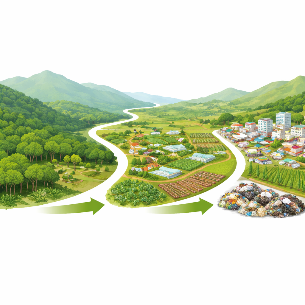
Highland getaways like Malaysia’s Cameron Highlands are prized for cool air, tea plantations, and green slopes. But behind the postcard views, farms, hotels, and markets are producing growing amounts of rubbish that are hard to collect and dispose of safely on steep, winding terrain. This study shows how satellites and digital maps can be combined to track where that waste comes from, how it changes over time, and where it piles up the most—information local planners need if they want tourism and agriculture without drowning the hillsides in garbage.
Watching the hills from space
The researchers focused on Cameron Highlands between 2020 and 2024, a period of rapid change as farming, urban growth, and post‑pandemic tourism reshaped the landscape. They used free satellite images from the European Sentinel‑2 mission and NASA’s Landsat‑8 to create yearly land‑use maps, distinguishing forest, cropland, built‑up areas, shrubland, bare ground, and water. With the help of high‑resolution imagery and field photos, they trained a computer‑based classifier to label every 10‑meter pixel on the map. Accuracy checks with hundreds of reference points per year showed that more than 86–91% of pixels were correctly classified, giving the team confidence that the maps captured real shifts on the ground.
Linking land change to growing piles of waste
At the same time, the team obtained detailed records of waste collected from markets, farms, hotels, and agricultural packaging facilities across the district. Each collection point was precisely mapped with GPS and checked through local audits. By lining up the annual land‑use maps with these on‑the‑ground waste measurements, the authors could ask: when cropland or town areas expand, does waste rise too? They found that it does. Cropland expansion showed a strong positive link with total waste, while areas with more tree cover tended to generate much less. Overall waste swung sharply over the five years, crashing during COVID‑19 restrictions in 2021 and peaking at nearly 1.2 million kilograms in 2023 as farming and tourism bounced back.
Pinpointing hidden hotspots
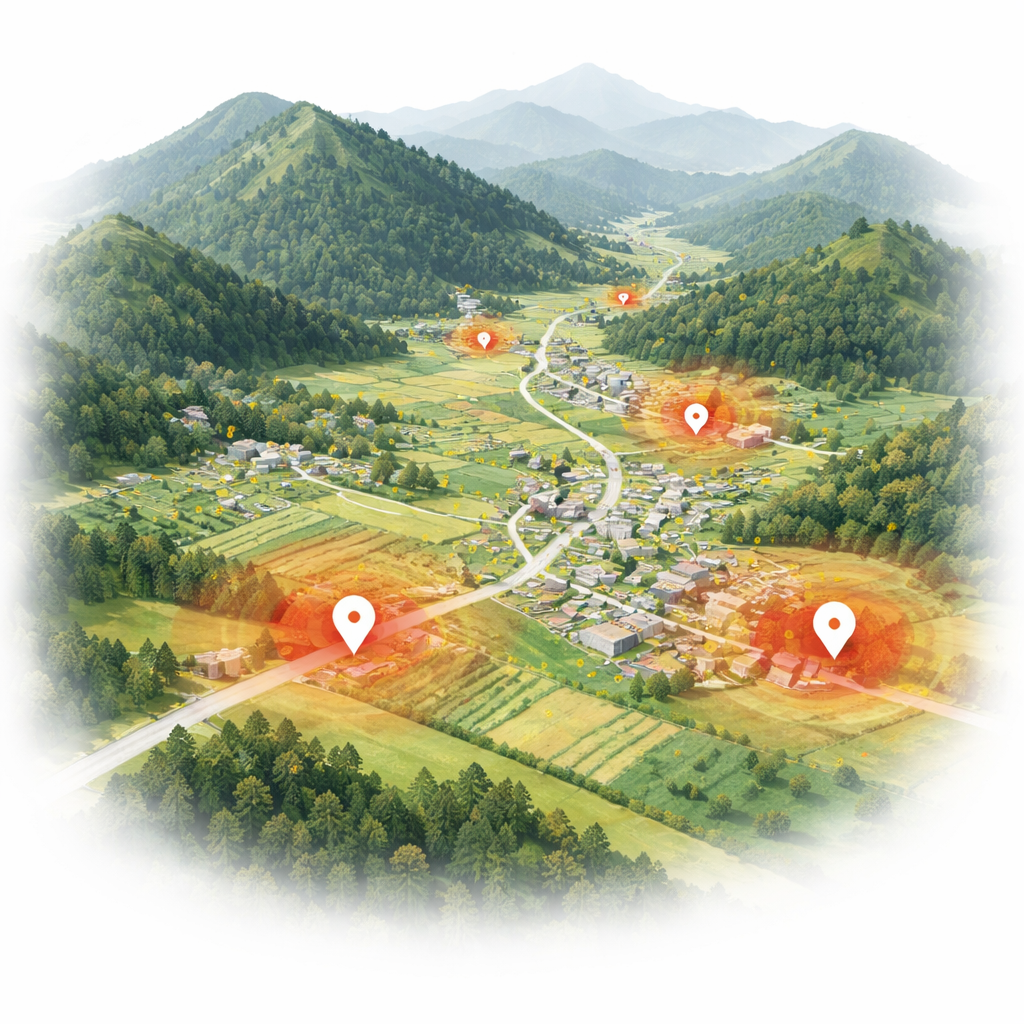
To move beyond averages for the whole district, the researchers built a spatial model that predicts waste at each location based on land‑use mix and geographic position. This flexible model captured non‑linear spatial patterns and identified where waste is likely to be unusually high. It revealed that more than 70% of the heaviest waste loads occur within about half a kilometer of built‑up or agricultural zones, especially around Brinchang, Tanah Rata, Kea Farm, and other busy corridors where farms, packaging houses, markets, and hotels cluster together. Forested areas, although still covering nearly 90% of the landscape, remained largely free of waste hotspots and acted as stabilizing buffers around these activity centers.
Guiding smarter decisions in fragile hills
By combining satellite‑based land maps with detailed waste records, the study demonstrates a practical way to forecast where rubbish will pile up as farms and towns expand into steep highlands. The key lesson for non‑specialists is simple: when forest is converted to crops and commercial areas, waste rises sharply and concentrates in narrow belts along roads and valley floors. The modelling framework—accurate enough to flag about 92% of high‑waste zones—can guide local authorities on where to place collection points, where to enforce zoning, and where to protect forest buffers. It also highlights priority areas for composting farm residues and recovering packaging materials, helping highland communities move toward a more circular, less polluting way of using their limited land.
Citation: Harun, S.N., Kemarau, R.A., Mazri, M. et al. A remote sensing framework for predicting and managing waste generation in tropical highland agroecosystems: case study of land use transitions in cameron highlands, Malaysia. Sci Rep 16, 12105 (2026). https://doi.org/10.1038/s41598-026-42488-x
Keywords: Cameron Highlands, solid waste, land use change, remote sensing, mountain tourism