Clear Sky Science · en
Coordinate transformation method for beam grazing angle calculation of space-based early warning radar
Watching Earth from Above
Modern life relies on knowing what is happening around the globe in real time, from monitoring missile launches to tracking space traffic. Space-based early warning radars, mounted on satellites orbiting Earth, are one of the tools that can provide this constant watch. This paper tackles a very specific but crucial question for such radars: exactly how does a radar beam skim past Earth’s curved surface, and how can we quickly and accurately calculate that angle in real time?
Why the Skim Angle Matters
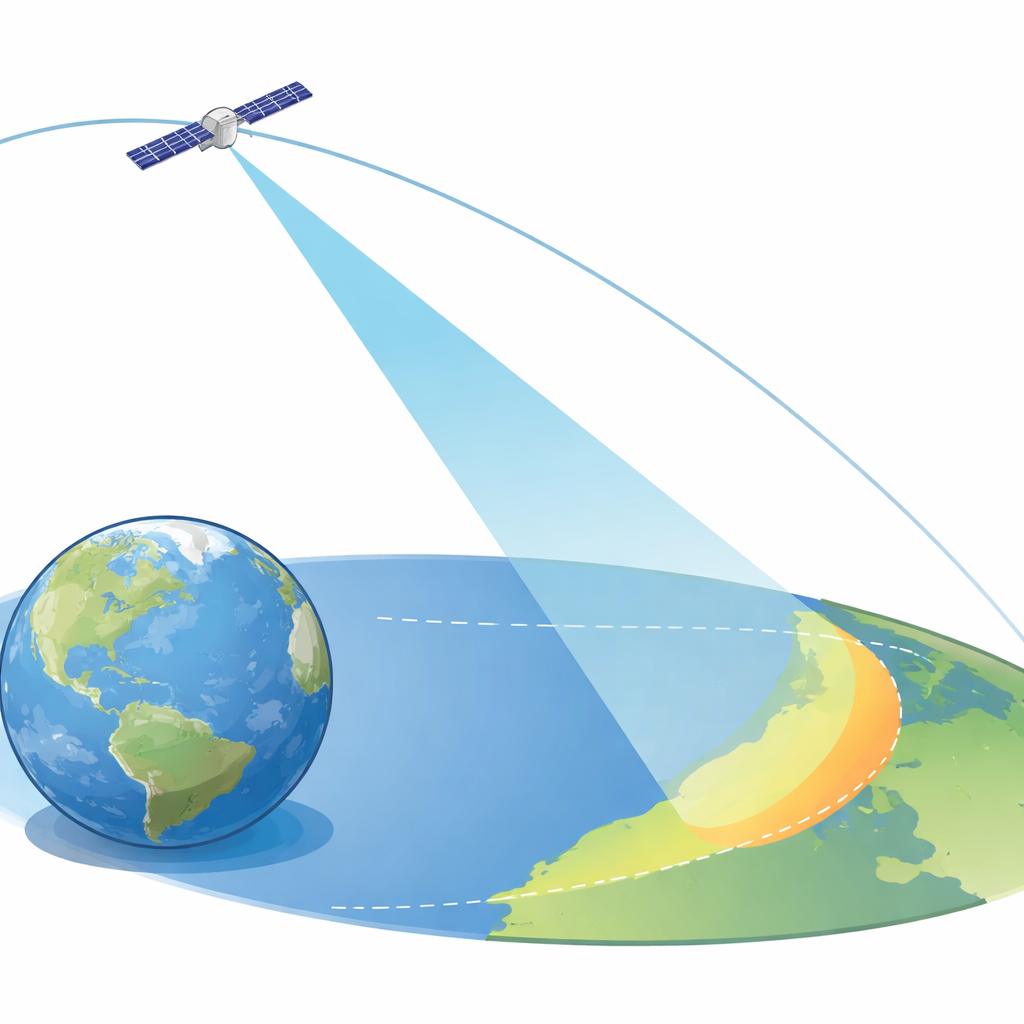
When a radar on a satellite looks toward Earth, its beam does not simply point straight down; it often glances across the surface at a shallow “grazing” angle. That angle, defined between the beam and the local horizontal at a point on the ground, strongly affects how far the radar can see and how well it can detect faint objects against background clutter. Because the satellite is racing around Earth, which itself is rotating and slightly squashed rather than perfectly round, this angle is constantly changing. Past work has treated the geometry in a simplified way, often ignoring the satellite’s detailed motion, which can limit accuracy for real operational systems.
Following the Satellite’s Changing Path
The authors base their method on how real low‑Earth‑orbit satellites move under the influence of Earth’s gravity and the thin upper atmosphere. Instead of tracking the satellite’s path point by point with heavy numerical simulations, they use compact formulas that describe how the key orbit parameters slowly drift over time. These parameters include the size and shape of the orbit and how the orbit’s plane is oriented in space. The model focuses on the dominant effects: the bulge of Earth around the equator and the drag from rarefied air, while safely ignoring much smaller influences. This strikes a balance between staying faithful to real orbital physics and keeping computations fast enough for operational use.
Changing Viewpoints Step by Step
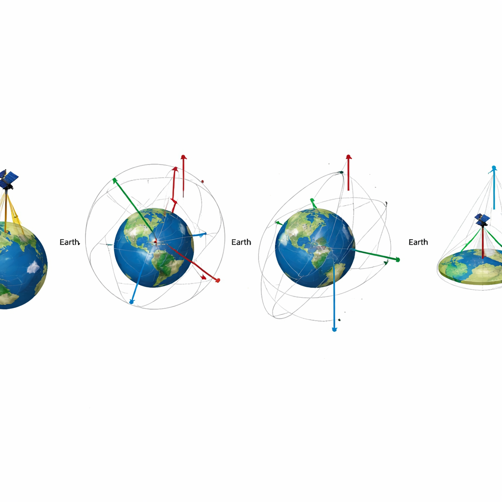
Once the satellite’s orbit at a given moment is known, the method turns that information into the exact position of the satellite relative to a ground point of interest. To do this, the authors chain together several coordinate systems, each suited to a different viewpoint. First, they place the satellite in a space‑fixed frame that does not rotate with Earth. Then they convert this position into an Earth‑fixed frame that spins with the planet, using international standards that account for subtle motions such as wobbling of Earth’s axis. Next, they shift to a local frame whose origin is the chosen ground point, with axes pointing north, east, and straight up. In that local frame, the line from ground to satellite naturally splits into horizontal and vertical components, from which the grazing angle follows via a simple trigonometric relation.
Putting the Method to the Test
To check that their streamlined approach is trustworthy, the authors apply it to a real satellite from the Starlink constellation, using publicly available two‑line orbit data. They compute the grazing angle for a specific ground location and compare the results with those produced by a high‑end commercial tool widely used in the space industry. For dozens of time points, the two sets of angles agree extremely well, with differences of less than a tenth of a percent. The small remaining discrepancies are traced to technical choices in how Earth’s rotation and orientation parameters are interpolated over time and to differences in numerical precision between software environments.
What This Means Going Forward
For non‑specialists, the message is that the paper delivers a clear recipe for turning orbit data and a ground location into an accurate estimate of how a satellite‑borne radar beam grazes Earth’s surface, fast enough for real‑time use. By carefully selecting which physical effects matter most and by organizing the problem as a sequence of well‑defined coordinate changes, the authors show that high accuracy does not always require heavy computation. Their framework can also be extended to work out how fast a target moves along the line of sight, which feeds directly into radar Doppler measurements. This paves the way for more reliable space‑based warning systems that can better track fast‑evolving events on and around our planet.
Citation: Huang, X., Zhang, Y. Coordinate transformation method for beam grazing angle calculation of space-based early warning radar. Sci Rep 16, 11784 (2026). https://doi.org/10.1038/s41598-026-42233-4
Keywords: space-based radar, satellite orbits, early warning systems, coordinate transformation, grazing angle