Clear Sky Science · en
Leveraging remote sensing, geophysical methods and AHP model to determine optimal locations for green hydrogen production on Egypt’s Mediterranean coast
Why this matters for our energy future
As the world scrambles to cut carbon emissions, "green" hydrogen has emerged as a promising clean fuel that can power factories, ships and even cities without adding greenhouse gases to the atmosphere. But building large hydrogen plants is expensive and risky—especially if they end up in the wrong place. This study shows how scientists used satellite images, digital maps and underground scans to pinpoint the most promising spots for green hydrogen production along Egypt’s Mediterranean coast, a region that could become a major supplier of clean fuel to Europe and beyond.
Finding the right place on the map
To begin, the research team focused on the area around Marsa Matruh, a coastal city in northwestern Egypt that already has a port, highways and an airport. The region sits on the Mediterranean, offering easy access to seawater for splitting into hydrogen and oxygen, and lies on important trade routes linking Egypt to Libya and Europe. Using remote sensing satellites and geographic information systems (GIS), the scientists built detailed digital maps that captured how the land is used, how high or steep it is, what kinds of rocks lie at the surface, how far each location is from the sea and major roads, and what local wind and air temperature conditions are like.
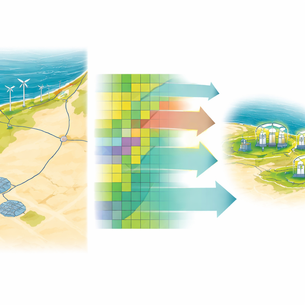
Turning many factors into one clear picture
Choosing a site for a large industrial project means weighing many competing needs at once. The team used a structured decision method called the analytic hierarchy process to assign importance scores to eight key factors: distance to sea, distance to roads, land use and land cover, geology, elevation, slope, wind speed and air temperature. Experts compared each factor against the others, and the method checked that their judgments were consistent rather than arbitrary. These weights were then combined with the mapped data layers inside the GIS software to calculate, for every point in the region, how suitable it would be for green hydrogen production.
Mapping where green hydrogen fits best
The combined analysis produced a "suitability map" that grouped the area into four classes: least suitable, marginally suitable, moderately suitable and most suitable. Only a small fraction of the total land—about 3.5 percent—fell into the highest category, mostly in the northern part of Marsa Matruh near the coast. These places are close enough to the sea for water supply and export routes, near roads for moving equipment and hydrogen, have gentle slopes and manageable elevations for building facilities, and enjoy strong sun and good wind speeds to power solar panels and turbines. At the same time, they avoid dense built-up zones and favor open rangeland or bare ground where new infrastructure can be added with less disruption.
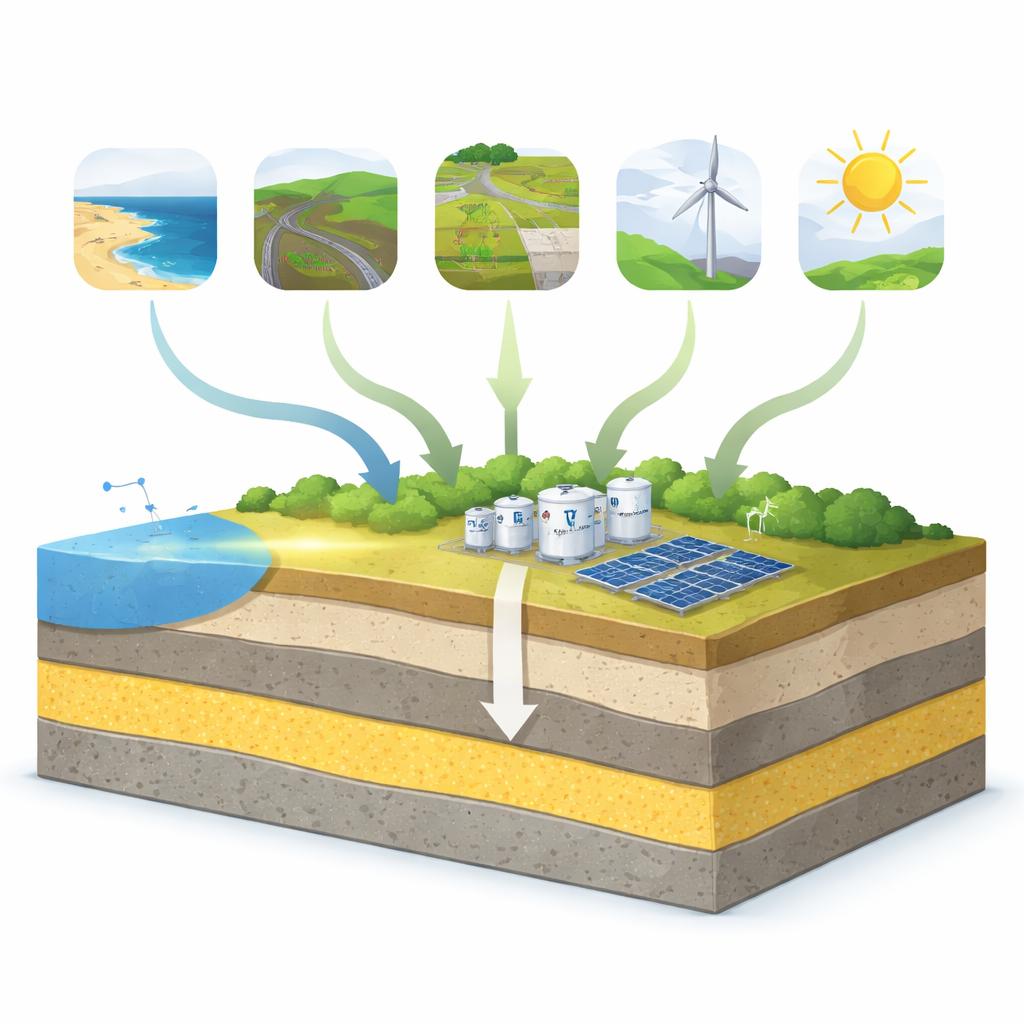
Looking beneath the surface
However, surface conditions tell only part of the story. Large hydrogen plants and their storage tanks must rest on solid, stable ground. To check what lies below, the researchers carried out a vertical electrical sounding survey at 11 carefully chosen points. By sending electric currents into the ground and measuring how the subsurface resisted the flow, they reconstructed layers of soil and rock down to tens of meters. These measurements revealed several rock types, with a particularly strong and resistive layer of dolomitic limestone appearing at depths between roughly 1 and 47 meters. Because this rock can bear heavy loads, the team identified areas where it is present at practical depths as especially promising foundations for hydrogen infrastructure.
What this means for Egypt and beyond
By blending satellite data, digital mapping, expert judgment and ground-based geophysical surveys, the study offers a practical roadmap for placing green hydrogen projects where they are most likely to succeed. It highlights northern Marsa Matruh as a leading candidate zone: close to the coast and Gargoub port, rich in sun and wind, connected by roads, and underlain by strong bedrock. While the authors stress that further engineering and economic studies are still needed, their framework shows how countries like Egypt can reduce guesswork, cut costs and lower risk as they expand clean energy. For a lay reader, the key takeaway is simple: smart use of both space technology and underground sensing can help ensure that the hydrogen economy is built in the right places from the ground up.
Citation: El Hateem, Y.Y., Diab, A.I., El-Sayed, H.M. et al. Leveraging remote sensing, geophysical methods and AHP model to determine optimal locations for green hydrogen production on Egypt’s Mediterranean coast. Sci Rep 16, 10671 (2026). https://doi.org/10.1038/s41598-026-41730-w
Keywords: green hydrogen, renewable energy siting, remote sensing, Egypt Mediterranean coast, geophysical surveys