Clear Sky Science · en
Compound effects of dams and levees reshape Yangtze flood dynamics and reveal substantial risk misestimations from ignoring levees
Why river defenses matter for everyday life
As climate change fuels heavier downpours, more people are living with the threat of catastrophic river floods. Along China’s Yangtze River, over 400 million residents depend on dams and earthen embankments—levees—to keep rising waters at bay. Yet most global studies of flood risk have only accounted for dams, treating levees as an afterthought. This paper shows that leaving levees out of the picture can seriously distort estimates of who and what is truly at risk, and it offers a new way to see how these two kinds of defenses work together—and sometimes against each other—along one of the world’s great rivers.
A giant river shaped by people
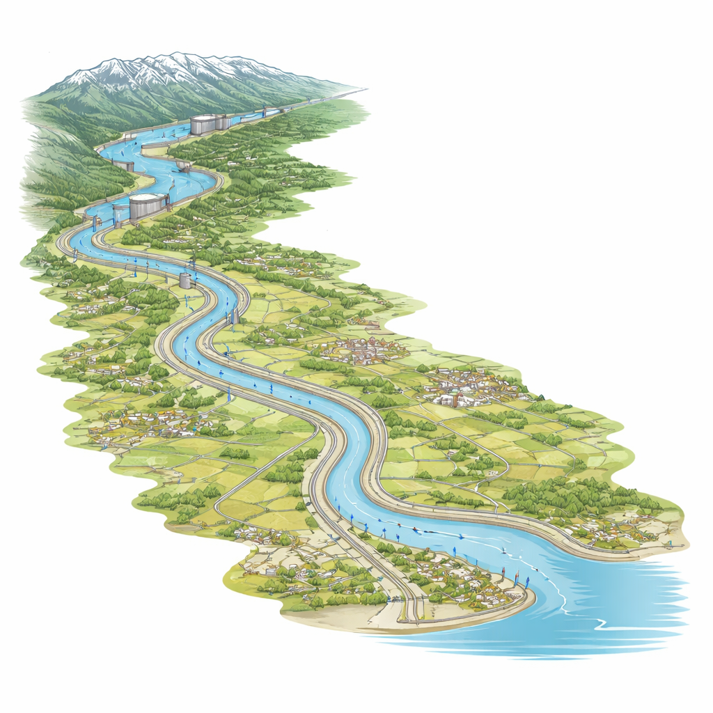
The Yangtze River Basin stretches some 6,300 kilometers from snow-capped headwaters to a low-lying delta on the East China Sea. It supplies 40% of China’s water resources and more than a third of its grain, but it is also notorious for devastating floods, such as those in 1998 and 2021. To tame this river, engineers have constructed hundreds of large reservoirs, including the Three Gorges Dam, as well as long chains of levees that confine the river in its middle and lower reaches. Dams hold back water in vast upstream lakes, while levees form raised walls that keep high flows from spilling into towns and farmland. Until now, most large-scale computer models of flood risk have represented dams but not levees, mainly because levees are harder to map and to describe in simple equations.
A digital river with both dams and walls
The authors use a specialized computer model called CaMa-Flood to recreate how water has moved through the Yangtze’s channels and floodplains from 1980 to 2019. They feed the model with daily runoff estimates, detailed maps of the river network, and new data sets that describe 327 major reservoirs and the locations and heights of levees. They then run four alternate histories: a "natural" river with no major structures; a river with only dams; a river with only levees; and a river with both in place. By comparing these scenarios, they can tease apart what each type of infrastructure does to high flows, low flows, and inundated areas, and they check the realism of the simulations against measured water levels and discharges at 32 gauging stations along the basin.
Different defenses, different jobs
The analysis reveals that dams and levees excel at different parts of the flow spectrum. Dams mainly act as giant buffers: they store water during wet periods and release it more slowly, which makes low and moderate flows more stable and improves the model’s accuracy for dry and normal conditions. Levees, by contrast, do little to change how much water is moving downstream, but they strongly affect where that water goes. By keeping floods inside the channel instead of allowing them to spread across the floodplain, levees sharpen the simulated peaks and make high-flow behavior match observations better. When both structures are included together, the overall performance is the most balanced and consistent across the basin, even if no single metric is the very best. In other words, dams help get the volume right, and levees help get the shape and timing of flood waves right.
How floods shrink—and shift—under human control
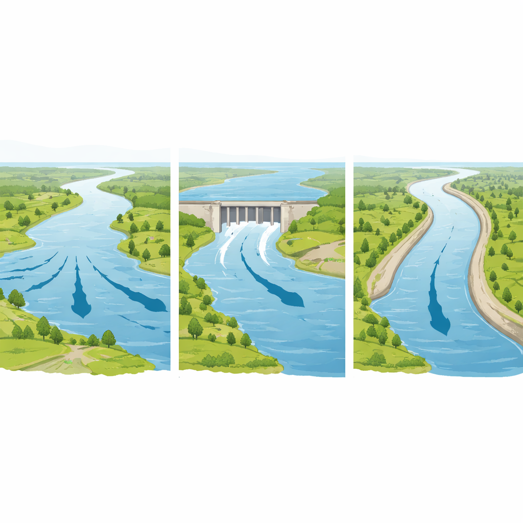
Looking beyond river gauges to the surrounding land, the model shows that dams and levees together dramatically reduce how much of the basin is underwater during major events. Compared with a natural, unregulated river, dams alone cut the yearly maximum inundated area by about half, while levees alone cut it by roughly two-thirds. When both are present, the average reduction is around 65%, and the number of days and places experiencing deep water during monsoon peaks drops sharply. Yet the picture is not simply one of across-the-board safety. Upstream of large reservoirs, stored water can raise local flood levels, and tightly walled channels downstream of levees can carry fast, high flows that pose hazards if defenses fail. The study also finds that in many locations, once strong levees are in place, adding dam storage brings only modest further shrinkage of flooded area, hinting at diminishing returns for new upstream structures.
What this means for flood risk and planning
For non-specialists, the key message is that counting dams without levees gives a misleading picture of flood danger. Models that ignore levees overestimate the area that floods by about 15% on average, and by more than 30% during extreme years like 1998, because they allow water to fan out over floodplains that, in reality, are now walled off and often heavily developed. At the same time, the apparent safety created by levees can hide new vulnerabilities, such as higher water levels inside the channel and greater consequences if defenses are overtopped or breached. By building a unified view of how dams and levees jointly reshape the Yangtze’s floods, this work offers a more realistic baseline for planning future protection, adjusting dam operations, and deciding where additional defenses—or more nature-based solutions—are truly needed as the climate continues to warm.
Citation: Xu, S., Sun, H., Zhang, L. et al. Compound effects of dams and levees reshape Yangtze flood dynamics and reveal substantial risk misestimations from ignoring levees. Sci Rep 16, 13298 (2026). https://doi.org/10.1038/s41598-026-41694-x
Keywords: Yangtze River floods, dams and levees, flood modeling, infrastructure risk, climate-driven flooding