Clear Sky Science · en
Crop and irrigation types ground-truth dataset for Moroccan agricultural regions
Why mapping farms from the ground up matters
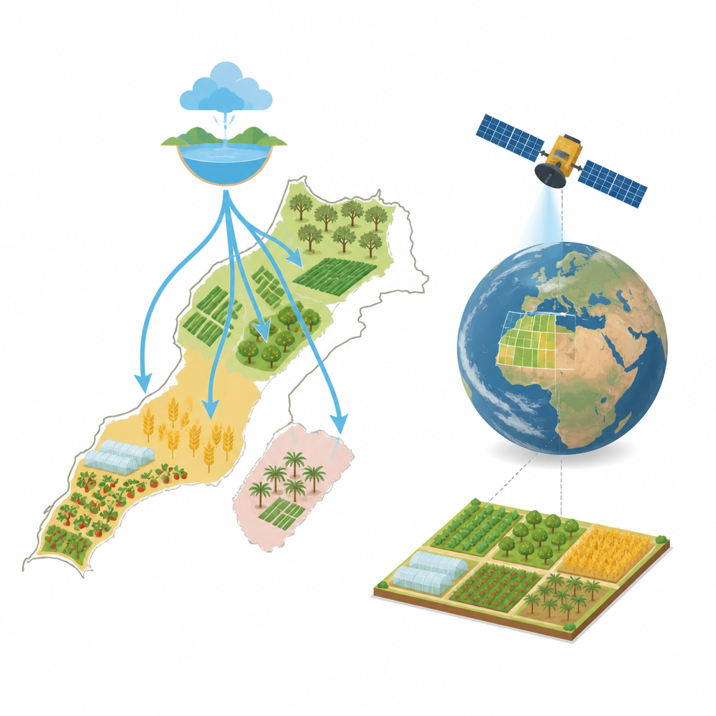
Food production in dry regions depends on every drop of water and every patch of soil. Yet we often lack detailed, trustworthy maps of what is grown where and how fields are watered. This article introduces a new open dataset from Morocco that links on-the-ground observations of crops and irrigation systems with satellite views, giving scientists and decision makers a powerful tool to better manage land and water in a warming, drying climate.
Farming in a land of limited water
Morocco sits at the meeting point of Mediterranean and North African climates, where rain is uneven and water supplies are under strain. Agriculture already contributes a large share of the national economy, and recent policies have pushed for higher production to support jobs and food security. At the same time, farmers face shrinking rivers, stressed groundwater, and rising temperatures. Understanding which crops are planted, how they change over the seasons, and what kinds of irrigation are used is key for planning water use, judging the success of farm policies, and tracking the impact of climate change on the countryside.
A new picture of Moroccan fields
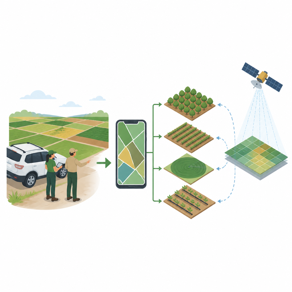
To fill this information gap, the research team carried out a large field campaign between late 2023 and early 2025 across five major farming regions: El Gharb, Tadla, Doukkala, El Haouz, and Souss. Using a mobile mapping app connected to a geographic information system, they traced the outlines of about 10,000 individual farm parcels directly in the field. For each parcel, they recorded what was growing there, whether the land relied on rain or was irrigated, and which watering method was used. The dataset covers 45 crop types, ranging from seasonal staples like wheat, corn, and vegetables to long-lived orchards of olives, citrus, and argan trees. Six irrigation systems were documented, from traditional flood and basin methods to modern drip, sprinkler, and pivot systems. Each record also includes a geo-tagged photograph to give a visual sense of the field conditions.
How the fieldwork was carried out
The team designed a standard survey form to ensure that every observer described crops and irrigation in the same way. Four trained surveyors traveled together, each equipped with the same smartphone setup, so that plots were drawn and labeled consistently. In the field, they digitized parcel boundaries on the spot instead of later guessing them from satellite images, a step that greatly reduced mapping errors. For some crops, such as wheat and tree orchards, they collected extra details like plant height, tree spacing, and trunk size. At the end of each day they reviewed their work, checked which areas were still missing, and corrected any doubtful entries, which helped keep the data both complete and reliable.
Checking the dataset against plant greenness
To test whether their labels made sense over time, the authors compared the mapped parcels with a satellite-based measure of plant greenness called the Normalized Difference Vegetation Index, or NDVI, throughout 2024. Fields marked as seasonal crops showed strong peaks in greenness during the growing season and low values once harvested, as expected. Tree crops kept higher greenness for most of the year, while bare soil remained low throughout. Mixed systems of trees with underplanted crops showed the highest and most varied greenness patterns. These clear differences across classes suggest that the field labels are consistent with how the vegetation actually behaves over the year.
What this resource offers for the future
The resulting dataset is freely available and designed to be updated over time. It can be combined with satellite images from missions such as Sentinel or Landsat to teach computer models how to recognize crop types and irrigation methods from space, and then extend that knowledge far beyond the surveyed parcels. For Morocco and the wider North African region, this means more accurate maps of where water-hungry crops are grown, how irrigation practices are shifting, and how farm policies play out on the ground. In simple terms, the study delivers a detailed “truth on the ground” map that helps turn satellite pictures into practical information for managing land and water under increasing climate pressure.
Citation: Ouassanouan, Y., Elfarkh, J., Grich, S. et al. Crop and irrigation types ground-truth dataset for Moroccan agricultural regions. Sci Data 13, 746 (2026). https://doi.org/10.1038/s41597-026-06993-y
Keywords: Morocco agriculture, crop type mapping, irrigation systems, remote sensing, ground truth data