Clear Sky Science · en
Wind shear enhances soil moisture influence on rapid thunderstorm growth
Why storms can suddenly explode
People who live in storm‑prone regions know how quickly a calm afternoon can turn into a dangerous thunderstorm with flash floods, fierce winds and frequent lightning. Yet even with modern satellites and powerful computers, forecasters still struggle to say exactly where the next big storm will ignite. This study explains why: it shows that the small‑scale pattern of wet and dry ground, working together with changes in wind with height, can sharply focus where the most explosive thunderstorms first burst into life.
Patchwork ground, patchwork storms
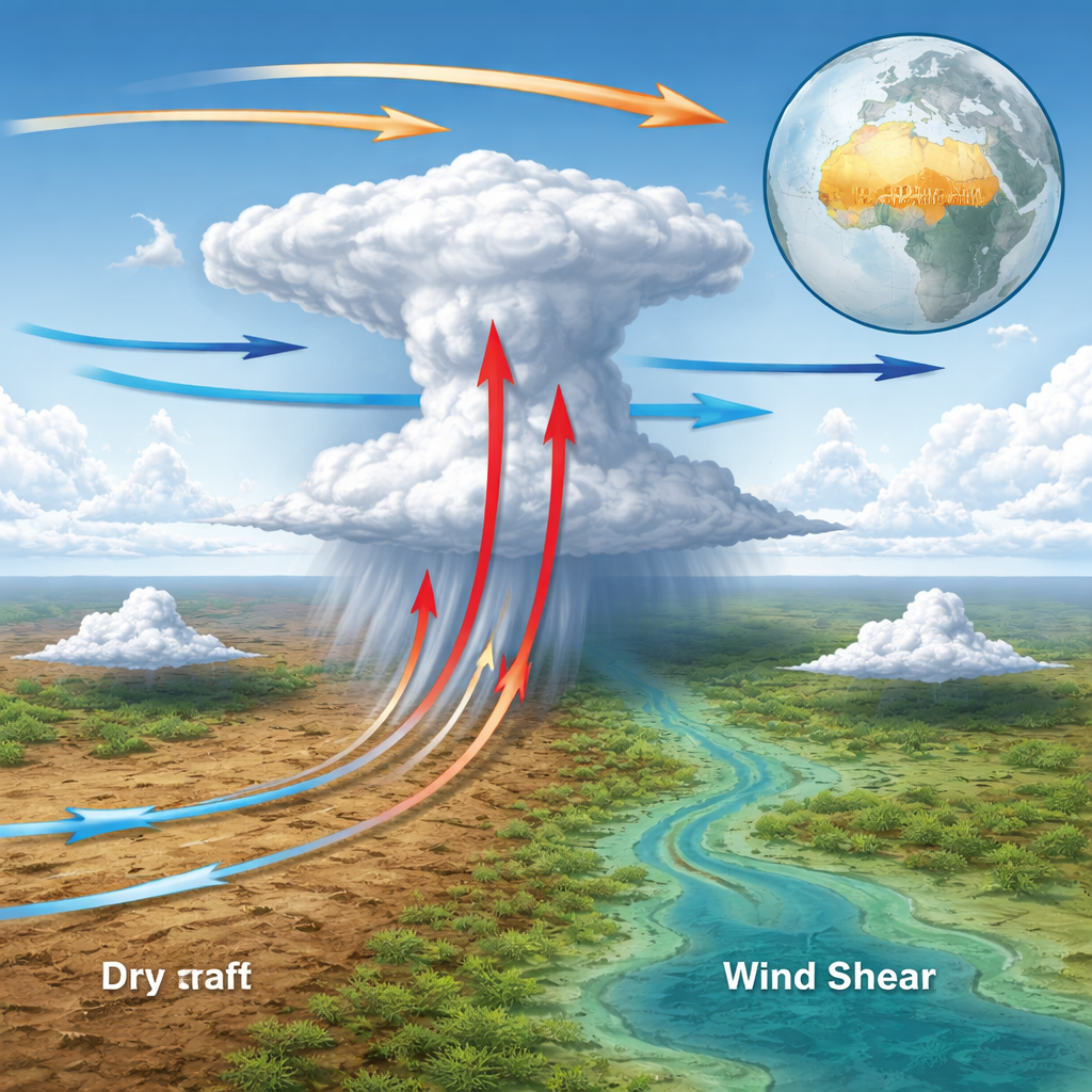
After rain, the land does not dry evenly. Some patches of soil stay moist while others quickly become parched. This patchwork controls how sunlight is turned into heat and water vapour. Over drier soil, more of the sun’s energy goes into heating the air; over wetter soil, more goes into evaporation. On scales of a few tens of kilometres, these differences create gentle "breeze" circulations, a bit like miniature sea breezes, that push air from cooler, wetter areas toward hotter, drier ones. Where these breezes meet, air is forced to rise, creating a favoured zone for the first towering storm clouds to form.
Following more than two million storms
The researchers tracked over 2.2 million afternoon thunderstorm "births" across sub‑Saharan Africa from 2004 to 2024 using European weather satellites. They pinpointed the moment when cold, high clouds first appeared and cooled rapidly, signalling that a storm was taking off. They then combined these records with satellite measurements of near‑surface soil wetness, land‑surface temperature, lightning and rainfall, plus wind data from a global weather reanalysis. By rotating every case so that the low‑level wind lined up in the same direction, they could build composite pictures of the typical ground and wind patterns that precede storm initiation.
When upper winds fight lower winds
Thunderstorms do not grow in still air. The speed and direction of the wind often change with height, a feature known as wind shear. Earlier work showed that shear can help organize storms and make them last longer. This study reveals that shear also determines how strongly soil patterns influence the very start of storm growth. The team sorted all events according to how the mid‑level winds compared with those near the surface: blowing the same way, the opposite way or sideways. They found that the classic picture—storms forming along the downwind edge of a dry patch—actually hides four much stronger patterns, each linked to a different shear direction. In every case, the most intense early growth happens where the soil‑driven breezes line up to enhance the low‑level inflow that feeds the rising cloud.
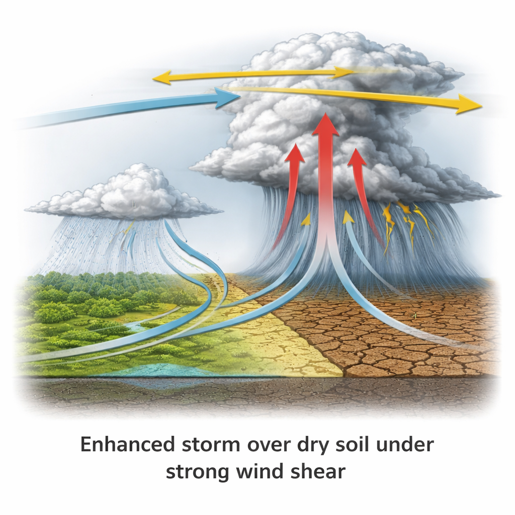
Dry ground as a lightning magnet
The most dramatic storms, defined as the top 1% in how fast their cloud tops cooled, showed the clearest fingerprint of dry‑versus‑wet soil. About 85% of these extreme cases occurred when wind shear was moderate to strong. Under such conditions, if the soil pattern was "favourable"—with drier ground arranged so that the soil‑driven circulations opposed the drift of the growing cloud—storms grew much faster than average. For strong shear, they were about two‑thirds more likely to become extreme than when the soil pattern was "unfavourable" and centred on wetter ground. In situations where mid‑level winds blew opposite to low‑level winds, rainfall and lightning became tightly clustered over the driest soil, turning these areas into magnets for the most hazardous weather.
Why this matters for forecasts
Across much of tropical North Africa, where wind shear is naturally strong and soil wetness is highly variable, this land‑wind interaction produces a strong tendency for afternoon storms to form and then rain over relatively dry patches. This helps explain why past global studies found that, surprisingly, rain often falls preferentially on drier soils rather than wetter ones. It also sheds light on why numerical weather models struggle in this region: they often smooth over fine‑scale soil variations and may not fully represent how shear and surface breezes work together. The study suggests that feeding real‑time information on soil moisture and land‑surface temperature into both traditional models and artificial‑intelligence systems could sharpen short‑range predictions of where the most dangerous storms will suddenly appear, improving early warnings for millions of people living under storm‑threatened skies.
Citation: Taylor, C.M., Klein, C., Barton, E.J. et al. Wind shear enhances soil moisture influence on rapid thunderstorm growth. Nature 651, 116–121 (2026). https://doi.org/10.1038/s41586-025-10045-7
Keywords: thunderstorms, soil moisture, wind shear, sub-Saharan Africa, weather prediction