Clear Sky Science · en
Forecasting of dengue importation risk in Brazil using deep learning and mobility networks
Why tracking dengue travel matters
Dengue fever is spreading across the globe, and Brazil is one of the hardest-hit countries. Yet dengue does not move only with mosquitoes; it also travels with people as they go from city to city. This study asks a simple but vital question: can we forecast where infected travelers are most likely to carry dengue next, week by week, across all of Brazil? The answer could help health officials act before outbreaks explode, by watching not just local case numbers, but also how human movement reshapes risk across the map.
A new way to see risk on the move
The authors build a forecasting framework that works in two stages. First, they predict how many dengue cases each of Brazil’s 5,570 municipalities will see in the near future, using a deep learning model that learns from 14 years of weekly case reports and local climate conditions. Second, they feed those forecasts into a detailed network describing how people move between cities by road, river, and air. By combining “how many infections are likely here” with “how strongly this place is connected to others,” the system estimates how much dengue pressure each city is likely to receive from elsewhere, creating a dynamic map of importation risk over the course of 2024. 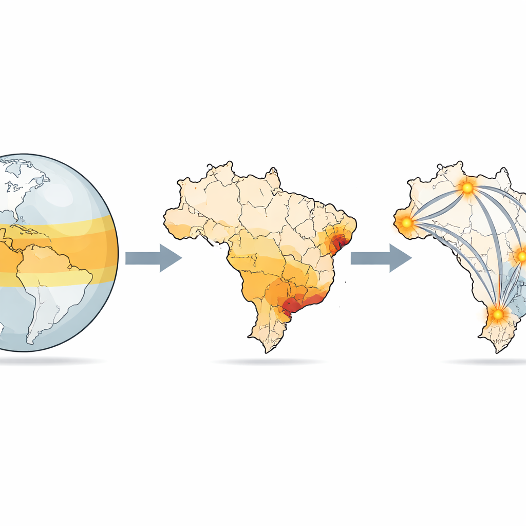
Seeing seasonal waves across a vast country
When the researchers look at Brazil’s 27 states over time, they see strong seasonal waves: dengue activity typically surges from February to May, but the timing and intensity vary sharply by region and year. The forecasts for 2024 point to an exceptionally large national surge, with especially heavy burdens in the Southeast and parts of the North. These patterns matter because a region with rising cases early in the season can become a powerful source, sending infected travelers along transport corridors into places that have not yet peaked. The framework makes these “upstream” and “downstream” relationships visible, rather than treating each state as an isolated island.
Mapping invisible highways of infection
Using the mobility network, the study reveals intricate pathways by which dengue risk flows between cities. Importation pressure grows rapidly from late summer into autumn, then fades, mirroring the usual season but adding a spatial twist: some cities sit at the crossroads. Large urban centers and transit hubs in São Paulo, Rio de Janeiro, Goiás, the Federal District and other regions show persistently high incoming pressure. Some of these hubs also send large amounts of risk outward, forming thick corridors of two-way exchange, while more remote towns—especially in parts of the Amazon and the far South—remain relatively insulated. 
Sources, sinks, and hidden dependencies
By comparing how much risk a city exports versus how much it imports, the authors identify “source” cities that drive national spread and “sink” cities that mostly receive infections from elsewhere. About two-thirds of municipalities behave as sinks, while a minority of heavily connected urban areas act as strong sources. At the state level, some places, such as São Paulo and Minas Gerais, are largely self-contained: most of their importation pressure comes from within their own borders. Others, such as the Federal District or certain northern states, depend heavily on a few external suppliers of risk. This source–sink picture highlights where upstream control could most effectively reduce downstream outbreaks.
Turning forecasts into action
For public health officials, the key message is that looking only at local case counts misses an important part of the story. A city with low current incidence but strong incoming connections from high-burden areas may sit on the edge of a future outbreak, especially if its climate and mosquito populations are favorable. The framework does not try to model every detail of mosquito biology or human behavior; instead, it cleanly separates two pieces of risk: the external pressure from incoming infections and the local conditions that determine whether those infections spark an epidemic. By updating these importation maps in near real time, the approach offers a practical way to prioritize surveillance, coordinate responses between states, and, in principle, extend similar tools to other diseases that hitchhike on human movement.
Citation: Chen, X., Moraga, P. Forecasting of dengue importation risk in Brazil using deep learning and mobility networks. npj Digit. Public Health 1, 11 (2026). https://doi.org/10.1038/s44482-026-00015-9
Keywords: dengue forecasting, human mobility, Brazil public health, deep learning, disease importation risk