Clear Sky Science · en
RadNet: an interpretable deep learning model for kilometer resolution solar irradiance estimation over China with Fengyun-4A satellite data
Why sunlight maps matter for everyday life
Behind every solar panel on a rooftop or in a desert field lies a basic question: how much sunlight actually reaches the ground, hour by hour, year after year? For a country like China, which is racing to expand clean energy and cut carbon emissions, knowing where and when the sun shines most reliably is vital. This study introduces a new way to turn raw images from China’s latest weather satellite into detailed, trustworthy sunlight maps, helping planners and power companies use solar energy more efficiently.
Turning satellite eyes into solar maps
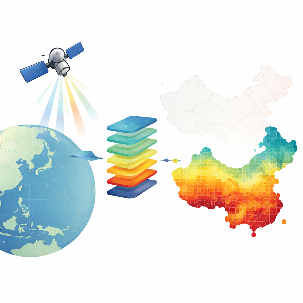
Solar power systems depend on “global horizontal irradiance,” the sunlight that hits a flat surface at ground level. Direct measurements from instruments on the ground are very accurate but scattered and sparse, leaving big gaps between stations. Traditional computer weather models and older satellite products cover wider areas but are often too coarse and biased for modern solar planning. China’s Fengyun-4A weather satellite offers a new opportunity: it constantly watches the country from space and records light in 14 different spectral bands at a resolution of 4 by 4 kilometers. The challenge is to convert these streams of satellite data into precise estimates of sunlight at the surface across the entire nation.
A new learning machine called RadNet
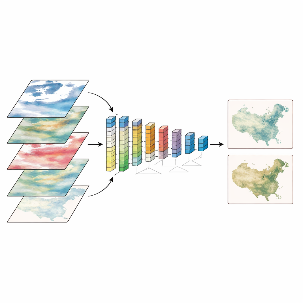
The authors designed a deep learning model named RadNet specifically to solve this problem. Instead of relying on hand-crafted rules, RadNet learns directly from data by matching satellite measurements with hourly sunlight readings from 100 ground stations across China. It ingests information from multiple satellite bands, along with the Sun’s position and local geography, and then learns how these factors combine to determine how much light reaches the ground. Importantly, RadNet is built on an architecture originally developed for “tabular” data, and it can automatically pick out which inputs matter most, greatly reducing the time-consuming step of manual feature selection that older machine-learning approaches require.
Sharper, more reliable sunlight estimates
When the team compared RadNet’s estimates to other methods and well-known sunlight databases, the new model consistently came out ahead. Across different years, RadNet showed lower errors and smaller biases than random forests, another deep-learning approach, and widely used products such as the National Solar Radiation Data Base and satellite-based Himawari and CERES datasets. It performed especially well under clear skies, where sunlight passes through the atmosphere with minimal cloud interference. Even under cloudy conditions—where broken clouds and rapidly changing patterns tend to confuse models—RadNet still beat the alternatives, though errors remained larger. The model also generalized well over time: trained mainly on data from 2022, it maintained high accuracy when tested on independent data from 2021 and 2023.
Seeing inside the black box
Many deep learning systems are criticized as “black boxes,” but RadNet is designed to be more transparent. By tracking which inputs the model attends to at each decision step, the researchers can see which satellite bands and angles are most influential. They found that a near-infrared band that is particularly sensitive to clouds contributes the majority of the model’s skill, followed by the solar zenith angle, which encodes the daily rise-and-fall of the Sun. Other infrared bands bring in information about water vapor, cloud tops, and surface features. This built-in interpretability makes it easier to trust and refine the model, and to understand when and why it might go wrong—for example, when clouds create parallax and scale mismatches between what a ground station sees and what the satellite averages over a larger area.
What this means for clean energy planning
In the end, RadNet produces high-resolution sunlight maps over all of China, at about a 4-kilometer grid, with better accuracy than existing reanalysis and satellite products. These detailed, hourly and annual maps highlight bright regions such as the Qinghai–Tibet and Inner Mongolia plateaus, and they reveal how clouds and air pollution shift sunlight from season to season and year to year. While there is still room to improve performance under complex cloud fields and extreme dust events, the approach shows that a carefully designed, interpretable deep learning model can turn raw satellite imagery into an actionable resource for solar developers, grid operators, and policymakers, helping China plan a more reliable and climate-friendly energy future.
Citation: Lu, C., Qin, Y., Jiang, Y. et al. RadNet: an interpretable deep learning model for kilometer resolution solar irradiance estimation over China with Fengyun-4A satellite data. npj Clean Energy 2, 7 (2026). https://doi.org/10.1038/s44406-026-00023-x
Keywords: solar irradiance, satellite remote sensing, deep learning, solar energy resources, China renewable energy