Clear Sky Science · en
Bridging spatial and temporal surface pressure dynamics for gust aerodynamic modeling
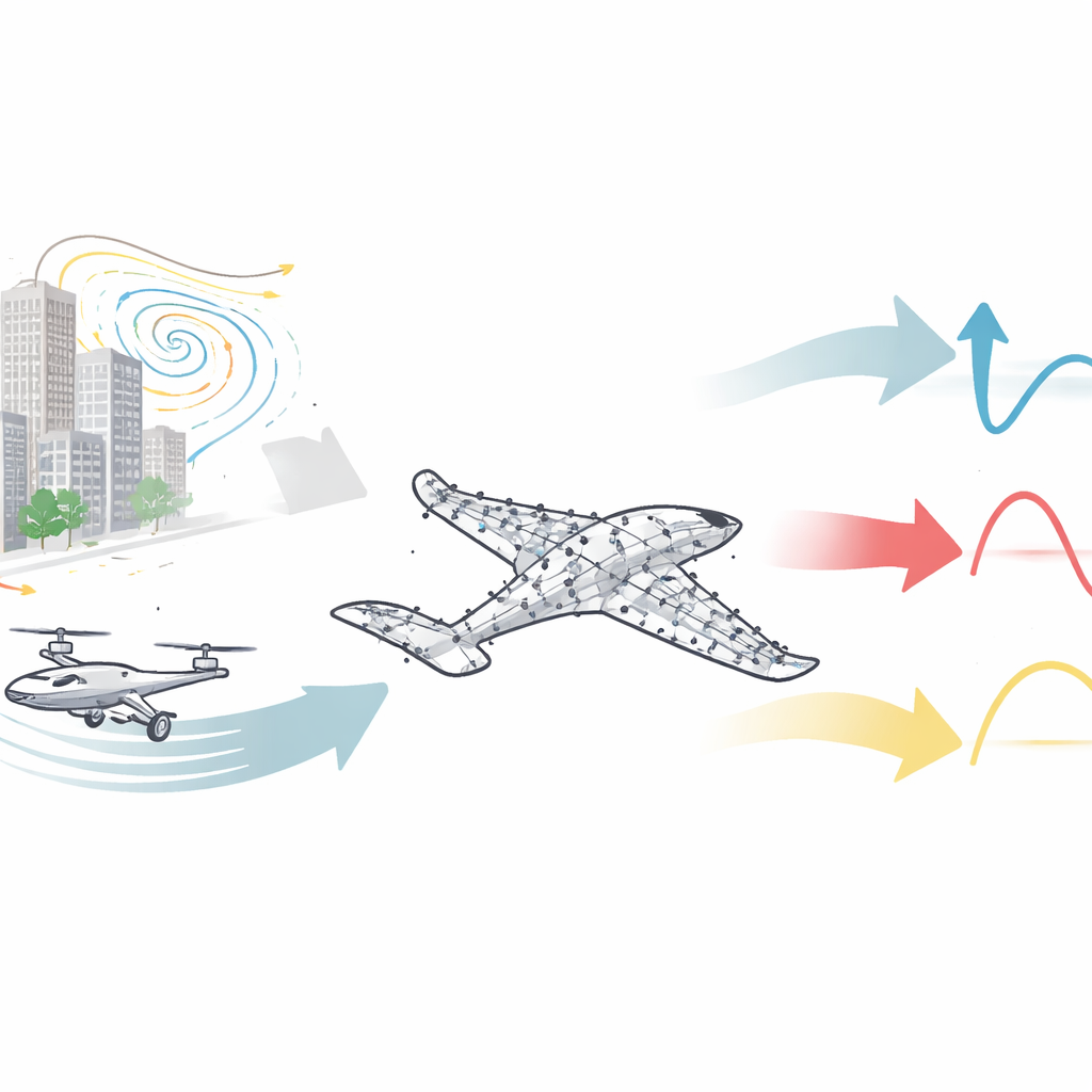
Why gusty winds matter for everyday flying machines
Small aircraft and drones are expected to handle everything from package delivery to air taxis in crowded cities. Yet their biggest enemy is something invisible: sudden gusts of wind that can double the forces on a wing in a blink, shaking vehicles and even risking a stall. This paper introduces a new artificial intelligence framework that learns to sense and predict how those gusts will push and twist an aircraft, using only a sparse set of pressure sensors on its surface. That ability is a key step toward safer, more reliable low-altitude flight in real-world, messy weather.
City winds and their hidden dangers
In modern cities, tall buildings, busy airports, and heat rising from pavement create complex, swirling air patterns. These gusts can include vertical updrafts, sideways wind shear, and strong vortices shed from skyscrapers or large airliners. For low-flying aircraft—like delivery drones or electric air taxis—such disturbances can rapidly change the pressure on the wings and body, leading to large, abrupt shifts in lift, drag, and twisting moment. Traditional flight-control systems are designed mainly for smoother conditions and often rely on simplified gust shapes, which struggle to represent the wild variety of real urban flows.
From pressure spots to a connected picture
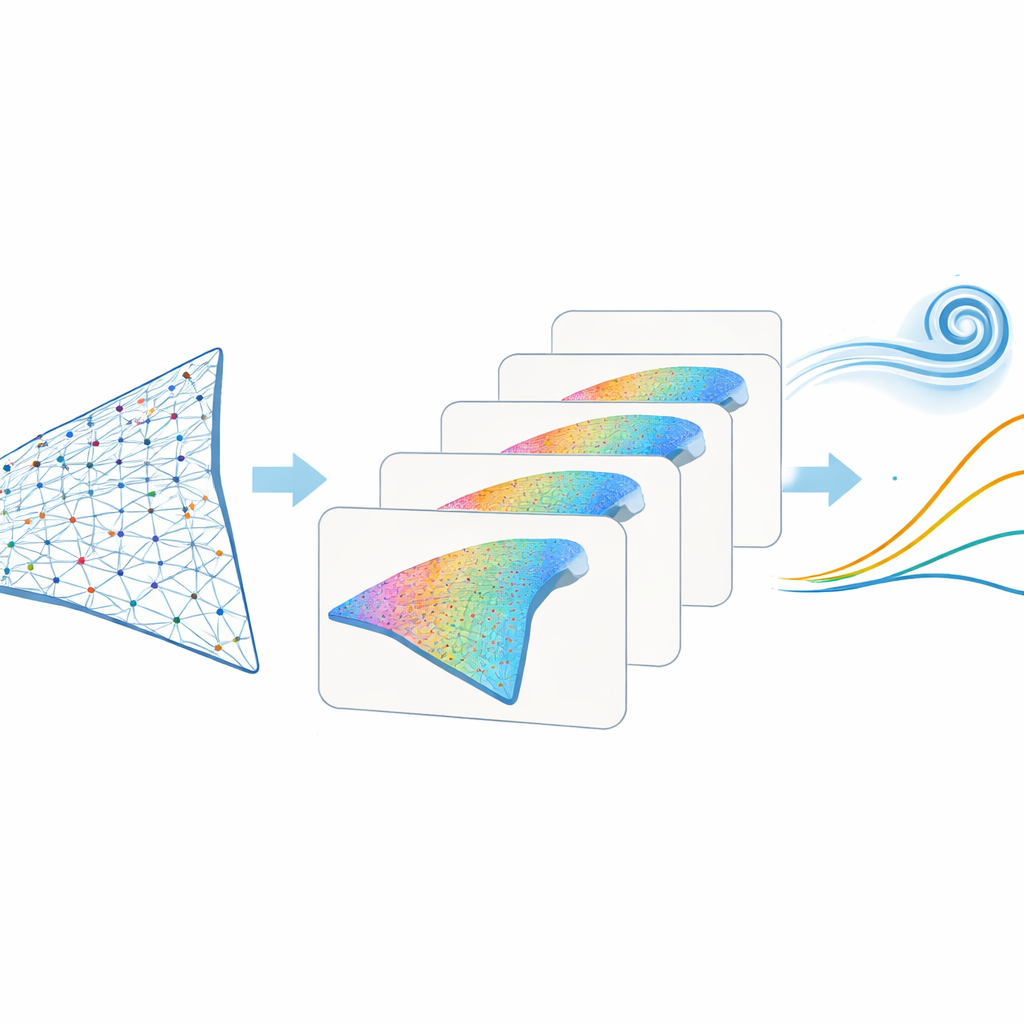
The forces that keep an aircraft aloft arise mostly from pressure differences over its surface. Engineers can place a limited number of tiny pressure taps on a wing, but these sensors only sample a few spots. The authors tackle this by treating the sensor layout as a network, or graph, in which each sensor is a node and the strength of its connection to every other sensor depends on their distance and physical relationship. Rather than linking only along the airflow direction or only across the wing, they show that a full set of links between all sensors is crucial: gusts create crosswise and three-dimensional flow patterns that cannot be captured by one-directional connections alone.
Teaching an AI to watch pressure change over time
Gust encounters are not just about where the pressure changes, but also when. The air’s inertia and the growth and shed of vortices mean that the forces on an aircraft lag behind the incoming disturbance. To capture this behavior, the authors combine their graph-based spatial view with a Transformer, a modern AI architecture built to handle sequences. The model first processes the sensor network to learn how pressures are related across the surface, then feeds this evolving picture into a temporal attention module that decides which moments in the gust history matter most. With this unified “Graph Transformer,” a single model can predict several outputs at once—lift, drag, and pitching moment—rather than training separate black-box models for each.
Testing in simple flows and in realistic turbulence
To see whether the approach works beyond toy examples, the team tests it on two very different datasets. One comes from clean computer simulations of a two-dimensional airfoil in controlled gusts at low flow speeds, where the patterns are relatively simple and noise-free. The other comes from towing-tank experiments with a three-dimensional delta-wing model at much higher speeds, closer to real low-altitude conditions, where turbulence, flow separation, and vortex breakdown make the physics far more complicated. In both settings, the model learns from a small set of pressure sensors to predict the changing forces during gust encounters with low error, including cases where gusts drive strong, highly unsteady vortices over the wing.
Seeing what the model pays attention to
Because the Transformer uses attention, the researchers can inspect which parts of each gust event the model focuses on. They find that it naturally highlights the onset and peak phases of the gust—exactly when forces change the most and when a flight controller most needs reliable estimates. The framework can also be run in reverse: given the pressure signals, it can infer how the wing’s angle of attack is changing in time, linking surface signatures back to the aircraft’s motion. When this inferred motion is then fed back into the force predictor, some of the remaining errors in sharp drag spikes are reduced, suggesting a path toward integrating more physical state information. The method remains robust even when moderate noise is added to the pressure data, hinting at practical resilience to imperfect sensors.
What this means for safer low-altitude flight
In plain terms, this study shows that a modest number of smartly interpreted pressure sensors can give an aircraft a kind of “skin sense” for gusts. By treating sensors as a fully connected network and letting an attention-based model learn how pressure patterns unfold in time, the framework can forecast how gusts will tug and twist a vehicle across a wide range of conditions. That capability could feed future control systems that automatically brace for gusts, making urban drones and air taxis safer and more reliable even when the wind is far from calm.
Citation: Chen, D., Liang, A., Sun, B. et al. Bridging spatial and temporal surface pressure dynamics for gust aerodynamic modeling. Commun Eng 5, 66 (2026). https://doi.org/10.1038/s44172-026-00612-9
Keywords: gust aerodynamics, urban air mobility, graph neural networks, transformer modeling, pressure sensing