Clear Sky Science · en
Transport-constrained eddy–mean energetics sustain extreme rainfall over China
Why stronger rainstorms in China matter
When summer rainstorms over China turn extreme, they can trigger floods, landslides, and disruptions that affect hundreds of millions of people. This study asks a deceptively simple question: what actually keeps these intense rain systems going? By tracing how moisture and energy move through the atmosphere, the authors show that the worst downpours are not just about having more water vapor, but about how air currents reorganize to pull in energy from far away and focus it over China.
Where and how extreme rain is getting worse
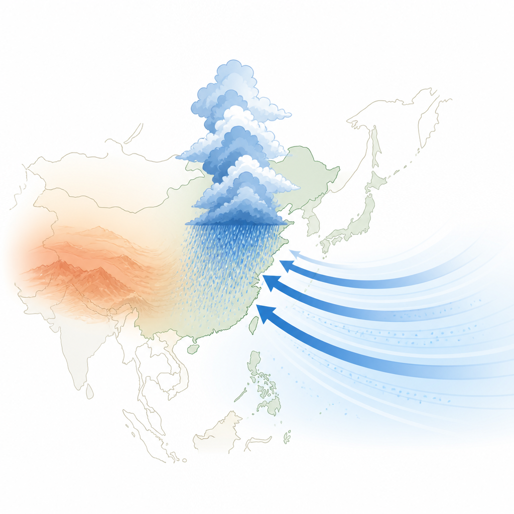
The researchers begin by mapping how often very wet summer days occur across China and how intense they are. Using rain gauges and a modern weather reanalysis, they confirm that the heaviest extremes cluster along the Yangtze River and China’s southeastern coast, with a clear gradient from drier northwest to wetter southeast. The reanalysis reproduces the big patterns well, though it tends to overestimate lighter rain in some regions and underestimate certain pockets of intense rain. This agreement gives confidence that the dataset can be used to probe the physical workings of extreme events in detail.
Moisture pathways during normal and extreme storms
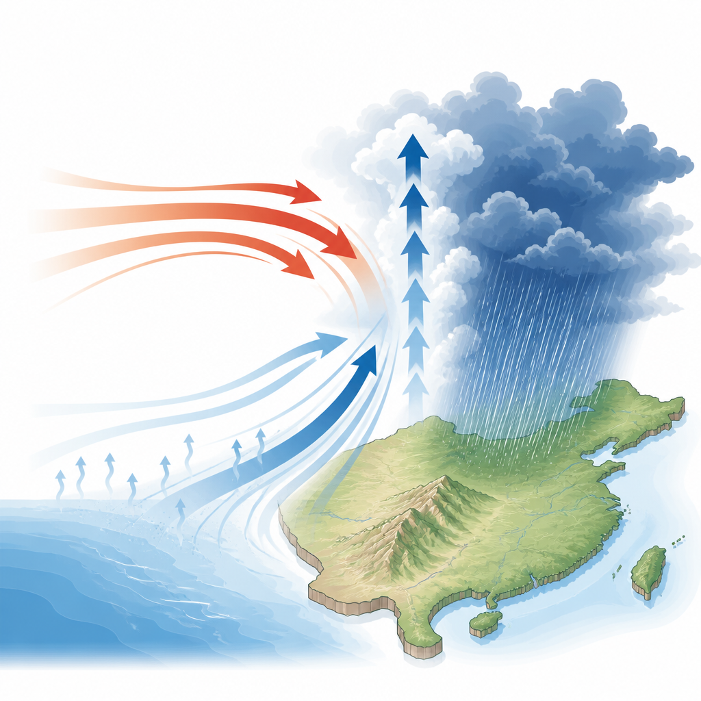
Next, the team examines how water vapor is transported during ordinary rainy days versus extremes. In both cases, the main way the atmosphere supplies moisture for rain is by lifting humid air upward, rather than by simply pushing it sideways. What changes in extreme events is who does the lifting. On typical days, large-scale, slowly varying upward motion dominates. During extremes, fast-changing weather disturbances take over, driving much stronger upward motion and concentrating moisture into narrower zones of heavy rainfall. Importantly, the overall direction of transport stays the same: moist air still moves upward, but the driving circulation shifts from a gentle background flow to more vigorous eddies and storms.
Energy supply that keeps storms alive
Heavy rain needs not only moisture but also a steady supply of energy to keep air rising. A natural suspect is radiation from the Sun and Earth, which clouds can trap or reflect. By combining satellite and reanalysis data, the authors find that during extreme storms over land, clouds actually reduce the net energy entering the atmospheric column compared with normal rainy days. Thick high clouds strongly reflect sunlight back to space, and while they also trap some heat, the shading wins out at the top of the atmosphere and at the surface. Inside the atmosphere, clouds mainly rearrange heat vertically rather than adding extra energy overall.
Warm air import as the hidden fuel
Because radiation does not provide the extra fuel, the atmosphere must draw energy from somewhere else. The analysis shows that during extremes, horizontal transport of moist energy into China becomes crucial. In particular, moving warm, relatively dry air from outside the region into the storm environment plays a leading role. Midlatitude weather systems and a strengthened high-pressure system over the western Pacific steer warm and moist air toward eastern China. This combination of warm inflow and moisture import makes the air column more energetic and buoyant, allowing stronger and more persistent upward motion even while clouds are shading the region.
What this means for future extreme rain
The study concludes that extreme summer rainfall over China operates in a transport-constrained regime: the intensity of storms is limited not so much by local heating from radiation, but by how efficiently large-scale winds can deliver energy and moisture from elsewhere. When the circulation reorganizes to enhance this lateral supply, extreme rainfall is more likely and more severe. For non-specialists, this means that understanding and forecasting future flood risks in China will depend heavily on how climate change reshapes regional wind patterns and energy transport, not just on how much extra moisture a warmer atmosphere can hold.
Citation: Yuan, X., Su, B., Liu, B. et al. Transport-constrained eddy–mean energetics sustain extreme rainfall over China. Commun Earth Environ 7, 443 (2026). https://doi.org/10.1038/s43247-026-03547-3
Keywords: extreme rainfall, East Asian monsoon, moisture transport, energy budget, China climate