Clear Sky Science · en
Satellite retrieved soil surface dynamics reduce the extent and frequency of sediment flux with implications for early warning systems
Why blowing soil matters to everyday life
Dusty winds do more than make the sky hazy. When soil is stripped away by strong gusts, it can ruin farmland, worsen air quality, speed up climate change and snarl transport. To prepare for sand and dust storms, scientists rely on computer models that estimate when winds are strong enough to lift soil into the air. This study shows that those models have been missing a key piece of reality: the changing state of the ground itself. By using satellites to watch how soil surfaces evolve, the authors find that wind-blown sediment is far less widespread and frequent than many models assume, reshaping our picture of global dust and early warning systems.
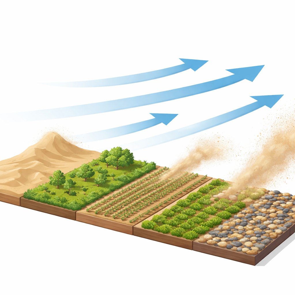
How wind lifts soil into the air
For decades, dust and sand storm models have used a simple rule of thumb: once wind at the surface passes a fixed threshold, loose grains start to move and can be swept into the air. This threshold was calculated from soil texture, such as the average grain size, and usually assumed that surfaces were dry, loose and had an endless supply of erodible particles. In practice, real landscapes are patchy. Soil can be clumped into crusts and clods, covered by stones or protected by vegetation. These features change how easily the wind can grab particles, and they change over days to years as weather, land use and previous storms reshape the ground. The classic fixed-threshold approach ignores this moving target, leading models to trigger blowing dust whenever the wind is strong enough, even when the surface has become too rough or protected to erode.
Reading soil conditions from space
The researchers tackled this problem by linking the brightness of the land surface, as seen from above, to how resistant the soil is to being eroded. They worked in the laboratory and wind tunnel with both carefully prepared quartz grains and natural sandy soils. By measuring how much light the surfaces reflected at different angles, and comparing that with the wind speed needed to start moving particles, they built a new calibration. This calibration connects subtle variations in surface shading—caused by clods, crusts, stones and plant cover—to a “dynamic threshold” for sediment movement. Because satellite instruments such as MODIS routinely measure land brightness (albedo) worldwide, this method, called dEARTH, can retrieve how the threshold changes across large areas and through time, capturing the feedback between wind, soil roughness and sediment supply.
Testing the new view of erosion
To check that their satellite-based thresholds were realistic, the team compared them with direct threshold measurements from field instruments and with observed sediment transport in wind tunnels and real landscapes. The new dynamic thresholds matched field thresholds about as well as traditional texture-based estimates but did a better job reproducing how much sediment was actually moved over time. When they fed dEARTH into erosion models and compared the results against measurements, the dynamic approach reduced the tendency to predict very large sediment fluxes and better matched how often moderate events occurred. The reason is that as the surface becomes rougher or more protected, the threshold rises and the number of hours when wind can exceed it drops, especially in regions with vegetation or crusted soils.
A smaller, patchier world of blowing dust
Applying the dEARTH model globally with satellite albedo, reanalysis wind and soil moisture data, the authors found that previous models have probably exaggerated how much of Earth’s land is actively losing soil to the wind. Under the classic fixed-threshold scheme, modelled sediment transport occurred over about 78 million square kilometres, spilling well beyond known drylands and into dense vegetation. With dynamic thresholds, that area shrank to 24 million square kilometres—69% less, and equivalent to about 40% of Earth’s land surface being reclassified as not actively eroding. The total global mass of wind-moved sediment also dropped by 45%, from roughly 187 to 102 petagrams per year. The biggest reductions occurred in regions with grassland, cropland and shrubland, where changing surface roughness often shields the soil; barren desert cores such as North Africa’s Bodélé Depression remained major sources.
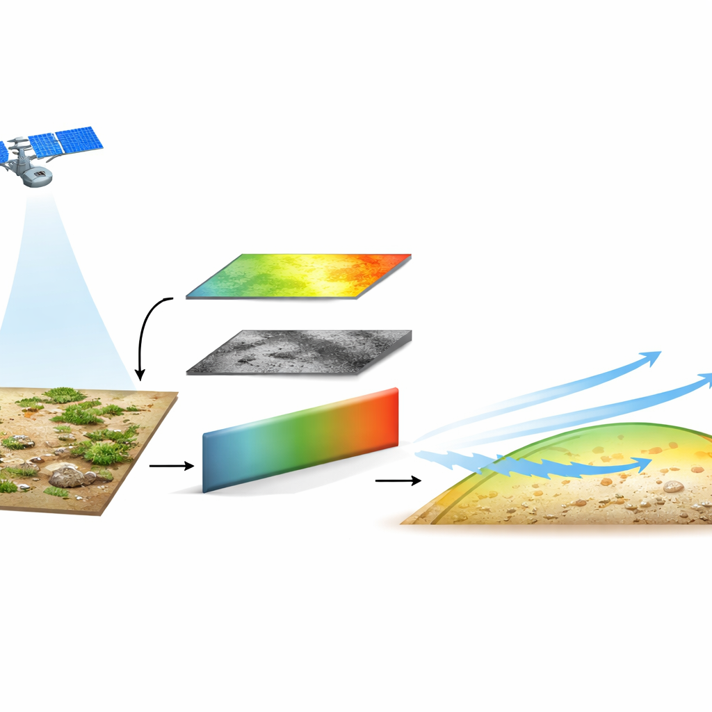
What this means for dust forecasts and land management
For non-specialists, the lesson is that the ground’s “armor” against the wind matters as much as the strength of the gusts themselves. By watching that armor evolve via satellites, the dEARTH approach offers a more realistic picture of when and where dust and sand storms can start. This should improve early warning systems, air-quality forecasts and estimates of how dust affects climate and agriculture, while avoiding exaggerated projections of land degradation. It also highlights the power of keeping soil surfaces rough and covered—with crops, grasses, crusts or stones—as a practical way to reduce harmful dust emissions in a warming, windier world.
Citation: Zhou, Z., Chappell, A., Zhang, C. et al. Satellite retrieved soil surface dynamics reduce the extent and frequency of sediment flux with implications for early warning systems. Commun Earth Environ 7, 259 (2026). https://doi.org/10.1038/s43247-026-03368-4
Keywords: dust storms, wind erosion, satellite remote sensing, soil surface roughness, early warning systems