Clear Sky Science · en
Large-scale circulation drives atmospheric river landfall in the western United States
Why rivers in the sky matter
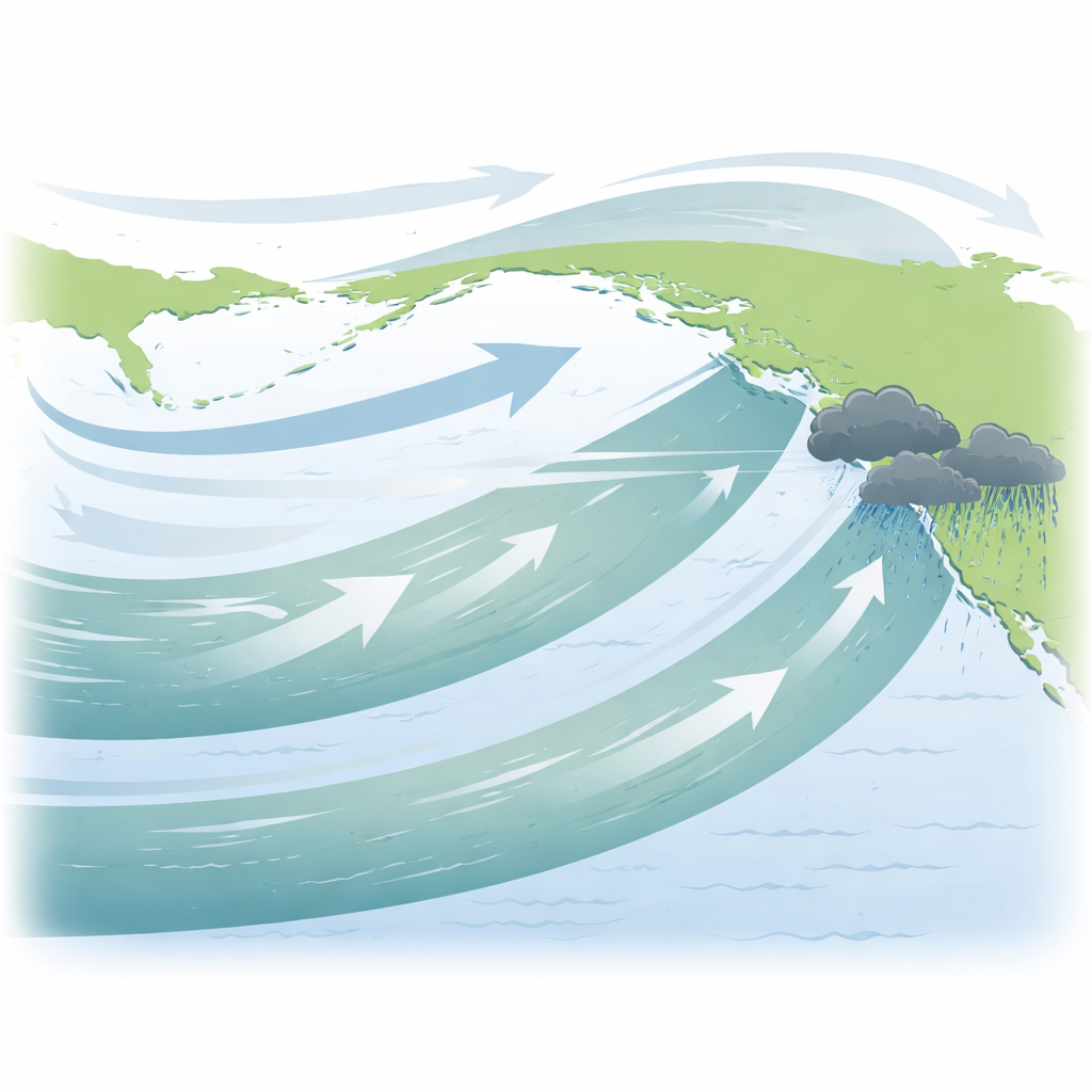
People living along the U.S. West Coast increasingly hear about “atmospheric rivers” when floods, landslides, or deep snowstorms make headlines. These long, narrow corridors of moisture in the sky deliver both life‑giving water and dangerous deluges. This study shows that many of the most important atmospheric rivers hitting the western United States are not driven only by familiar storm systems, but are also powered by a slower, continent‑spanning wind pattern over the North Pacific that quietly steers moisture toward the coast.
Invisible highways of water
Atmospheric rivers are like aerial conveyor belts that move huge amounts of water vapor from the tropics toward the poles. In winter, they are a primary source of rain and mountain snow for California and the Pacific Northwest, helping to refill reservoirs and snowpack. At the same time, when they stall over one area or arrive in rapid succession, they can trigger severe floods and landslides. Traditionally, scientists have pictured these rivers in the sky as narrow plumes just ahead of powerful ocean storms called extratropical cyclones, treating them mainly as by‑products of those fast‑moving weather systems.
A new look at storm versus background flow
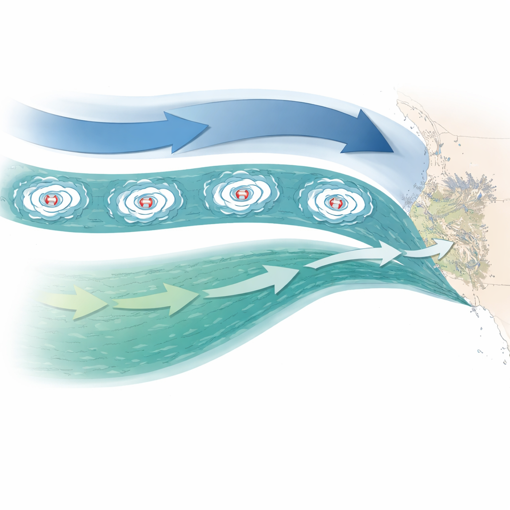
The authors revisited this picture using a “multiscale index” that separates quick, storm‑scale motions from slower, continent‑spanning air‑flow patterns in reanalysis data from 1979 onward. Over the open North Pacific, most atmospheric rivers lined up well with energetic storms, consistent with the classic view. But as these moisture plumes approached the U.S. West Coast, the relationship weakened. The analysis revealed that landfalling atmospheric rivers there often draw a surprisingly large share of their moisture transport from broad, slowly varying circulation features that operate on time scales of several weeks, not just a few days.
A looping pattern around the North Pacific
Diving deeper, the study identified a recurring large‑scale pattern in upper‑level winds and pressure that wraps around the North Pacific like a giant atmospheric loop. The authors call this the circum‑North Pacific, or CNP, pattern. In its “positive” phase, this pattern sets up a quasi‑stationary corridor of southwesterly winds that taps humid subtropical air and guides it toward the western United States. When this slow‑moving corridor overlaps with ordinary traveling storms, their effects add together. The result is an “intermediate” type of atmospheric river that is powered both by fast storms and by the large‑scale background flow. These hybrid rivers tend to be longer and wider, and they penetrate farther inland than storm‑driven cases alone.
Why some events are especially damaging
By comparing different types of landfalling atmospheric rivers, the authors found that intermediate events, energized by the CNP pattern, deliver up to twice as much winter precipitation to parts of the western U.S. as purely storm‑driven rivers. They are also more likely to fall into the highest impact categories used by forecasters, largely because they linger over the same region for longer rather than because their peak intensity is dramatically higher. A striking example is the late‑December 2022 event in California: although a series of ordinary storms passed by, the prolonged, extreme moisture inflow was sustained mainly by a persistent large‑scale corridor associated with the CNP pattern, helping to push many locations into the most hazardous category.
What this means for forecasts and the future
For residents, water managers, and emergency planners, the key message is that the most consequential atmospheric rivers along the U.S. West Coast often owe their strength to a partnership between local storms and a vast, slowly evolving wind pattern over the North Pacific. This means that monitoring and predicting those larger‑scale patterns, not just individual storms, will be crucial for improving warnings weeks in advance. It also suggests that to understand how climate change will alter flood and water‑supply risks, scientists must track how these broad circulation patterns respond, not only how much extra moisture a warmer atmosphere can hold.
Citation: Park, C., Ming, Y. Large-scale circulation drives atmospheric river landfall in the western United States. Commun Earth Environ 7, 378 (2026). https://doi.org/10.1038/s43247-026-03281-w
Keywords: atmospheric rivers, North Pacific circulation, U.S. West Coast floods, subseasonal prediction, climate variability