Clear Sky Science · en
High-resolution geomechanical modeling reveals accelerating infrastructure risks from permafrost degradation in Northern Alaska
Why Frozen Ground Matters to Everyday Life
Much of northern Alaska is built on permafrost—ground that stays frozen year-round. As the Arctic warms far faster than the rest of the planet, this frozen ground is thawing, causing the land to sink and weaken. That quiet shift beneath the surface can crack roads, tilt houses, and strain pipelines, threatening remote communities and the economy that depends on them. This study shows, in unprecedented detail, how quickly those risks are rising this century and when the biggest jump in damage is likely to occur.
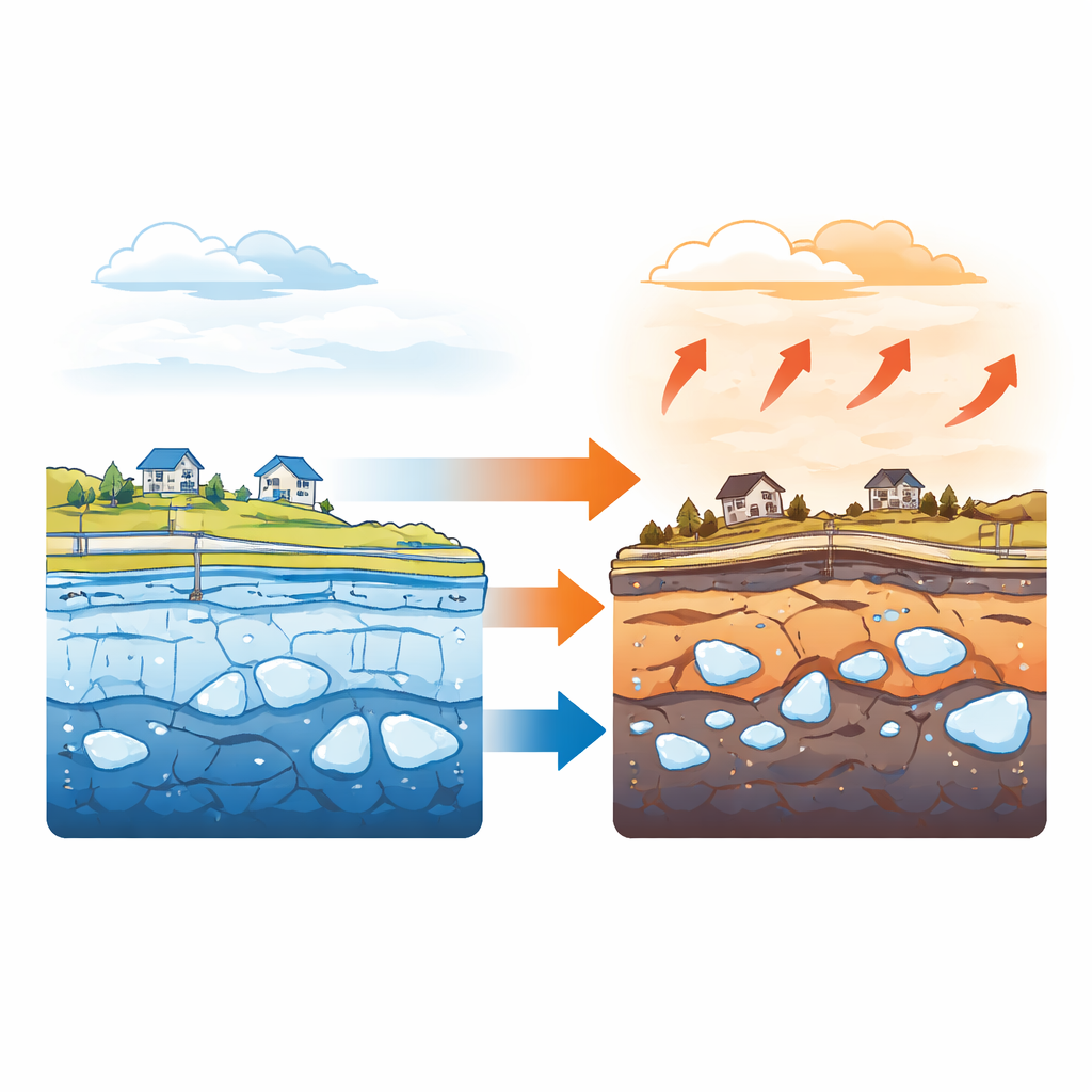
Frozen Foundations Under Pressure
Permafrost acts like a natural foundation: when it is cold and ice-rich, it can support heavy structures. Warming air temperatures melt the ice within the soil, creating pockets of water and softer ground. The authors focus on two key problems this creates for buildings, roads, and pipelines. First, the surface sinks, a process called settlement, as ice melts and the soil compresses. Second, the ground’s ability to carry weight—its bearing capacity—drops as the frozen soil loses strength. Past large-scale studies often used simplified approaches that ignored how the added weight of infrastructure itself pushes thawed soil down. This work instead couples detailed ground-temperature simulations with engineering models of soil behavior to capture both the climate and loading effects at a fine, 30-meter grid across Alaska’s Arctic Coastal Plain and four key coastal villages.
Mapping a Sinking Landscape
The team tested their approach by comparing modeled ground sinking to satellite and field measurements near Point Barrow, Prudhoe Bay, and Deadhorse. Their model closely matched observed rates, then projected changes forward through the 21st century under moderate (RCP4.5) and high (RCP8.5) greenhouse gas scenarios. Under intense warming, average settlement across the Arctic Coastal Plain reaches about 1.1 meters by the 2090s when typical building loads are included—more than double what would be expected if no structures were present. Settlement is not uniform: coastal zones and river deltas with ice-rich, easily compressed soils sink much more. Among four coastal communities, Point Lay stands out as especially vulnerable, with projected settlement up to 2.7 meters by the end of the century, while Utqiaġvik sees smaller but still significant sinking.
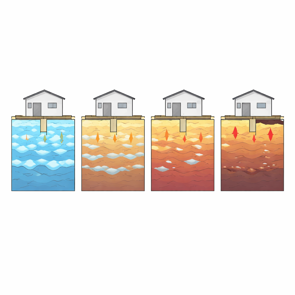
Weakening Ground Beneath Homes and Roads
At the same time, the strength of the frozen ground diminishes in a strongly nonlinear way. Using laboratory-based relationships for how ice-rich soils slowly deform under long-term loads, the researchers estimate how much weight permafrost foundations can safely carry over a 50-year lifetime. By the 2050s, average bearing capacity across the Arctic Coastal Plain drops by roughly one-quarter under both climate scenarios, consistent with earlier coarse-scale studies. After mid-century, however, things deteriorate sharply under high emissions: by the 2090s, average capacity plunges by over 90 percent, and some areas lose essentially all support as ground temperatures rise above freezing. Local patterns reflect both soil makeup and warming rates. For example, Wainwright and Point Lay see faster early-century losses as their permafrost warms more quickly, while Kaktovik starts stronger but still suffers large declines by century’s end.
When Risk Rises Fast
Translating these physical changes into real-world impacts, the authors estimate what fraction of existing buildings, roads, and pipelines will cross damage thresholds tied to excessive sinking or loss of safety margins in foundation strength. Up to about the 2050s, the picture is still manageable: under high emissions, less than 10 percent of infrastructure is classified as at risk. But between the 2060s and 2080s, they identify a critical “transition window” when risk climbs very quickly. By the 2070s and 2090s under RCP8.5, roughly 80 percent of buildings, 60 percent of roads, and nearly 90 percent of pipelines on the Arctic Coastal Plain are projected to face serious problems from either excessive settlement or greatly weakened support. Under the more moderate RCP4.5 pathway, these fractions are much lower, highlighting the importance of limiting warming.
What This Means for Arctic Communities
For residents, planners, and policymakers, the message is clear: the Arctic’s frozen foundations are already changing, and the most damaging effects on infrastructure are likely to arrive suddenly rather than gradually late in the century. Because the study uses detailed, physics-based models at community scale, its maps can help identify specific neighborhoods, road segments, and pipeline corridors that are most exposed, and guide choices about reinforcement, relocation, or new design standards. Yet the authors also stress uncertainties and the need to incorporate local engineering practices and Indigenous knowledge. Their overall conclusion is stark but actionable: without emissions cuts and proactive adaptation, the ground supporting northern Alaska’s communities will sink and weaken enough to endanger most major infrastructure within a few decades, making early planning essential.
Citation: Wang, Z., Xiao, M. & Nicolsky, D. High-resolution geomechanical modeling reveals accelerating infrastructure risks from permafrost degradation in Northern Alaska. Commun Earth Environ 7, 375 (2026). https://doi.org/10.1038/s43247-026-03240-5
Keywords: permafrost, Arctic infrastructure, ground settlement, climate warming, northern Alaska