Clear Sky Science · en
Beyond localized methane plume detection: a dual-path deep learning framework for sensor-agnostic global hyperspectral methane plume monitoring
Why tracking invisible gas matters
Methane is a powerful greenhouse gas that traps far more heat than carbon dioxide over a few decades, yet much of its leakage into the air goes unseen. Pinpointing where methane escapes from oil fields, landfills, coal mines, and farms is crucial for cutting emissions quickly, but current satellite methods can be slow and labor intensive. This study presents a new artificial intelligence system that can spot methane plumes worldwide more rapidly and reliably by learning directly from detailed spaceborne measurements of sunlight reflected off Earth.
Two smart ways to see methane from space
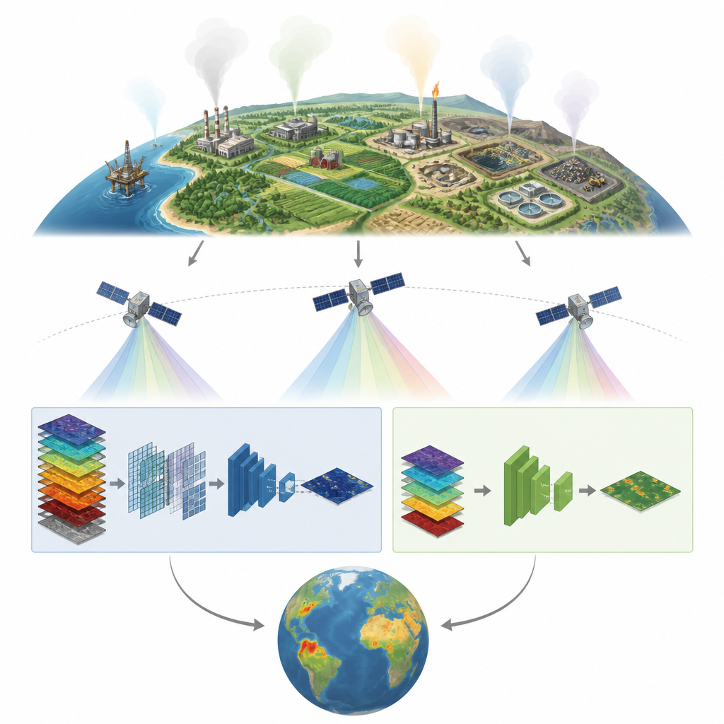
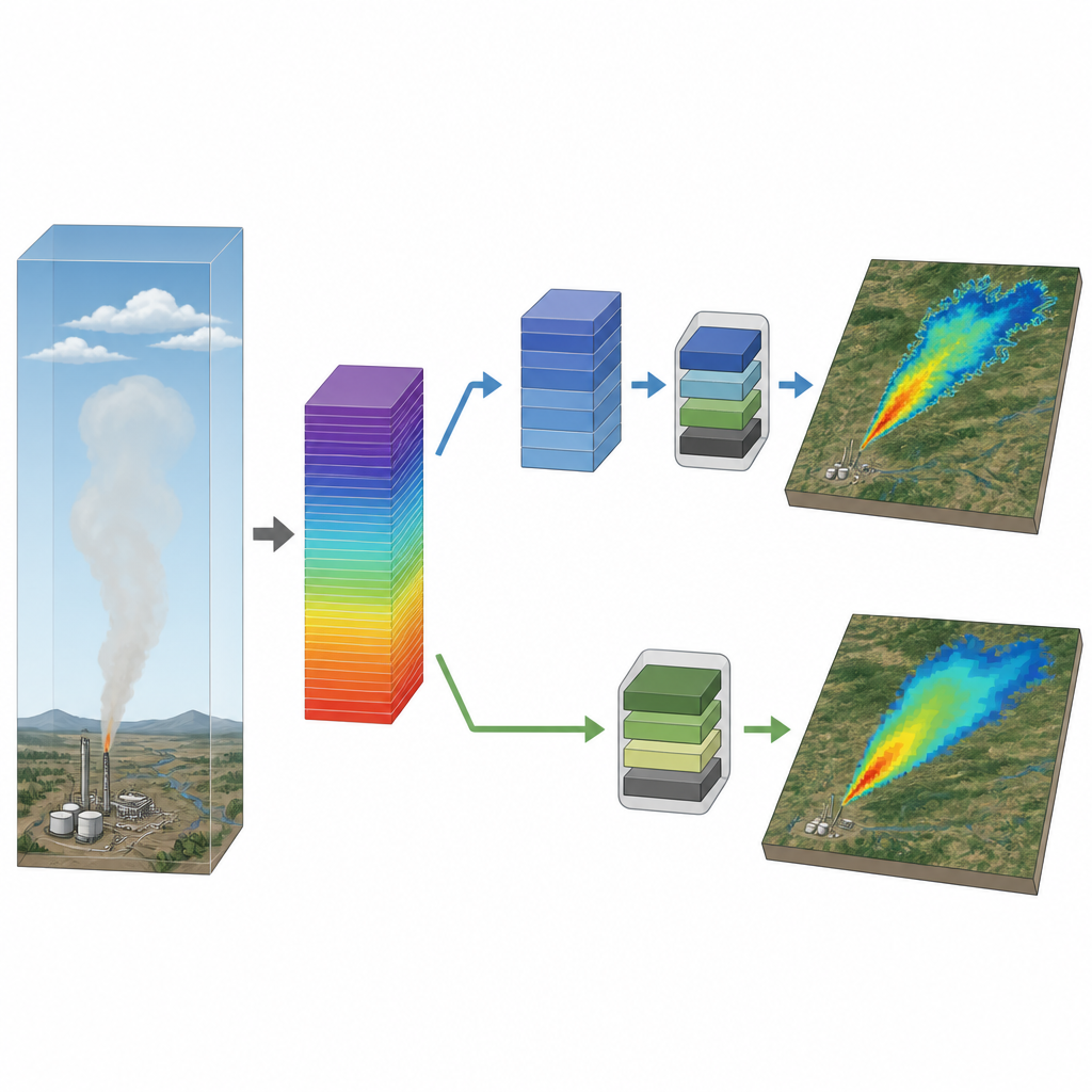
Modern satellites equipped with hyperspectral sensors capture sunlight in dozens of closely spaced colors, especially in ranges where methane strongly absorbs light. The authors compare two main ways to feed these rich data into deep learning models that draw pixel-by-pixel maps of methane plumes. One path uses raw radiance data, the measured light coming to the sensor in selected wavelengths. The other path uses an “enhancement” product, where traditional physics-based processing has already boosted the methane signal. By designing a dual-path framework, the team can test the strengths and weaknesses of both approaches under the same conditions.
How the dual-path system performs
Using thousands of carefully labeled plumes from NASA’s EMIT instrument and the Tanager-1 satellite, the researchers train three different image-segmentation networks for each path. Models working with the enhancement product consistently identify methane plumes more accurately, especially their faint edges and small, low-contrast features. These models also produce fewer false alarms when no plume is present. In contrast, models using raw radiance data are somewhat less accurate but still competitive, and they avoid a costly preprocessing step, which lets them scan new scenes quickly. This speed makes the radiance path attractive for rapid, first-look screening immediately after satellite data arrive.
What affects detection success on the ground
The study also explores when the system struggles. Both paths perform best when plumes are large or strongly concentrated, but the enhancement-based models hold up better when plumes are weak, patchy, or small. Surface type matters too. Dark, highly textured areas like forests, or mixed bare soil and sparse vegetation, can blur the contrast between plume and background, leading to more missed or mistaken detections. By analyzing performance across land cover classes, the authors show that bright, uniform surfaces make it easier for the models to tease out methane signals, while complex surfaces pose a tougher challenge, especially for the radiance-based path that must learn directly from raw light measurements.
Peering inside the AI’s “thinking”
To check whether the system relies on real methane physics rather than quirks in the data, the team applies explainable AI tools that highlight which image regions and wavelengths drive the models’ decisions. For the enhancement-based models, the most influential areas line up with the heart and edges of the visible plume. For the radiance-based models, the most important wavelengths coincide with known methane absorption features and sharp changes in the spectrum. This close match between learned patterns and established physical behavior suggests that the AI is focusing on scientifically meaningful cues rather than spurious correlations.
From single missions to global monitoring
A key test is whether the same model design can work across different satellites. The authors take the best enhancement-based network trained on EMIT data and apply the same architecture to Tanager-1 data, retraining it without any custom tweaking. Despite differences in resolution, viewing geometry, and labeling styles, the model reaches very similar skill levels on both sensors. It also successfully maps thousands of plumes across multiple continents and sectors, from oil and gas fields to landfills and coal mines, revealing where emissions cluster and how often they occur.
What this means for climate action
The study shows that pairing a slower, highly reliable enhancement-based path with a faster, radiance-based path can support both thorough emission accounting and near-real-time spotting of large leaks. By confirming that the models’ internal logic reflects real methane absorption patterns, and by demonstrating that one architecture can be reused across different satellites, the work lays a practical foundation for global, sensor-agnostic methane surveillance. For decision makers, this means better tools to find and prioritize leaks, track progress under international pledges, and act quickly on one of the most fixable pieces of the climate puzzle.
Citation: Yang, S., Kim, Y., Choo, M. et al. Beyond localized methane plume detection: a dual-path deep learning framework for sensor-agnostic global hyperspectral methane plume monitoring. npj Clim Atmos Sci 9, 115 (2026). https://doi.org/10.1038/s41612-026-01387-8
Keywords: methane emissions, satellite monitoring, hyperspectral imaging, deep learning, climate mitigation