Clear Sky Science · en
A GIS-based AHP approach integrating geospatial and magnetic data for groundwater potential mapping in a structurally complex arid region, Egypt
Why hidden water under deserts matters
In some of the driest corners of the planet, entire cities depend on water that cannot be seen at the surface. Along Egypt’s Red Sea coast, fast growing resorts and communities must stretch limited freshwater supplies while facing erratic rain and flash floods. This study explores how to find the most promising underground water pockets in such harsh landscapes by combining satellite images, field data, and subtle signals from Earth’s magnetic field. The result is a detailed map that shows where drilling new wells is most likely to succeed without wasting money or further stressing fragile water reserves. 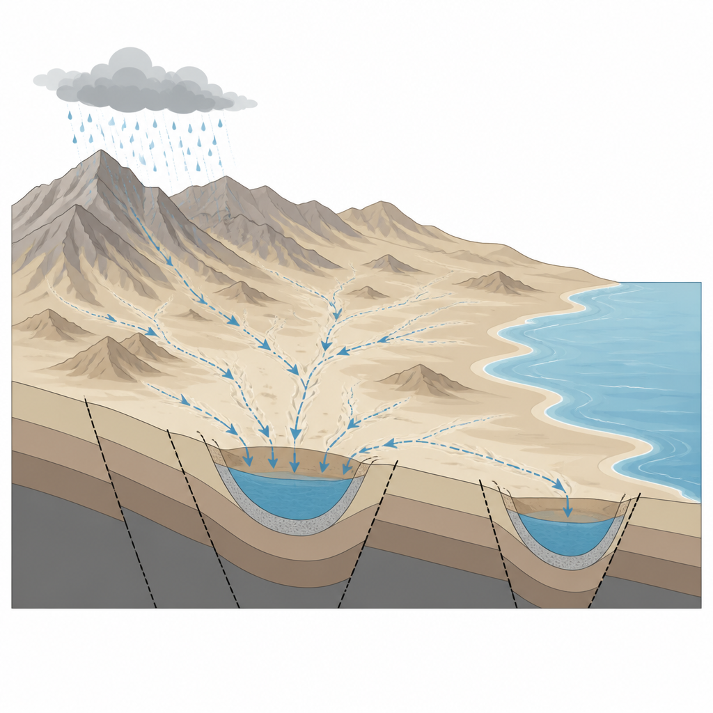
Thirsty land between mountains and sea
The research focuses on an area of about 3500 square kilometers between the Red Sea Hills and the cities of Hurghada and El Gouna. Here, rain is rare and usually falls in short, violent storms that send water rushing down dry valleys toward the coast. Most of this water runs off quickly, but a small share can seep into the ground and recharge underground stores. The region includes several types of underground reservoirs, from cracks in old hard rocks in the hills to younger sand and gravel deposits in valley bottoms and coastal plains. Understanding how these varied layers connect is vital for predicting where fresh or mildly salty water can still be tapped.
Using maps, data, and expert judgment together
To build a realistic picture of groundwater potential, the authors assembled sixteen different map layers that describe both the surface and what lies beneath. Surface layers include height, slope, land cover, soil type, drainage patterns, and estimated rain. Subsurface layers come from airborne magnetic surveys, which help outline the depth of hard basement rocks and the position of buried faults. Each of these factors influences how easily water can soak into the ground, move through cracks, and remain stored. The team used a method called the Analytical Hierarchy Process, which asks experts to compare the importance of each factor pair by pair, then turns those judgments into a set of weights that combine all layers into a single groundwater potential map.
Finding the hidden low spots that store water
The combined map divides the study area into zones of high, moderate, and low groundwater potential. High potential zones make up about one third of the area and cluster in broad, low lying basins such as the Tarboul syncline, the West Hurghada trough, and fan shaped plains near El Gouna. In these places, thick piles of sand and gravel blanket deep rock depressions, and both surface streams and underground fractures guide floodwater into storage. A key feature is the Bali Shear Zone, a long fracture belt that lines up with Wadi Bali and appears to act as a recharge corridor, helping water move from the mountains into structural lows. Steep, rocky highlands with thin soils rank lowest, since they shed water quickly and offer little space for it to collect. 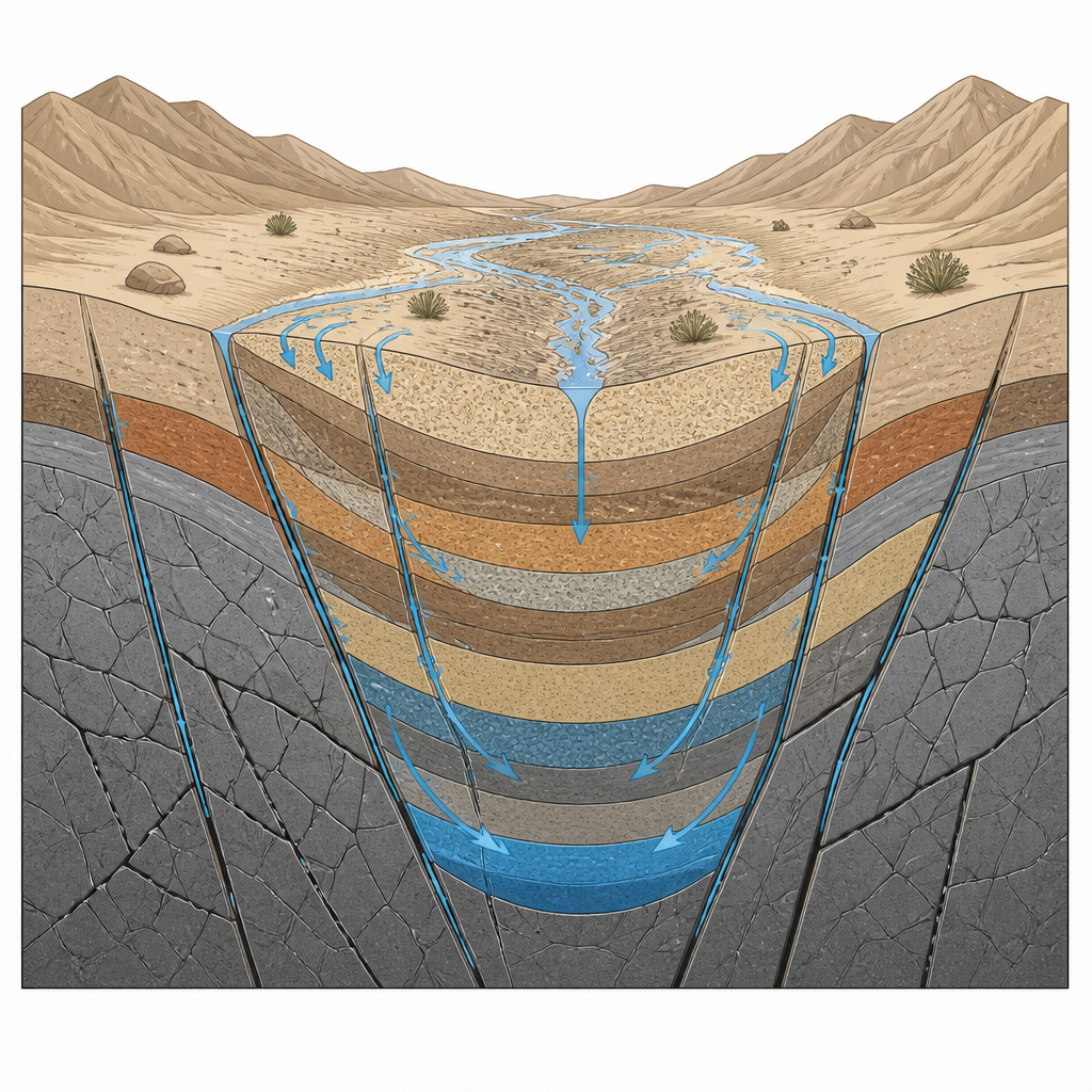
Testing and fine tuning the water map
The researchers checked their map against records from 57 wells spread across the region. Most known water points fall within the areas the model labels as high or moderate potential, giving a test score that suggests the map is a reliable guide at regional scale. A follow up analysis examined which inputs mattered most. Layers that describe rock type, fault and fracture density, and slope turned out to have the strongest influence on the final pattern, while more subtle terrain measures played a lesser role. This supports the idea that in such rifted desert settings, the architecture of deep faults and basins is more important than surface shape alone when it comes to storing scarce water.
What this means for water planning
For planners and local communities, the study’s message is clear. The best places to look for new groundwater supplies around Hurghada and El Gouna are not randomly scattered but tied closely to deep, fault controlled basins and valley fans where storm water can drain and linger. The southern part of the Tarboul Basin, in particular, stands out as a priority target for future wells. While the authors note that better rain records and higher resolution maps would further sharpen their results, their approach offers a practical, transparent way to narrow down drilling sites and to protect key recharge corridors in arid coastal regions that depend on unseen water underground.
Citation: Zamzam, S., Gadallah, E., Henaish, A. et al. A GIS-based AHP approach integrating geospatial and magnetic data for groundwater potential mapping in a structurally complex arid region, Egypt. Sci Rep 16, 15353 (2026). https://doi.org/10.1038/s41598-026-52393-y
Keywords: groundwater, Red Sea Egypt, remote sensing, fault-controlled aquifers, arid hydrology