Clear Sky Science · en
A 3D inversion method of TEM combining PSO-NLCG optimization and adaptive regularization
Seeing Hidden Structures Under Our Feet
Many of the resources and hazards that matter most to modern life lie out of sight underground. Engineers want to locate old mine workings before building, water managers need to trace aquifers, and geologists search for metal ores. This study presents a smarter way to turn surface measurements of fleeting electromagnetic signals into clear three dimensional pictures of what lies below, aiming to make such surveys more accurate, stable, and useful in real projects.
Listening to Fading Signals in the Ground
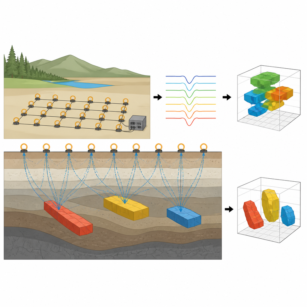
The work focuses on the transient electromagnetic method, in which a loop of wire on the surface sends a brief pulse of current into the ground and then listens as the resulting electromagnetic field dies away. Changes in the decay curve carry clues about how well different layers and bodies conduct electricity, which in turn relates to rock type, water content, or voids. Turning these noisy, short lived signals into a 3D map is hard because many different underground arrangements can match the same data, and the measurements are often contaminated by power lines and other interference.
Balancing Data Fit and a Plausible Underground Picture
To tackle this, the authors cast the problem as an optimization task: find a 3D distribution of electrical properties that best reproduces the observed signals while remaining geologically reasonable. They measure how well a proposed model matches the data and add a second term that rewards smooth, not overly jagged, structures. A key advance is that this smoothing weight is not fixed. At first it is strong, helping the solution stay stable despite noise. As the calculation proceeds, it is gradually relaxed so the model can sharpen the shapes and boundaries of true underground features instead of over smoothing them.
Combining Broad Search with Fine Tuning
The second ingredient is a hybrid search strategy that blends two kinds of numerical methods. Particle swarm optimization mimics a flock of simple explorers testing many different underground models across a wide range, which helps avoid getting stuck in a poor local solution. Once this global search has homed in on a promising region, a nonlinear conjugate gradient method takes over to refine the model efficiently using local slope information. The authors also include bounds to keep model values within realistic limits and stopping rules that avoid wasting computation once improvements become negligible.
Testing on Benchmarks and Synthetic Ground Models
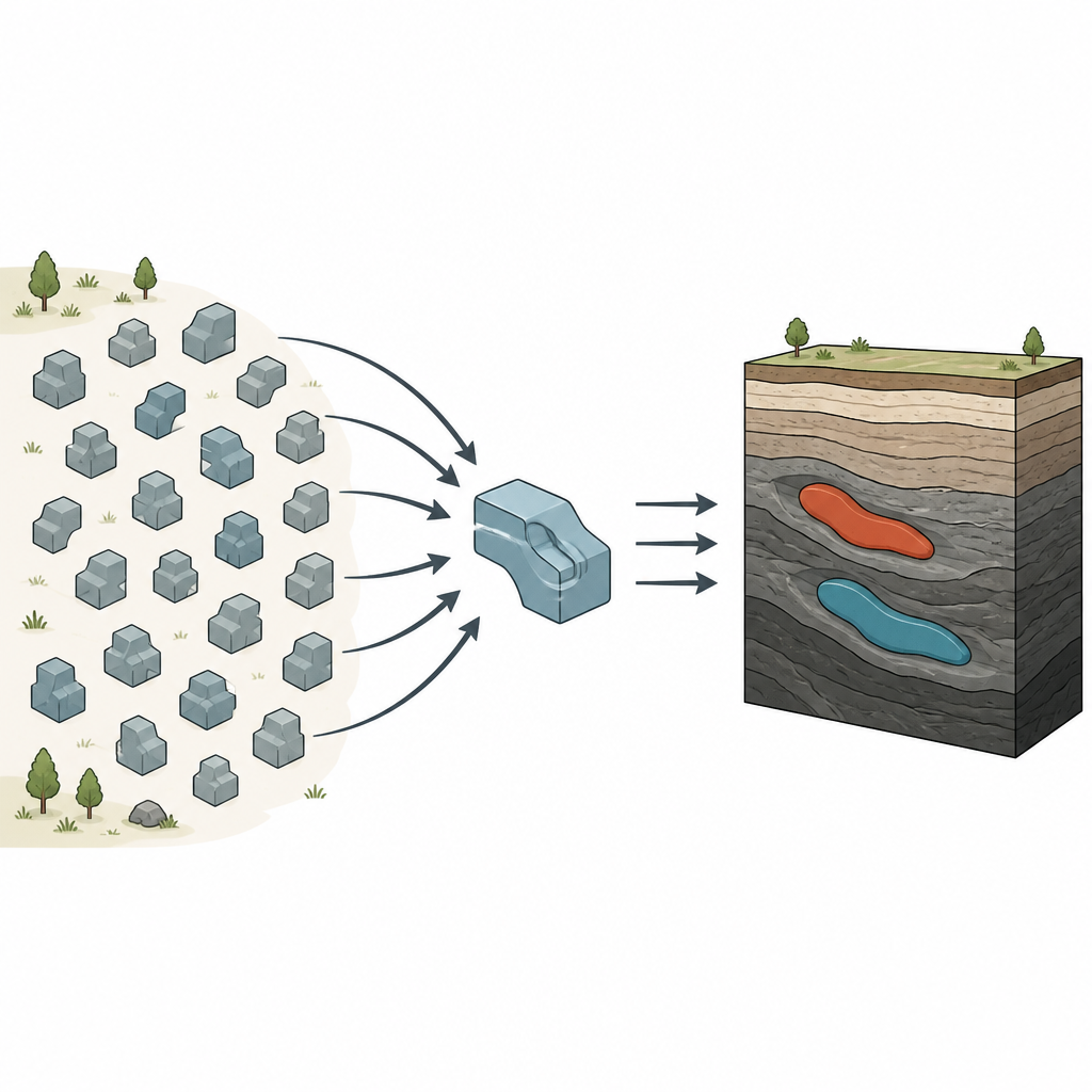
The team first checked their hybrid approach against a suite of standard mathematical test functions that are widely used to compare optimization algorithms. Across both simple and highly irregular landscapes, their combined method consistently reached values closer to the theoretical best than either swarm or gradient methods alone, while keeping run time only slightly above that of faster but less accurate schemes. They then applied the technique to computer generated underground scenarios containing one or more plate like bodies with different conductivities from their surroundings, adding realistic noise to the simulated measurements. In these tests, conventional methods either distorted the shapes, smeared the boundaries, or misplaced the targets, whereas the new approach recovered size, depth, and position much more faithfully.
Proving Its Worth on Real Construction Site Data
Finally, the authors used their method on field data from a building site with known underground goaf areas left by earlier mining. Survey lines and depth slices produced by the new inversion aligned well with the locations and depth ranges of most of the known cavities. In regions where two anomalies lay very close together, the method merged them, but overall the spatial match was strong, showing that the approach is robust outside controlled tests.
Clearer Underground Maps for Safer Decisions
In plain terms, this study shows how combining a wide ranging search with careful fine tuning, and adjusting the smoothness of the picture as it sharpens, can yield clearer, more reliable 3D maps of what lies below the surface. For planners, miners, and environmental engineers, that means better chances of finding hidden structures, avoiding hazards, and using underground space wisely, all from measurements taken at ground level.
Citation: Jianqiang, C., Feng, Z., Xuhai, D. et al. A 3D inversion method of TEM combining PSO-NLCG optimization and adaptive regularization. Sci Rep 16, 16115 (2026). https://doi.org/10.1038/s41598-026-48117-x
Keywords: transient electromagnetic, 3D inversion, geophysical imaging, optimization algorithm, underground structures