Clear Sky Science · en
Integrating fuzzy AHP and geo-spatial modeling for wind farm suitability assessment in Kuwait
Why Finding the Best Wind Spots Matters
As the world looks for cleaner ways to power our homes and cities, desert countries rich in oil face a puzzle: where, exactly, should they put wind farms so they add new energy without disrupting existing industries and fragile environments? This study tackles that question for Kuwait, showing how advanced mapping and decision tools can pinpoint the safest, strongest, and most practical places to harvest wind—helping the country move from talking about renewables to building them in the right places.
Understanding Kuwait’s Wind Promise
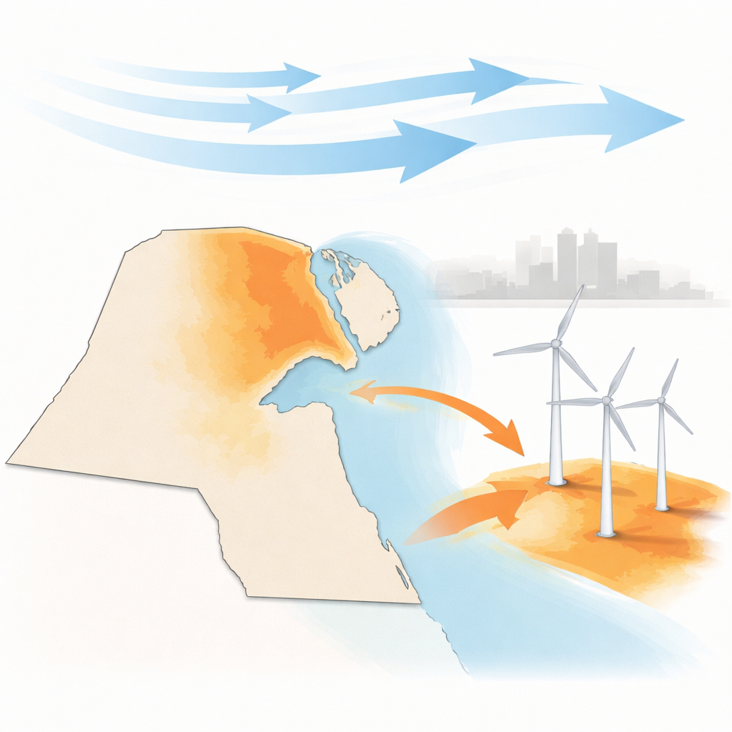
Kuwait’s fast-growing population and extreme summer heat create enormous demand for electricity, most of it still supplied by burning oil. At the same time, the country has pledged to boost renewables as part of its Vision 2035 plan and aims for 15%–30% of its power from clean sources in the coming years. Earlier studies showed that Kuwait has decent wind, especially in the north, but they were based on older, low-altitude measurements at only a few stations. This left a key question unanswered: once you factor in real-world issues like oil fields, cities, wildlife, sand movement, and power lines, how much land is truly suitable for modern, tall wind turbines—and where is it?
Blending Many Maps into One Clear Picture
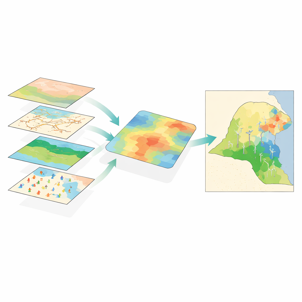
The researchers built a country-wide digital picture of Kuwait by bringing together 26 different pieces of information. These included wind speed and wind power density at 100 meters above the ground, elevation and slope, soil and geology, land use, roads, airports, military zones, oil and gas fields, protected natural areas, water wells, and even how sand dunes shift over time. All of these layers were processed inside a Geographic Information System (GIS), which lets scientists treat the country like a stack of maps that can be compared, combined, and analyzed pixel by pixel.
Making Sense of Expert Judgment and Uncertainty
Not all factors matter equally for a wind farm. Strong, steady winds and closeness to the power grid are clearly more important than, say, small variations in slope. To capture this, the team asked a panel of Kuwaiti experts—from universities, the environment authority, and energy institutions—to compare factors in pairs and judge which mattered more. They used a method called the fuzzy Analytic Hierarchy Process, which turns fuzzy human terms like “much more important” into numbers while also checking that the answers are logically consistent. At the same time, an “entropy” method looked at the actual data to see which layers carried the most information. These two views—human judgment and hard numbers—were blended into compromise weights and then run through a more advanced “type‑2 fuzzy” model that explicitly handles uncertainty in both the data and the expert opinions.
Where the Best Wind Land Really Is
When the team overlaid all the weighted criteria, each square of land in Kuwait received a suitability score and was grouped into four classes from “unsuitable” to “highly suitable.” The results show that about 8.6% of the country—around 1,444 square kilometers—is highly suitable for onshore wind farms, mainly in the western and northern desert plateaus around Al‑Jahra and Al‑Abali. Nearly half the country falls into a moderate, still-viable category, while only about one-tenth is ruled out entirely because of conflicts with cities, oil infrastructure, sensitive ecosystems, or poor wind. Using conservative assumptions about how densely turbines can be spaced, the highly suitable zones could host roughly 2,500 megawatts of capacity, enough to supply a large share of Kuwait’s planned renewable energy target.
Checking the Model Against Reality
To make sure the model wasn’t just good on paper, the authors compared their high-suitability areas with two real-world yardsticks. First, they overlaid Kuwait’s existing Shagaya Renewable Energy Park, the country’s flagship wind and solar complex. All the current turbines fell squarely inside the “highly suitable” class. Second, they compared their suitability scores with independent wind power maps from the Global Wind Atlas at heights of 50 and 100 meters. The overlap between the strongest wind corridors and the model’s best zones was very high, with a strong statistical match. This double check suggests the method can reliably steer planners toward places that are both windy and practically buildable.
What This Means for Kuwait’s Energy Future
For a lay reader, the key message is straightforward: Kuwait has more than enough good-quality wind land in its western deserts to make wind power a serious part of its energy mix, without crowding out cities or oil operations. By carefully layering physical, environmental, and social constraints, and by treating uncertainty honestly rather than ignoring it, the study turns a vague idea—“Kuwait should use more wind”—into a concrete map and capacity estimate. Policymakers can now focus new projects in clearly defined corridors, plan transmission lines in advance, and avoid costly trial-and-error siting. The authors stress that detailed on-the-ground measurements are still needed before construction, but their framework offers a ready-made roadmap for turning Kuwait’s desert winds into a dependable pillar of its low‑carbon future.
Citation: Atalla, M.A., Al-Quraishi, A.M.F., Ataalla, E.A.B. et al. Integrating fuzzy AHP and geo-spatial modeling for wind farm suitability assessment in Kuwait. Sci Rep 16, 11601 (2026). https://doi.org/10.1038/s41598-026-46695-4
Keywords: wind energy, site suitability, Kuwait, GIS mapping, renewable planning