Clear Sky Science · en
Real-world road damage dataset with potholes, cracks, and maintenance holes
Why bumpy streets matter
Anyone who has swerved around a pothole or felt their car jolt over a crack knows that damaged roads are more than a nuisance: they affect safety, repair bills, and how smoothly cities run. Yet checking every street by hand is slow, costly, and sometimes unsafe. This study introduces a new collection of real roadside photos designed to help computers automatically spot potholes, cracks, and maintenance holes so that road crews can plan repairs faster and more fairly across urban and rural areas.
A closer look at bad roads
The authors focus on three common features of worn streets: potholes, cracks, and maintenance holes. Potholes are the familiar bowl shaped holes that can damage tires and suspensions. Cracks are thin breaks that can spread and eventually turn into larger faults. Maintenance holes are round covers that lead to pipes and cables below ground. Although they are not damage, they can look surprisingly similar to potholes in photos. Previous collections of road images often ignored maintenance holes or mixed them up with damage, making it harder for computer systems to tell harmful defects from normal infrastructure.
How the pictures were gathered
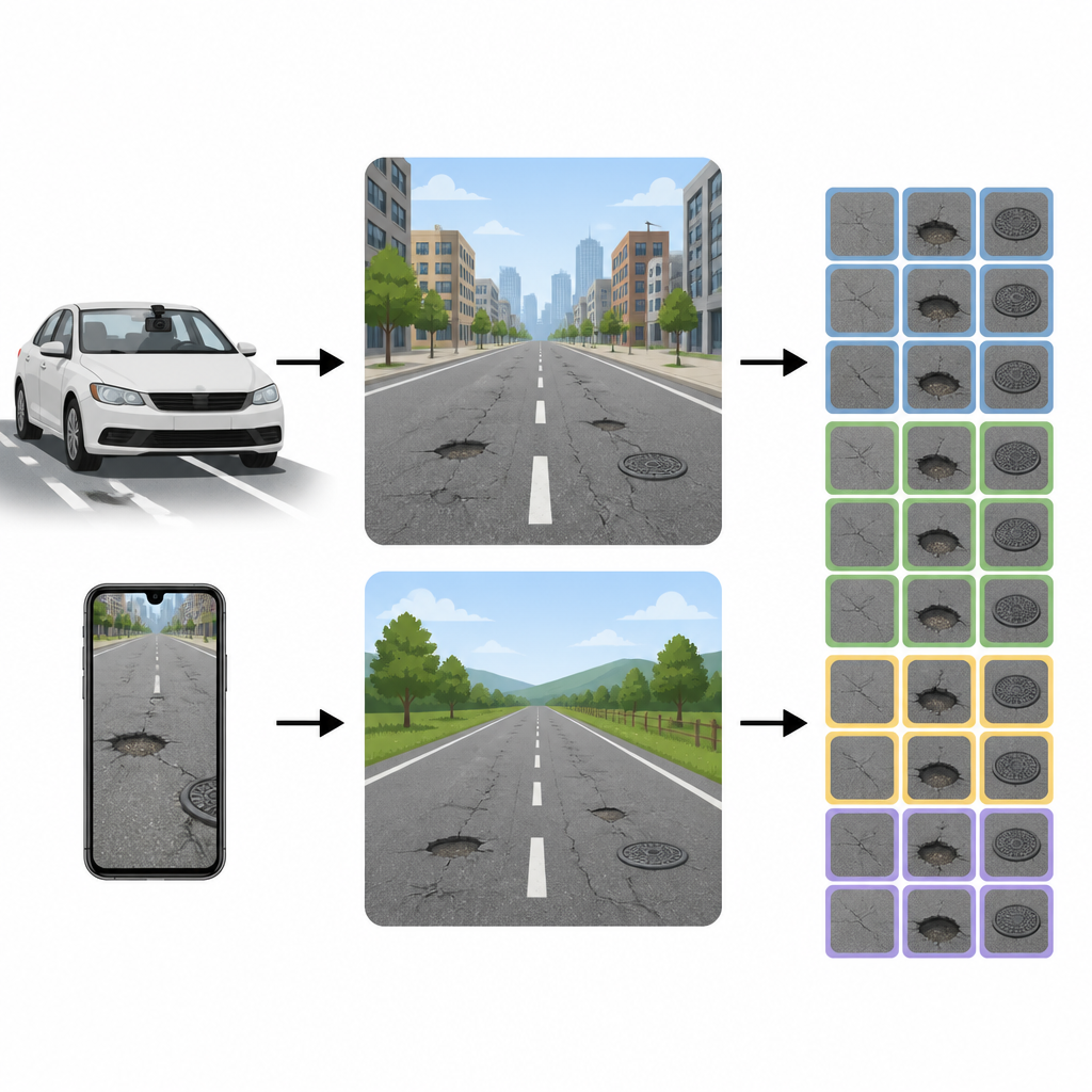
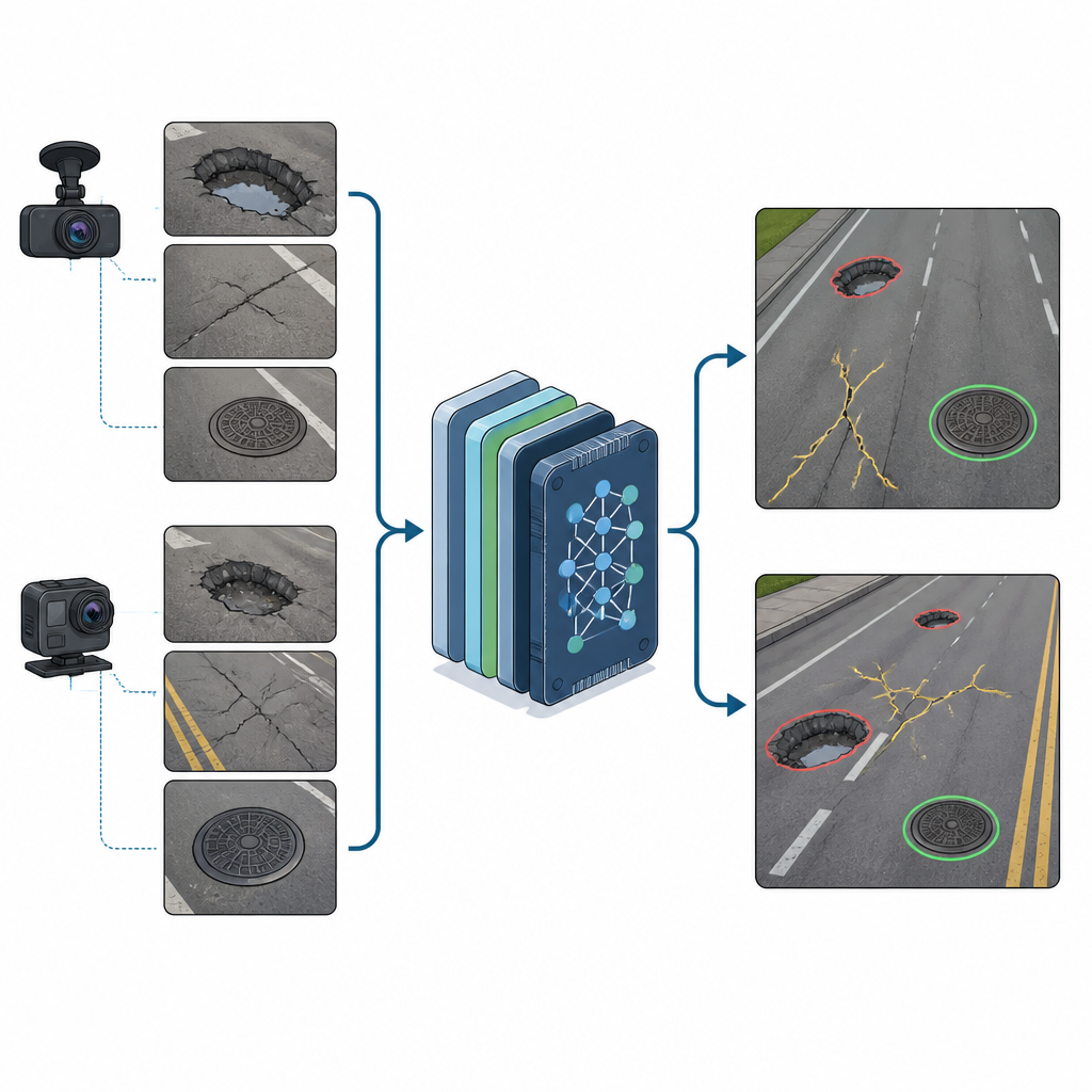
To build a more realistic picture of everyday roads, the team manually collected images in and around Rome and the nearby town of Sacrofano in Italy. They used two low cost devices that many cities could afford: a GoPro camera mounted on a car’s windshield and a simple Samsung smartphone used while the car was stopped. Driving at modest speeds, they recorded streets under different lighting and weather conditions, then extracted still images where road defects were clearly visible. All pictures were resized to a practical resolution and carefully checked to blur faces and license plates, remove very poor quality frames, and avoid scenes with extreme darkness, glare, or heavy rain that would make labeling unreliable.
Turning road scenes into usable data
After cleaning the images, the researchers went through 2009 pictures by hand and marked every visible pothole, crack, and maintenance hole. They used specialized annotation software that lets a person draw a rectangle around each object and assign it to one of the three categories. In total, they labeled 1261 potholes, 2519 cracks, and 957 maintenance holes. The files are stored in formats that are directly compatible with popular artificial intelligence tools, so other groups can easily load the images and labels. The dataset also captures both urban and rural roads, wet and dry surfaces, and varied viewing angles, giving computers a richer sense of how damage really looks from a moving vehicle or a person standing by the roadside.
Testing smart detectors on the new set
To see how useful this collection is in practice, the authors trained several modern object detection systems, including recent compact versions of the YOLO family of models that are designed to run on small computers. They split the dataset into multiple folds, training on part of the images and testing on the rest in rotation to check consistency. The models were judged on how precisely they flagged damage, how many true defects they found, and how tightly their predictions matched the actual locations. The best compact model achieved high precision for all three classes, especially for maintenance holes, showing that the images and labels support accurate learning even when computing power is limited. The study also compared older and newer model designs, finding that up to date lightweight networks working at higher image resolution clearly outperformed traditional approaches.
What this means for future road care
For non specialists, the key message is that this work delivers a practical and openly available set of real street images that make it easier to train and compare smart systems for spotting road problems. Because the photos come from ordinary cameras, cover both city and country roads, and include tricky lookalikes like maintenance holes, they give engineers a realistic test bed for tools that could ride on buses, service vehicles, or even smartphones. While the dataset currently reflects Italian roads and does not yet track how damage grows over time, it lays a solid foundation for safer, more timely, and more cost effective road maintenance guided by reliable computer vision.
Citation: Giordani, E., Arcioni, L., Gil-Martín, M. et al. Real-world road damage dataset with potholes, cracks, and maintenance holes. Sci Rep 16, 15318 (2026). https://doi.org/10.1038/s41598-026-46679-4
Keywords: road damage, potholes, computer vision, object detection, autonomous driving