Clear Sky Science · en
National-scale spatial modelling of dust storm pollution and vulnerability of tourism destinations and infrastructure
Why dust and travel matter
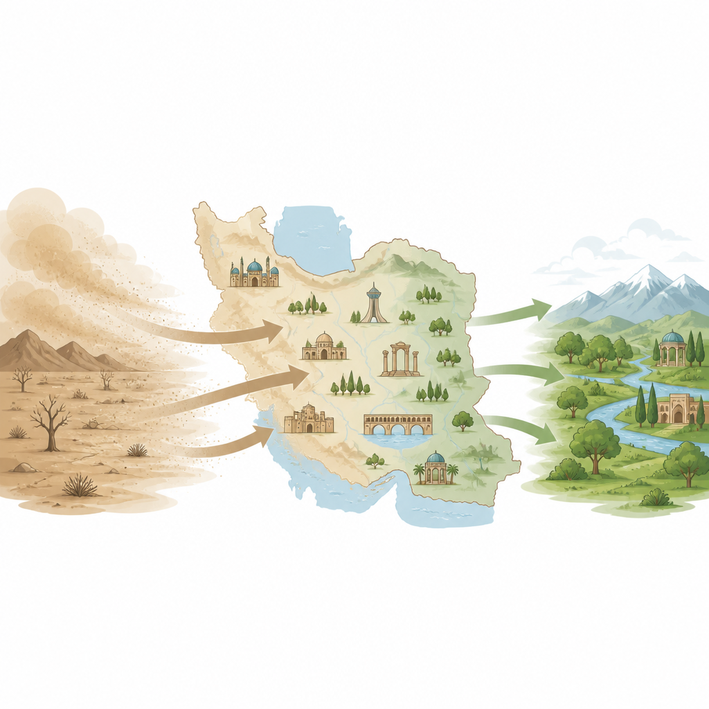
For many people, a holiday means blue skies, clear views, and fresh air. But in dry parts of the world, powerful dust storms can turn that picture on its head, filling the air with fine particles that harm health, damage buildings, and hide famous views. This study looks at how dust storms threaten tourism across all of Iran and asks a simple question with big consequences: which destinations and routes are most at risk when the air fills with dust?
Dust storms as a hidden travel risk
Dust storms are not just short, dramatic events; in many arid and semi-arid regions they have become a recurring form of pollution. Fine mineral particles lifted by strong winds can travel long distances, dim sunlight, and enter lungs. In Iran and neighboring areas, climate change, drought, land degradation, and poor land and water management have made dust storms more frequent and intense. Tourism is especially sensitive to these conditions because visitors care about clean air, good visibility, and safe outdoor activities. When dust levels rise, landscapes become dull, monuments weather faster, and both visitors and workers face health risks, all of which can reduce visitor numbers and satisfaction.
Mapping where tourism and dust collide
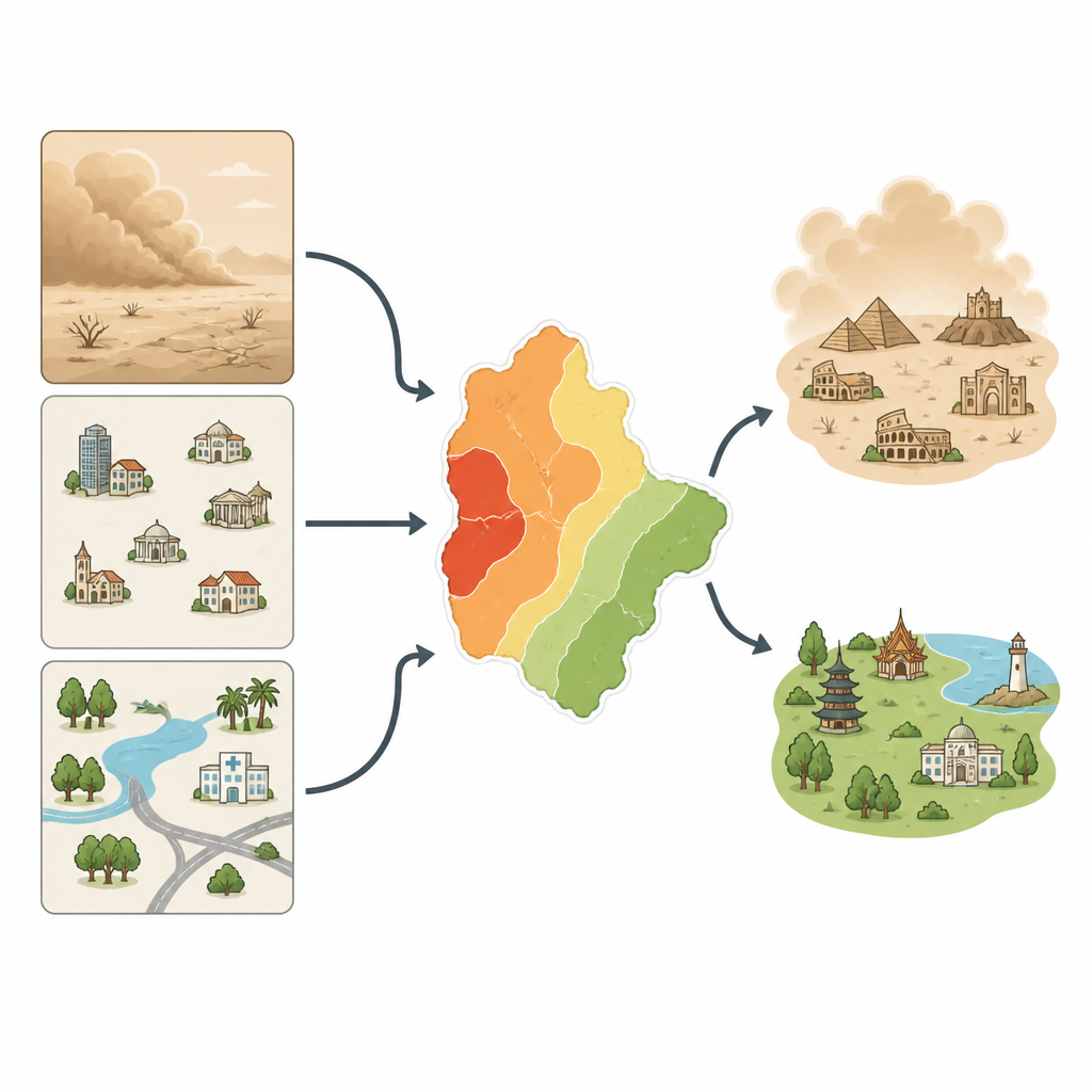
The researchers developed a nationwide picture of how dust storms and tourism overlap across Iran. They used satellite data to track dust in the atmosphere, rainfall, and vegetation, and combined these with detailed maps of tourism infrastructure, such as hotels, restaurants, service centers, natural attractions, historical sites, and religious destinations. Within a geographic information system, they built a model based on three ideas: exposure (how often and how intensely an area is hit by dust), sensitivity (how many and what types of tourism sites are there), and adaptive capacity (how well the local environment and infrastructure can cope). Each factor was turned into standardized maps, then weighted using a structured decision method that draws on expert judgment to reflect which indicators matter most.
Turning complex data into a simple risk picture
Using these ingredients, the team calculated separate maps for dust exposure, tourism sensitivity, and adaptive capacity, and then blended them into a final vulnerability map. Areas with frequent, intense dust storms and little rain scored high on exposure. Regions packed with accommodation, catering, and entertainment facilities scored high on sensitivity. Places with more vegetation, water resources, easy access to cities, transport, electricity, and health centers scored higher on adaptive capacity, meaning they were better equipped to buffer dust impacts. Finally, the model combined these layers, reducing vulnerability in places with strong adaptive capacity and raising it where support systems are weak. The country was then divided into five classes, from very low to very high vulnerability.
Where tourism is most at risk
The results show that about a third of Iran’s territory falls into the high or very high vulnerability classes, mostly in the central, eastern, and southern provinces. These regions often have dry climates, sparse vegetation, and limited water resources, yet still host important tourism routes and religious, historical, or coastal destinations. Provinces such as Qom, Sistan and Baluchestan, South Khorasan, Bushehr, Yazd, and parts of Isfahan stand out as hotspots where dust pressure is strong and the capacity to cope is lower. In contrast, northern provinces along the Caspian Sea, with lush forests and high rainfall, show very low vulnerability: they experience little dust, have rich vegetation that captures particles, and enjoy dense infrastructure and services. The study also reveals that a sizable share of hotels, restaurants, and religious sites lie in high-risk zones, while many natural attractions are fortunately located in cleaner, more stable environments.
What this means for future trips
For travelers, tourism planners, and local communities, the study’s main message is that dust storms are not just a weather inconvenience but a spatially uneven risk to an entire travel system. Some regions can absorb dust shocks thanks to strong ecosystems and services, while others face a combination of harsh climate, fragile landscapes, and limited support. By clearly mapping these differences, the research offers a practical tool for guiding new investments, protecting vulnerable heritage and hospitality sites, and steering tourism growth toward more resilient areas, helping keep trips safer and more enjoyable even as dust storms become more common.
Citation: Mahmoodi, H., Nadizadeh Shorabeh, S., Farhadi, M. et al. National-scale spatial modelling of dust storm pollution and vulnerability of tourism destinations and infrastructure. Sci Rep 16, 15844 (2026). https://doi.org/10.1038/s41598-026-46544-4
Keywords: dust storms, tourism vulnerability, Iran, spatial modelling, arid regions