Clear Sky Science · en
Water infiltration and saturated hydraulic conductivity in an agricultural watershed with pedogenetic discontinuity
Why soil water matters on farmed hills
On sloping farmland, every rainstorm forces a choice: will water soak into the ground to feed crops and refill streams slowly, or rush across the surface, eroding soil and carrying farm chemicals away? This study looks inside the soil of a tobacco-growing valley in southern Brazil to see how hidden layers of rock fragments and clay control that choice, and why usual surface measurements can mislead farmers and watershed planners.
Hidden layers beneath the fields
The researchers worked in a small headwater basin where steep upper slopes give way to gentler lower land. Beneath fields, they found a common pattern: a shallow, coarse surface layer with gravel and sand overlying denser, finer material deeper down. These sharp shifts in texture, called soil discontinuities, can behave like buried barriers. Instead of letting water move straight down, they often redirect it sideways along the slope, changing how quickly the land wets up, dries out, and sheds runoff into streams.
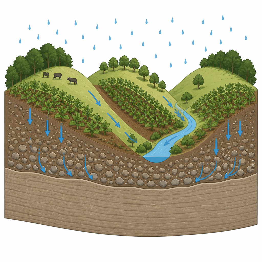
Measuring how fast water can move
To understand how these buried layers affect water movement, the team combined field tests and lab work. In the fields, they used metal rings filled with water to measure how quickly the soil could keep taking in water once it was fully wet, a value known as the steady infiltration rate. Back in the lab, they tested undisturbed soil cores from several depths for properties such as grain size, density, water storage, and how easily water could pass through when the soil was saturated. They repeated this across five hillslopes and three positions on each one: upper slope, midslope, and toeslope at the bottom.
Strong contrasts from top to bottom
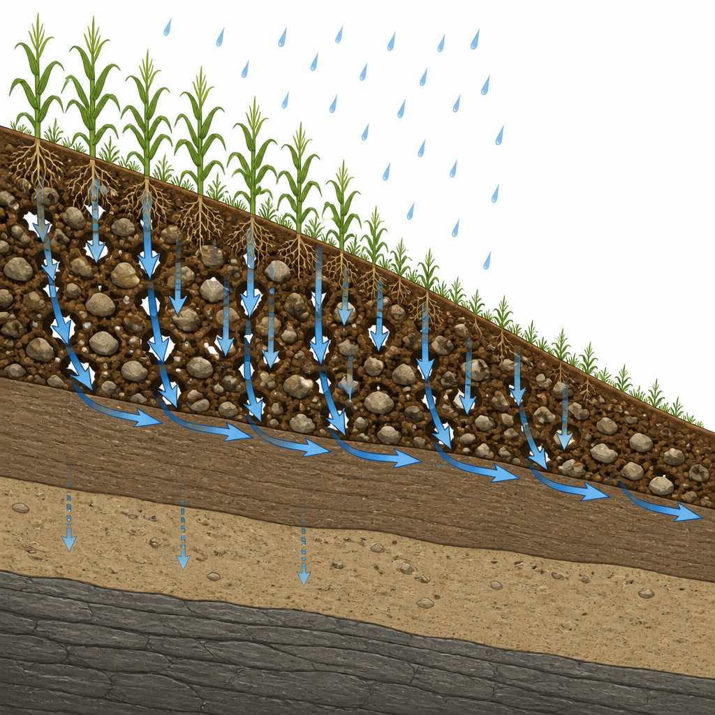
The measurements revealed striking contrasts. Near the surface, especially where tobacco ridges are regularly tilled, water flowed through quickly, sometimes hundreds of millimeters per hour. Deeper layers, particularly those rich in clay, often slowed flow almost to a standstill. Infiltration at the surface also varied strongly from place to place, even within a few meters, and was often higher on midslopes than at the top or bottom. Soils with more gravel and sand tended to be looser, with lower density and less water held tightly, while finer, clay-rich soils stored more water but allowed it to move more slowly. Overall, the watershed showed a patchwork of fast and slow zones, shaped by erosion, sediment build-up, crop management, and subtle differences in slope.
Looking at the whole profile, not just the skin
A key question was which measurement best predicts how a hillslope will handle a storm. The researchers compared surface values with a profile-wide indicator that combines the resistance of all layers into a single effective conductivity. This deeper view aligned much better with the field infiltration tests than the top-layer measurement alone. In other words, even when the tilled surface was very open to water, buried dense layers could still throttle downward flow, forcing water to spread sideways and sometimes reappear as runoff lower on the slope.
What this means for land and water care
For farmers and watershed managers, the study’s message is that what lies below the plow layer matters as much as what is on top. Practices that simply loosen the surface cannot fully solve runoff and erosion problems if deep, tight layers remain. Instead, careful management must consider soil depth, layering, and slope position, using field inspections and targeted measurements rather than relying only on maps or surface tests. By paying attention to the whole soil profile, it is possible to better anticipate where water will infiltrate, where it will run off, and where it might move sideways underground, helping to protect both crops and downstream waters.
Citation: Dalbianco, L., Minella, J.P.G., Tiruneh, G.A. et al. Water infiltration and saturated hydraulic conductivity in an agricultural watershed with pedogenetic discontinuity. Sci Rep 16, 15449 (2026). https://doi.org/10.1038/s41598-026-46420-1
Keywords: soil infiltration, hillslope hydrology, saturated hydraulic conductivity, erosion risk, tobacco agriculture