Clear Sky Science · en
A two-layer heterogeneous ensemble model based on stacking for debris-flow susceptibility mapping: a case study of Yajiang County, China
Why mud and rock surges matter to us
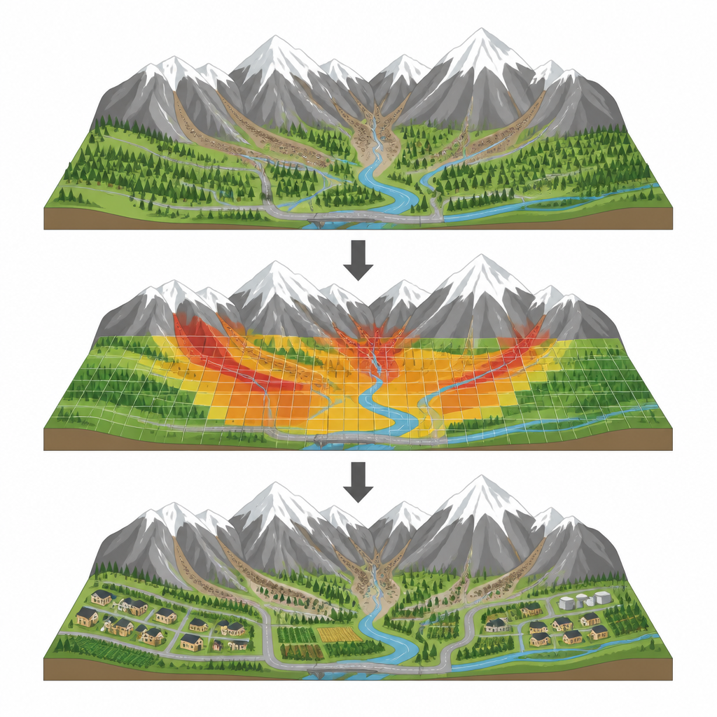
In steep mountain regions, sudden torrents of mud, rocks, and water can roar down valleys with little warning, wiping out roads, homes, and farmland. These events, called debris flows, are common in parts of western China, including Yajiang County in Sichuan Province. The study behind this article asks a practical question with global relevance: can we use modern data tools to draw clearer maps of where such disasters are most likely to strike, so that people and planners can stay out of harm’s way?
Looking for danger zones in the mountains
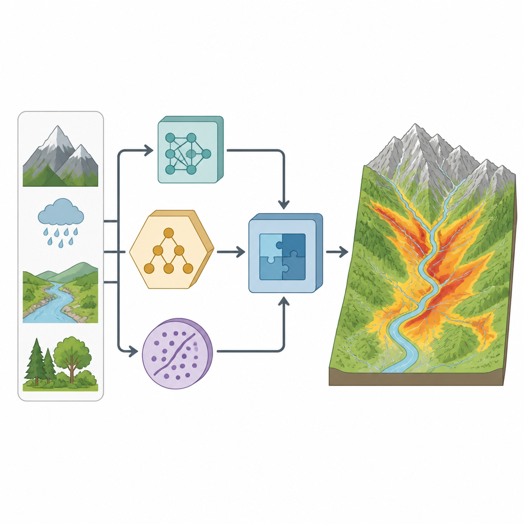
The researchers focused on Yajiang County, a high mountain area cut by deep river valleys and busy roads, where debris flows often occur. They began by assembling a detailed inventory of known debris flows and an equal number of nearby locations where such events had not been recorded. For every spot, they collected information on twelve environmental and human factors, including elevation, slope, rainfall, distance to rivers and roads, vegetation cover, soil type, and how wet the ground tends to be. The region was divided into a fine grid of small squares so that each cell could be evaluated for its likelihood of future debris flows.
How multiple smart tools work together
Instead of relying on a single computer model, the team built a layered system that combines several different types of machine learning. Three base models were used: an artificial neural network that mimics networks of brain cells, a support vector machine that looks for the best boundary between safe and unsafe locations, and a decision tree that splits the data into simple if–then rules. These base models each processed the same environmental information and produced their own estimates of debris flow likelihood. A second layer, using a simpler statistical method, then learned how to blend the three outputs into a final, improved prediction. This two-layer approach is known as a heterogeneous ensemble based on stacking, and in the study it is called the ASC-Stacking model.
Finding what matters most for risk
To avoid confusing the models with unhelpful inputs, the researchers first checked how strongly the twelve factors were related to each other and which ones actually helped distinguish debris flow sites from quiet slopes. They found that distance to rivers, distance to roads, elevation, and the detailed shape of the ground surface were the most informative. Rivers provide ready-made channels and water, while roads reflect human earthworks that can destabilize slopes. Rainfall and slope, although clearly important to the physical process, varied less across the study area and therefore did not help as much to tell high-risk cells from low-risk ones. The team trimmed out the least useful factors to keep the models both efficient and focused.
Comparing maps and checking accuracy
With the cleaned data set, the scientists produced four debris flow susceptibility maps, one from each base model and one from the stacked ensemble. All four agreed on the broad picture: the highest risk zones hug the river valleys, especially along the Yalong River, while most of the county falls into low or very low risk categories. To test how well each map captured reality, they checked how many known debris flows fell into the high and very high risk zones and used a standard curve-based score of prediction quality. All models performed well, but the stacked ensemble stood out, correctly concentrating nearly 90 percent of known debris flows in the very high risk areas and achieving the highest accuracy score among all approaches.
From risk maps to safer land use
The improved map produced by the stacked model has direct value for local decision makers. By clearly showing which valley segments are most prone to debris flows, authorities can guide new housing and roads away from danger, reinforce existing structures in risky stretches, and place rain gauges and warning systems where they will do the most good. Although the method still depends on the quality of input data and how non-debris locations are chosen, the study demonstrates that combining several smart tools can yield a more reliable picture of hidden hazards. In simple terms, blending different kinds of computer “opinions” helps draw a clearer risk map, giving mountain communities a better chance to live and develop safely alongside powerful natural forces.
Citation: Qiao, S., Huang, F., Chen, J. et al. A two-layer heterogeneous ensemble model based on stacking for debris-flow susceptibility mapping: a case study of Yajiang County, China. Sci Rep 16, 15407 (2026). https://doi.org/10.1038/s41598-026-46289-0
Keywords: debris flow, susceptibility mapping, machine learning, ensemble model, Yajiang County