Clear Sky Science · en
Late Quaternary activities of the Xinbaoan–Shacheng fault in the North China Plain
Why this hidden fault matters
The North China Plain is home to tens of millions of people, high-speed railways, and major reservoirs—yet some of the faults beneath it leave only subtle traces at the surface. This paper focuses on one such structure, the Xinbaoan–Shacheng Fault, and asks a basic but vital question: how often does it generate large earthquakes, and how big are they likely to be? By reading the landscape and the buried layers of soil and sand, the authors reconstruct thousands of years of seismic history to better understand future risk for this heavily populated region. 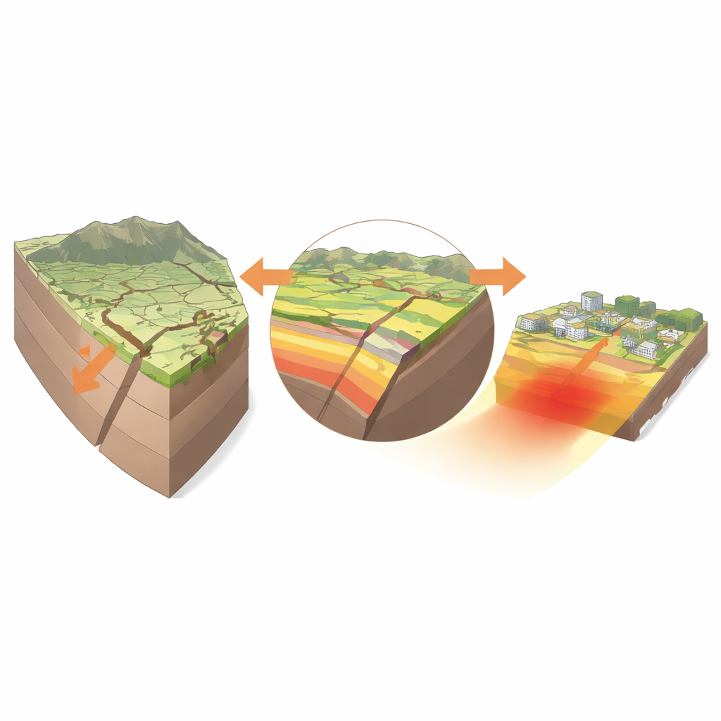
A fault on a continental crossroads
The Xinbaoan–Shacheng Fault sits where two major tectonic zones in northern China meet, within the Huai-Zhuo Basin northwest of Beijing. This basin, squeezed and stretched by movements in the surrounding crust, has produced several strong historical earthquakes, including a damaging magnitude 7 event near Shacheng in 1720. The fault defines the basin’s northern edge and runs for about 32 kilometers, dipping steeply beneath the plain. Although previous work had recognized that it was active in the recent geological past, its true slip rate and the rhythm of its large earthquakes were poorly known, leaving regional hazard assessments on shaky ground.
Reading earthquake scars in the landscape
To tackle this problem, the researchers combined satellite imagery, detailed field mapping, and precise elevation surveys. On the ground, they identified low but distinct steps—fault scarps—where the land surface has been lifted on one side relative to the other by past quakes. These scarps offset alluvial fans and river terraces by up to about a meter, and even where human activity has smoothed the landscape, careful measurements with GPS equipment reveal subtle breaks in slope. Together, these features outline a composite surface rupture zone about 32 kilometers long, with heights typically 1.5 to 3 meters, implying at least one past earthquake in the magnitude 6 to 7 range that tore the ground open along much of the fault. 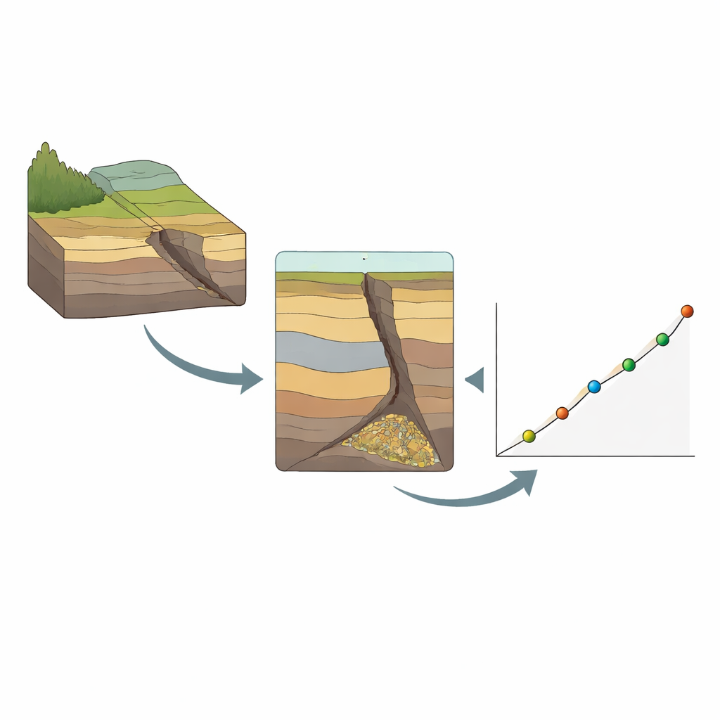
Digging trenches to uncover buried shocks
The most powerful evidence comes from a trench excavated across a clear scarp near Xinbaoan Railway Station. In the vertical wall of this excavation, the team mapped seven distinct layers of loess, sand, and gravel, all cut and offset by a steep normal fault. Some layers are sharply displaced, while others thin or show wedge-shaped accumulations where material slid or washed into a scarp after the ground broke. By sampling key layers for optically stimulated luminescence dating—a technique that measures when sediment grains were last exposed to sunlight—the authors pinned down when these buried disturbances occurred. The trench records at least two sizeable earthquakes since the Late Pleistocene, with one in the Late Pleistocene itself and a younger event in the Holocene that offsets the older layers but not the modern soil.
Timing, size, and rhythm of past earthquakes
By combining ages and offsets from this new trench with two earlier sites along the same fault, the authors reconstructed a longer sequence of six large earthquakes over roughly the past 24,000 years. The average interval between strong events is about 3,400 years, but the pattern is irregular, with stretches of more frequent earthquakes separated by longer quiet periods. Measurements of how far layers have been shifted vertically, together with the fault’s steep angle, point to typical single-event displacements of a few tens of centimeters and characteristic magnitudes in the upper 6 to 7 range. When they fit all the displacement–age data with a simple trend, they derive a long-term vertical slip rate of only about 0.06 millimeters per year—slow by global standards, but still capable of building up dangerous strain over millennia.
What this means for people today
For a lay reader, the main message is that even a modest-looking fault, slipping only a fraction of a millimeter per year, can produce rare but powerful earthquakes that threaten nearby towns, rail lines, and reservoirs. The Xinbaoan–Shacheng Fault has been active from the Late Pleistocene right up to the late Holocene, and the youngest event may correspond to the destructive 1720 Shacheng earthquake. Although the fault’s average recurrence time is measured in thousands of years, enough time has passed since 1720 that strain is once again quietly accumulating. By turning subtle landforms and buried sediments into a long-term earthquake calendar, this study sharpens seismic hazard estimates for the Huai-Zhuo Basin and offers a blueprint for assessing similarly quiet but dangerous faults elsewhere.
Citation: Qiu, C., Yu, Z., Li, L. et al. Late Quaternary activities of the Xinbaoan–Shacheng fault in the North China Plain. Sci Rep 16, 10644 (2026). https://doi.org/10.1038/s41598-026-46281-8
Keywords: paleoseismology, active faults, earthquake recurrence, North China Plain, seismic hazard