Clear Sky Science · en
Integrated reservoir quality index (IRQI): a novel approach for reservoir quality assessment
Why Finding Good Rock Matters
Every drop of oil or gas we use has traveled a long way from deep underground rocks to the surface. But not all rocks are equally good at storing and letting these fluids flow. This study introduces a new way to rate how "good" a reservoir rock is, using a single score that blends many kinds of subsurface information. That score, called an integrated reservoir quality index, aims to help energy planners find the best zones to produce from, especially in geologically complex fields where traditional methods often disagree.
From Local Measurements to a Bigger Picture
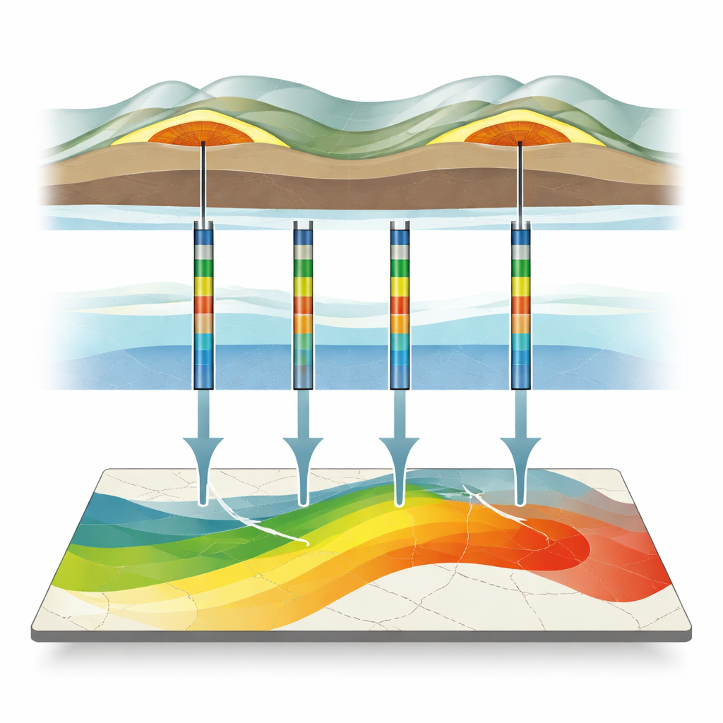
Conventional assessments of reservoir quality rely heavily on measurements from wells: how much empty space is in the rock (porosity), how easily fluids move (permeability), how much clay is present, and how much of the pore space is filled with water. These data are detailed but very local—essentially vertical columns of information. In contrast, seismic surveys provide a continuous picture across an entire field, but only indirectly reflect rock properties and have lower vertical detail. This mismatch makes it difficult to build a reliable, field‑wide picture of where the best reservoir zones lie, particularly in layered and faulted rocks like those in the Asmari Formation of southwest Iran.
Blending Many Rock Clues into One Score
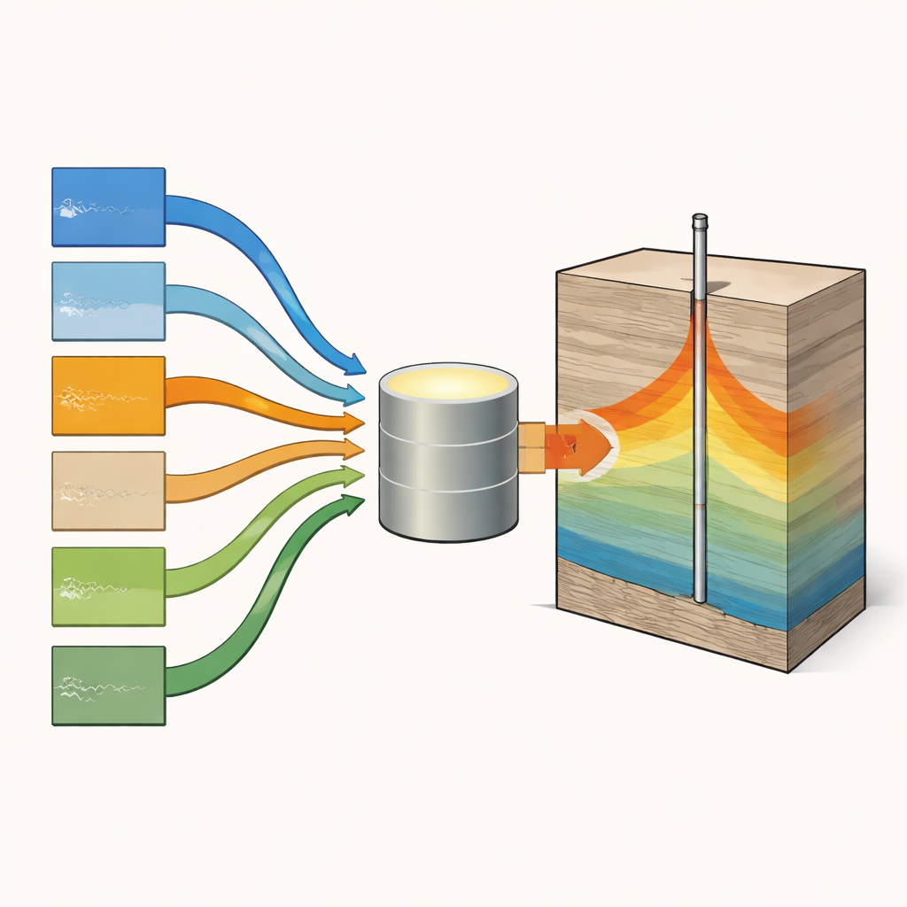
The authors propose a new index that combines three families of measurements: basic reservoir properties from well logs (such as effective porosity, water content, and clay content), rock strength behavior (captured by a brittleness indicator), and elastic properties (parameters derived from how seismic waves travel through the rock). Before combining them, every input is converted to the same 0–1 scale so that no parameter dominates just because it is measured in larger numbers. Unlike many previous approaches, the method does not assign fixed weights; instead, each parameter is allowed to influence the index naturally, depending on how it behaves in a given field. The final formula rewards zones with high porosity and brittleness and low water and clay content, while also adjusting for elastic behavior that reflects how stiff or compliant the rock is.
Testing the Index in Two Very Different Fields
To check whether this single score actually tracks real reservoir quality, the authors applied it to the Asmari Formation in two oilfields with contrasting geology. In Field A, the upper interval is sandstone and the lower is carbonate; in Field B, this pattern is reversed. For each well, the team calculated the index from log data and compared it with known high‑ and low‑productivity layers. In the sandstone units, the index consistently highlighted continuous "sweet spots" where rocks are clean, porous, and relatively brittle, while it showed only patchy, lower values in the tighter carbonate intervals. In Field A, the index was also checked against laboratory measurements from core plugs, where very water‑rich samples correctly received near‑zero scores. Statistical tests showed that the index tracks porosity and brittleness positively and water content negatively, in line with geological expectations.
Extending from Wells to the Whole Reservoir
Having shown that the index behaves sensibly at the wells, the authors then spread it across the entire reservoirs. They did this by first using seismic inversion, a technique that converts seismic reflections into a property called acoustic impedance, which is closely related to rock density and stiffness. This property, combined with the well‑based relationships, was used to estimate the index in the spaces between wells, producing continuous slices of reservoir quality. When these maps were compared with the detailed logs, high index zones matched intervals with higher porosity, lower water and clay content, favorable elastic signatures, and, in Field A, better core‑measured flow properties. Compared side‑by‑side with standard acoustic impedance images, the new maps showed clearer, sharper boundaries between good and poor zones and a more faithful representation of known sweet spots.
What This Means for Future Energy Decisions
In simple terms, this work turns a tangle of different subsurface measurements into a single, physically grounded score that can be mapped across an entire reservoir. Instead of juggling separate views from petrophysics, rock mechanics, and seismic data, decision‑makers get one integrated quality layer that is calibrated at wells and extended through seismic imaging. The approach proved reliable in two fields with very different layering and complexity, suggesting it could be adapted to other reservoirs worldwide. While more tests with additional core data and more varied geology are needed, the integrated reservoir quality index offers a promising tool for more confident well placement, better field development plans, and more efficient use of existing hydrocarbon resources.
Citation: Leisi, A., Kadkhodaie, A. & Kadkhodaie, R. Integrated reservoir quality index (IRQI): a novel approach for reservoir quality assessment. Sci Rep 16, 10596 (2026). https://doi.org/10.1038/s41598-026-46154-0
Keywords: reservoir quality, seismic inversion, well log analysis, rock mechanics, Asmari Formation