Clear Sky Science · en
Smart mobility infrastructure: improving campus parking efficiency in real time
Finding a parking space without the stress
Anyone who has circled a crowded campus lot knows how frustrating and time consuming the hunt for a free parking space can be. This paper introduces a practical way to turn ordinary campus parking into a smart service that shows drivers open spots in real time, cuts down on wasted fuel, and helps universities use their existing space far more efficiently.
Why campus parking is so hard
University parking lots were never designed for today’s volume of cars and constant comings and goings. Drivers often resort to “cruising” around rows of vehicles hoping to spot a vacancy, which adds to traffic, burns fuel, and increases emissions. Earlier attempts at smart parking relied on ground sensors buried in each space or on distant cloud computers analyzing video feeds. Ground sensors can be expensive to install and easily confused by weather or stray objects, while cloud only systems suffer from delays and need a strong network connection at all times.
A camera on the lot and a tiny computer on the pole
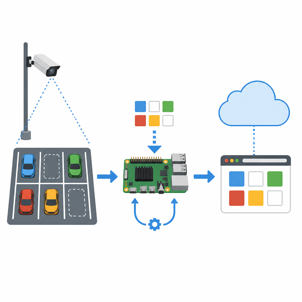
The authors propose a middle path that keeps the “brains” of the system close to the parking lot itself. A small camera mounted above a row of spaces sends images to a credit card sized computer, the Raspberry Pi, fixed on the same pole. On this device, a modern vision program called YOLOv8 scans each image and decides which bays are occupied and which are free. By training this program with about 2,000 photos taken on their own campus under sun, shade, and poor lighting, the team taught it to recognize cars and empty spaces with high accuracy tailored to local conditions. The system checks each frame in under half a second, fast enough to keep up with real traffic.
Connecting the lot to the cloud and to drivers
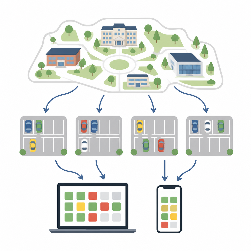
Once the local device knows the state of each space, it sends a compact summary of the results to cloud services. Instead of streaming heavy video, it transmits short data messages that describe which slots are free. These travel through a lightweight link to an online platform and are stored in a simple web server. A browser based dashboard then shows a clear picture of the lot, marking spaces as taken or available. Because this runs in any web browser, students, staff, and visitors can check parking status on a phone or laptop without installing a special app, and campus managers can review trends over time.
Smarter data flow for real conditions
The design is built to cope with the messy realities of campus networks. The Raspberry Pi keeps watching the spaces even if the internet connection drops, avoiding frozen or misleading displays. When the signal is weak, the system automatically adjusts how it sends messages to reduce lost data by around one fifth. Parking records saved in cloud storage are used to forecast demand, which simulations suggest could improve overall use of the lot by about 45 percent. Multiple camera units can be added across many zones, each working on its own but feeding into a single online view, which makes it easier to scale from a test row of spaces to an entire campus.
What this means for everyday drivers
For the average person, the value of this work is simple: less time hunting for parking and a smoother trip onto campus. By blending small, low cost computers, smart image analysis, and a simple web page, the system turns ordinary parking rows into a shared real time resource. It does this while respecting privacy, since full video views are limited to managers and most users see only colored markers for each space. Although the study focuses on universities, the same approach could help offices, hospitals, and city streets use their lots more wisely and make daily travel a little less stressful.
Citation: Jefflin Deno , J., Karthi Sree, S., Maheswari, S. et al. Smart mobility infrastructure: improving campus parking efficiency in real time. Sci Rep 16, 15186 (2026). https://doi.org/10.1038/s41598-026-46053-4
Keywords: smart parking, campus mobility, Internet of Things, computer vision, Raspberry Pi