Clear Sky Science · en
Assessment of landslide hazard under specific rainfall scenarios based on a hybrid CNN-TRIGRS and matrix approach: a case study of Meishan Town, Zhejiang Province, China
Why sliding hills matter to everyday life
Landslides may sound like rare mountain disasters, but in many hilly towns they threaten homes, roads, and power lines every rainy season. In Meishan Town in eastern China, frequent typhoons and long wet spells regularly soak the slopes above communities. This study explores a new way to pinpoint which parts of the landscape are most likely to give way under different kinds of rain, offering local planners and residents clearer guidance on where danger is highest and when it is most likely to strike. 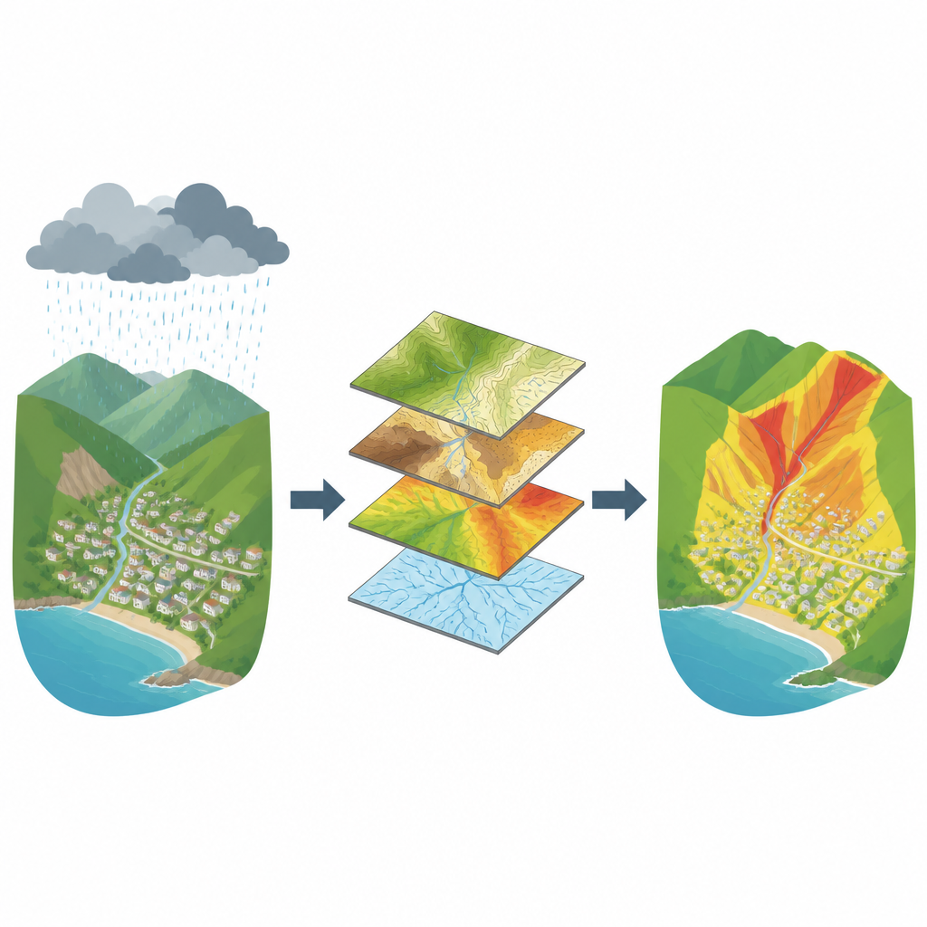
A town caught between steep hills and heavy rain
Meishan Town sits in a low mountain area where elevations mostly range between 160 and 250 meters. Layers of weak rock such as shale weather into loose soil that rests on top of harder, less permeable bedrock. When rainwater seeps into this soil, it can build up pressure along the contact with the bedrock, turning the interface into a slippery surface. Combined with steep slopes and channels that concentrate runoff, this geological setting makes the area prone to shallow slides that skim off the upper soil, a pattern confirmed by 45 recorded landslides clustered in the surrounding hills.
Blending smart learning with physics of slopes
To understand where landslides are most likely to start, the researchers combined two types of tools. First, they used a form of artificial intelligence called a convolutional neural network, which learns patterns directly from data rather than relying on hand-picked rules. It examined ten features that can influence slope failure, including height, steepness, rock type, distance to rivers and roads, and vegetation cover, to assign each 30 by 30 meter patch of land a susceptibility score. Second, they used a physics-based slope model that simulates how rainfall infiltrates the ground and reduces the safety margin of the soil on a slope, expressed as a factor of safety. This model, known as TRIGRS, tracks how changing water pressures during storms can push a slope from stable to unstable.
Testing many kinds of storms on the same hills
The team focused on four realistic rainfall scenarios drawn from a decade of local weather records. These ranged from several days of steady moderate rain, through heavy and torrential rain, to short but intense cloudbursts. For each scenario, TRIGRS estimated how much of each slope moved into various stability classes, from very stable to very unstable. The results showed that most of the area is safe in dry conditions, but high-intensity rain, even over a few hours, sharply expands the most unstable zones, particularly on steep slopes near basin edges and in the central hills where past landslides have concentrated. Duration also matters, but intense bursts of rain were found to be especially effective at quickly undermining slope strength.
A clear grid for combining where and when
Translating all this information into practical hazard maps required a way to merge the long-term susceptibility in each grid cell with its short-term stability under specific rain. The researchers built a simple decision matrix that cross-tabulates five levels of susceptibility with five levels of stability. Each combination is assigned a hazard level, again in five steps from very low to very high. For example, a cell that is both highly susceptible and unstable under a given storm is marked as high or very high hazard, while a cell with low susceptibility and stable behavior remains low hazard. This rule-based table makes the combined result easy to interpret: each hazard category reflects both how prone the ground is and how it responds to a particular rainfall pattern. 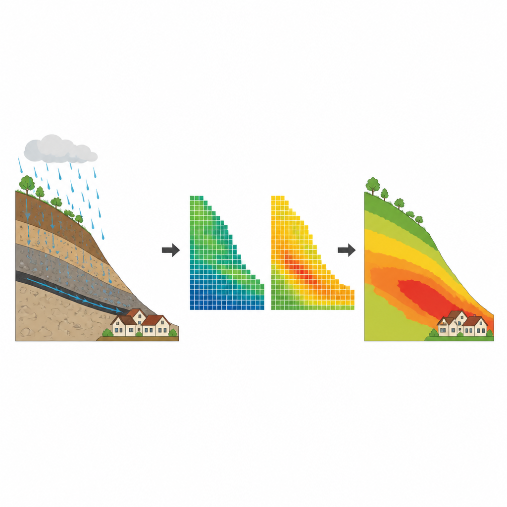
What this means for people living on risky slopes
When the team compared their hazard maps with the known landslide locations, more than 90 percent of past slides fell in the high and very high hazard zones, and almost none occurred in the very low zones. This strong match suggests the hybrid approach can reliably flag dangerous areas even where detailed monitoring networks are lacking. While the method still depends on good input data and cannot capture every small feature of the terrain, it offers local authorities an efficient and transparent way to plan land use, prioritize slope inspections, and tailor early warnings to specific types of storms, helping communities like Meishan Town live more safely with their surrounding hills.
Citation: Wang, Z., Wang, Z., Shi, F. et al. Assessment of landslide hazard under specific rainfall scenarios based on a hybrid CNN-TRIGRS and matrix approach: a case study of Meishan Town, Zhejiang Province, China. Sci Rep 16, 16200 (2026). https://doi.org/10.1038/s41598-026-46051-6
Keywords: landslide hazard, rainfall, slope stability, neural networks, hazard mapping