Clear Sky Science · en
Subtractive clustering for spatial resource allocation problems in waste management
Why smarter bin placement matters
Across towns and cities, recycling often fails not because people do not care, but because the nearest collection point is too far away or too full. This paper explores a new way to decide where to place limited waste containers so they are easy to reach, fairly shared, and matched to how people actually move through their surroundings.
From people and bins to a map of needs
The authors look at spatial resource allocation problems, where a limited number of facilities must serve many scattered users. In waste management, these facilities are containers, transfer stations, or treatment plants, and the users are residents generating rubbish. Good planning tries to cover as many people as possible while keeping travel effort and costs low. Real life complicates this task because people move around, roads shape how they travel, and each facility has a limited capacity. Traditional methods either focus on mathematical optimisation, which can become very slow for large regions, or on clustering methods that group nearby demands but struggle to include capacity limits and realistic travel paths.
A clustering idea adapted to the real world
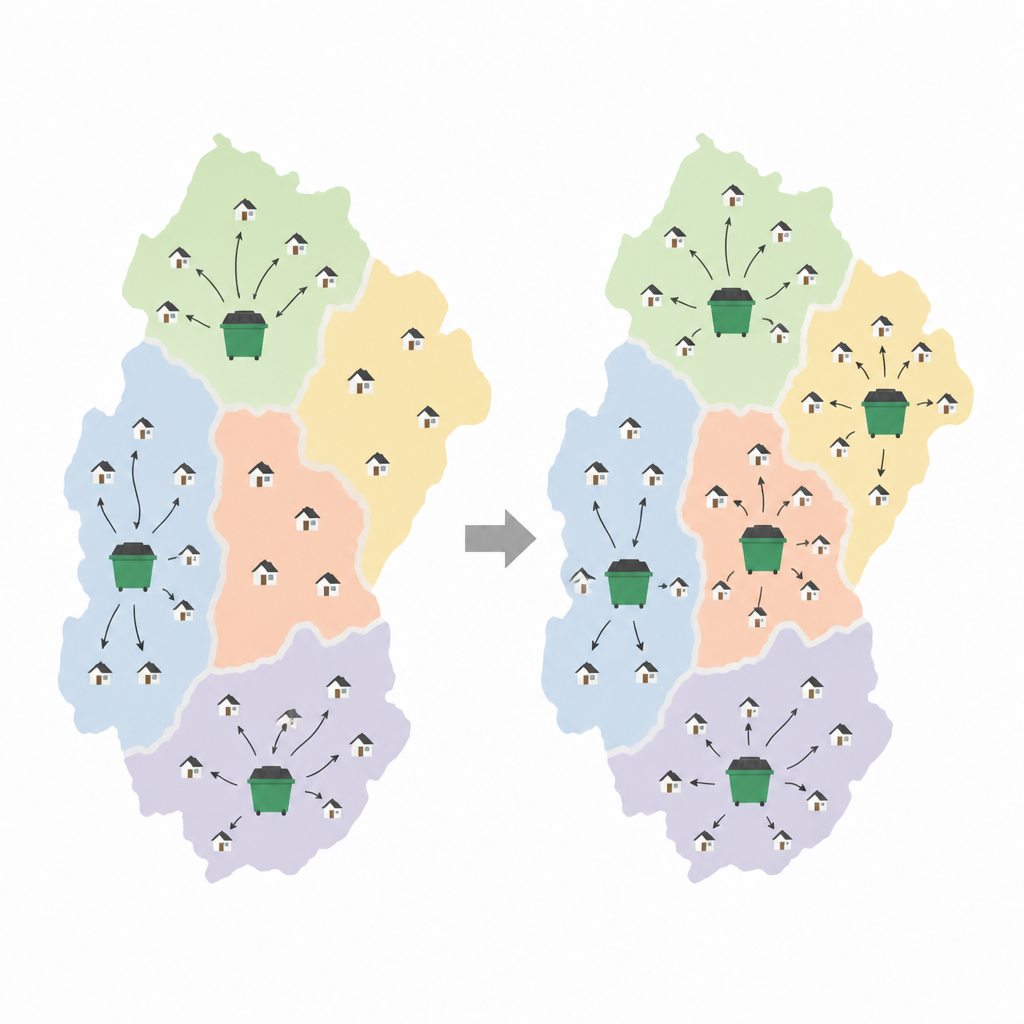
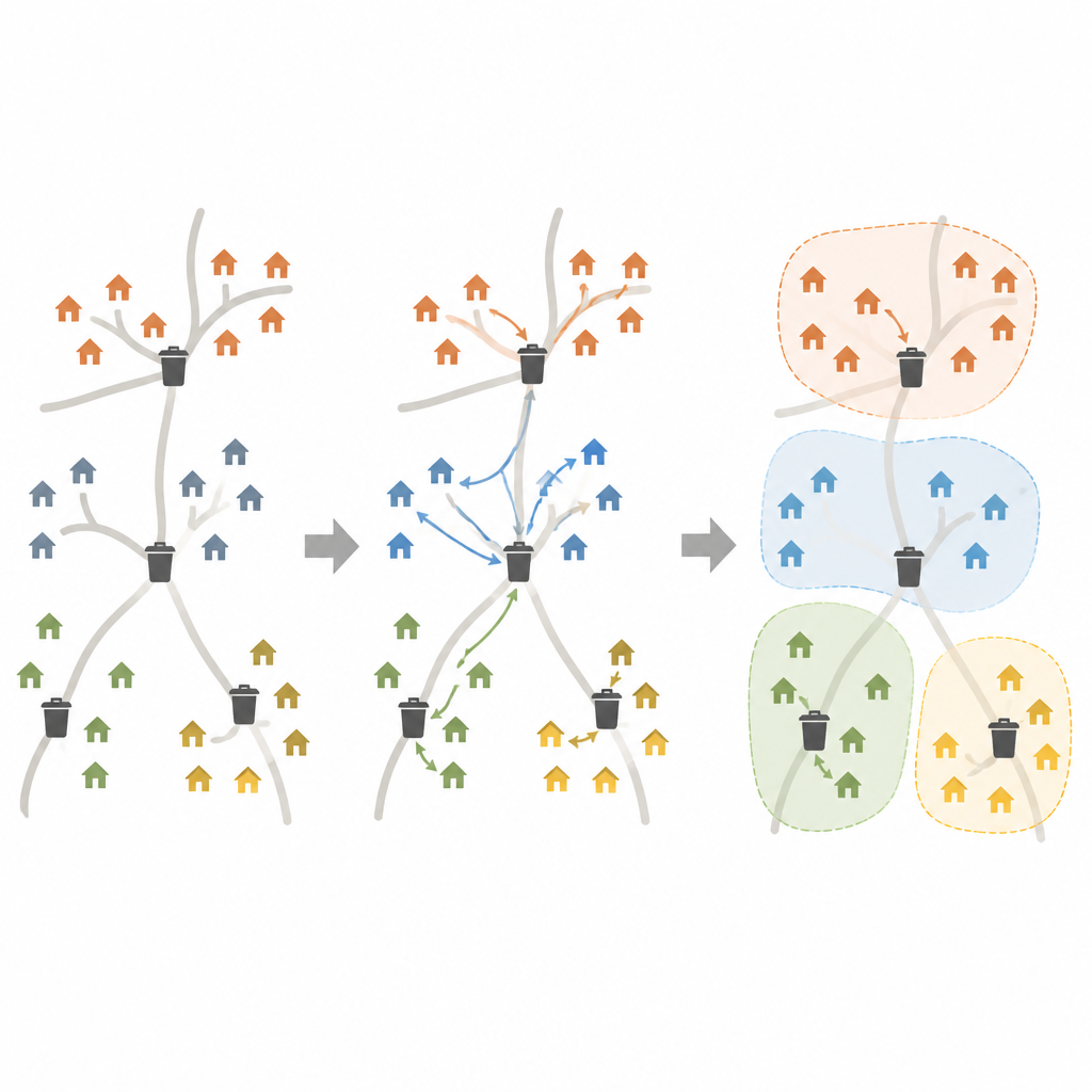
The study adapts a technique called subtractive clustering to capture how demand and service interact across space. Every settlement, or potential location for a container, is given a “potential” value that reflects how many people it can conveniently serve, including those in neighbouring settlements. This is calculated with simple distance-based curves that describe two human-friendly ideas: how willing people are to travel to a bin, and how attractive a bin’s location is. The algorithm then places containers one by one at the most promising locations, reducing the remaining potential in their surroundings according to each container’s capacity. If needs remain high at the same spot, more containers can be placed there, which allows the method to handle unequal capacities and very busy areas.
Following the roads instead of straight lines
A key improvement is that the method does not measure distance “as the crow flies.” Instead, it uses road network distances or travel times, which better reflect how people actually reach bins. This is especially important for large regions, where rivers, mountains, or sparse roads can make a nearby bin on the map effectively far away. The authors also design simple measures to judge how well a container plan works. These include the share of demand that remains uncovered, how much the new plan differs from the current one, and how closely the spatial pattern of containers matches the spatial pattern of people.
Putting the method to the test in Hungary
To show the approach in action, the researchers study textile waste containers across Hungary. At the time of the study, 2,453 containers were spread over only 503 of the country’s more than 3,000 municipalities, leaving large areas without service. Assuming textile waste is proportional to population, they use their method to redistribute the same number of containers while keeping capacities realistic. The resulting layout spreads containers across nearly twice as many municipalities and makes their pattern on the map closely resemble the population pattern. Simple distance-based metrics show that the new plan serves people much more evenly than the existing system. The authors also compare their approach with common alternatives based on linear programming and k-medoids clustering, finding similar or better solutions with far less computing effort in large problems.
What this means for future city and regional planning
For a lay reader, the main message is that smarter placement of a fixed number of collection points can greatly improve who is served, without adding new bins. By blending a simple clustering idea with realistic road distances, travel behaviour, and capacity limits, the method offers planners a flexible tool for designing container systems at both city and country scale. While the paper focuses on textile waste in Hungary, the same ideas could guide where to put other shared facilities, such as recycling points, charging stations, or health services, helping match limited resources to people’s daily movements more fairly and efficiently.
Citation: Kenyeres, É., Kummer, A. & Abonyi, J. Subtractive clustering for spatial resource allocation problems in waste management. Sci Rep 16, 14986 (2026). https://doi.org/10.1038/s41598-026-45718-4
Keywords: waste management, spatial planning, clustering, recycling containers, road networks