Clear Sky Science · en
Personal trip purpose inference based on dynamic time–age functional zones
Why your trips matter more than you think
Every day, millions of trips are quietly logged by smartphones and transit systems, showing where people move but not why. Are they going to work, heading home, meeting friends, or shopping? This study shows how those invisible “whys” can be inferred from large piles of anonymous movement data by carefully reading the changing character of city neighborhoods over time and across age groups. The result is a powerful tool that can help cities plan fairer, more efficient transport systems without constantly running expensive surveys.
From dots on a map to real-life activities
Modern cities collect huge amounts of location data from sources like mobile phones, transit smart cards, and GPS traces. These records are rich in detail about origins and destinations but almost never include trip purpose. Traditionally, researchers have relied on detailed household travel surveys—where people report why they travelled—to build rules or machine-learning models that can be applied to these bigger datasets. However, most earlier work treated each destination’s land use as static: a place was simply tagged as “residential,” “work,” or “shopping,” regardless of what time of day it was or who was visiting.
Capturing how neighborhoods change through the day
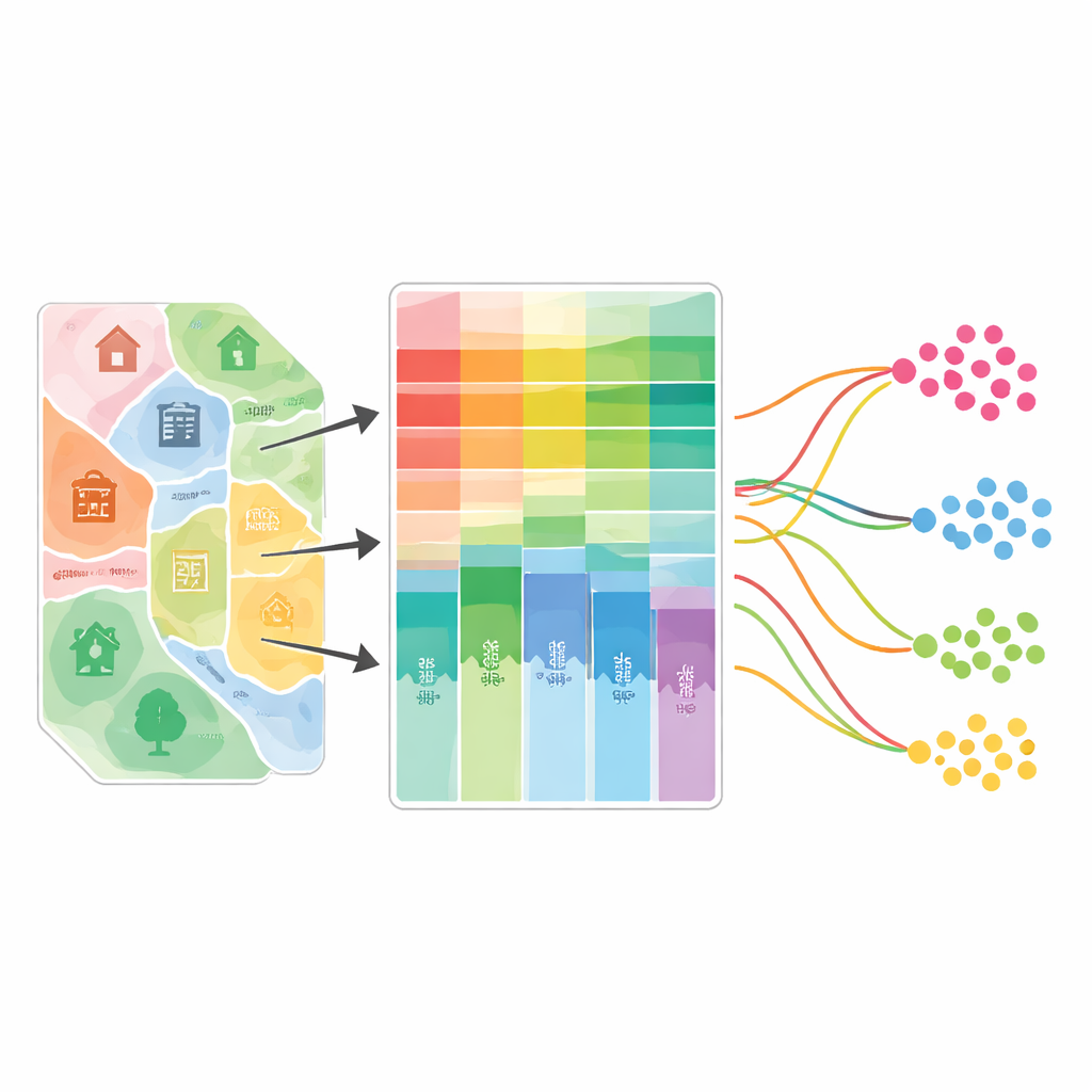
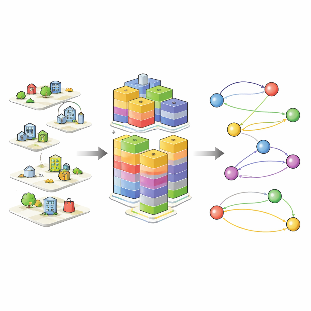
The authors argue that city areas behave very differently across hours and age groups. A district near a university might serve mainly students in the morning, office workers at midday, and diners or partygoers at night. Parks, schools, churches, and offices also attract distinct age groups at different times. To capture this, the study builds “dynamic time–age functional zones” for each small administrative district in Seoul. The team combines more than 770,000 records of places of interest—such as homes, workplaces, schools, shops, medical facilities, and leisure sites—with check-in data from the Yelp Open Dataset and age patterns from Korea’s national household and personal travel surveys. They divide the day into six time bands and the population into four age groups, then assign different weights to each type of place depending on when and by whom it is typically visited. This creates a time–age-sensitive profile of what each neighborhood is mainly used for under different conditions.
Teaching machines to guess why people travel
Using these dynamic functional zones as key inputs, along with traveler age, gender, trip timing, distance, and transit access, the researchers train two kinds of models to infer trip purpose: an extreme gradient boosting (XGBoost) model and a long short-term memory (LSTM) neural network. Both are trained on nearly 401,000 survey trips that include known purposes, grouped into five broad categories: going home, going to work, education, shopping or dining, and other reasons. In tests, XGBoost slightly outperforms LSTM, correctly identifying trip purposes about 84% of the time versus 78% for the neural network. When the authors strip out the time–age dynamics and use only static neighborhood functions, accuracy drops by up to 3 percentage points, confirming that the changing character of places truly helps the models see why people move.
Applying the method to real-world phone data
The team then applies their trained models to a massive “daily life movement” dataset from Seoul, built from anonymized mobile phone signals. This dataset covers millions of trips but only roughly labels origins and destinations as home, work, or “elsewhere,” without explicit purposes. The models infer purposes for almost four million trips over one month. More than half are classified as home-related and about one-third as work-related, with smaller shares for education and shopping or dining. Where the movement labels are clear—such as home-to-work or work-to-home—the inferred purposes agree with the phone-derived types about 68% and 74% of the time, respectively. Patterns over time and age make sense too: early-morning and late-afternoon trips skew toward commuting, teenagers’ trips are often for education, and evening travel leans toward returning home.
What this means for everyday travel
In plain terms, the study shows that by combining detailed maps of what neighborhoods offer with when and by whom those places are used, cities can reliably guess the reasons behind most trips, even when people never answer a survey question. This opens the door to using existing phone and transit data to understand commuting, school runs, shopping, and leisure travel at fine scales. Planners could, for example, spot where evening trips from business districts to dense housing areas call for more buses, or where school-related movements suggest safer walking and cycling routes. While the method still struggles with rarer or mixed-purpose trips, it demonstrates a practical path toward turning anonymous movement traces into meaningful stories about how and why people move through the city.
Citation: Lee, J., Park, S. Personal trip purpose inference based on dynamic time–age functional zones. Sci Rep 16, 14608 (2026). https://doi.org/10.1038/s41598-026-45683-y
Keywords: trip purpose, urban mobility, functional zones, transport planning, mobile phone data